
Carbon Credits (Carbon Farming Initiative) Act 2011
I, GREG HUNT, Minister for the Environment, make this Methodology Determination under subsection 106(1) of the Carbon Credits (Carbon Farming Initiative) Act 2011.
Dated 6: 8: 2014
Greg Hunt
GREG HUNT
Minister for the Environment
Part 1 Preliminary
1.1 Name of determination 7
1.2 Duration 7
1.3 Definitions 7
1.4 Kind of project to which this Determination applies 16
Part 2 Requirements for declaration as eligible project
2.1 Eligible projects 18
2.2 Location 18
2.3 Project land characteristics 18
2.4 Project mechanisms 18
2.5 Project types 19
2.6 Identification of project area 19
Part 3 Delineating boundaries
3.1 Division of project area into strata 20
3.2 Requirements for strata 20
3.3 Delineating stratum boundaries 21
3.4 Ortho-rectified aerial imagery 22
3.5 Growth disturbances 22
3.6 Revision of strata affected by growth disturbance 23
3.7 Requirements for disturbance-affected strata 23
3.8 Requirements for fire-affected strata 23
3.9 Requirements for revisions of strata boundaries 23
Part 4 Project operation
4.1 Change of project type 25
4.2 Preparation burns 25
4.3 Removal of non-project trees for a project 25
4.4 Removal of project tree biomass from a permanent planting project 26
4.5 Specifying the management regime for a harvest project 26
4.6 Change of management regime for a harvest project 26
4.7 Removal of project tree biomass from a harvest project 27
4.8 Requirements for operation of a harvest project 27
4.9 Estimating predicted project average carbon stocks 27
4.10 Requirements for estimating predicted project average carbon stocks 28
Requirements for rotation lengths 28
Part 5 Methods for estimating net project abatement
Division 5.1 Estimating project removals
Subdivision 5.1.1 General
5.1 General 29
Subdivision 5.1.2 Carbon inventory
5.2 Carbon inventory 29
5.3 Precision standard 31
Subdivision 5.1.3 Allometric functions
5.4 Allometric functions for live project trees 31
5.5 Stratum-specific functions 32
5.6 Regional functions 32
5.7 CFI function 32
5.8 Converting a stratum-specific function to a regional function 33
5.9 Allometric domain 33
5.10 Regression analysis 33
5.11 Minimum data requirements 34
5.12 Regression requirements 35
5.13 Allometric report 36
Subdivision 5.1.4 Applicability of allometric functions
5.14 Testing the applicability of allometric functions 36
5.15 Compatibility checks 36
5.16 Validation test 37
5.17 Reporting requirements for compatibility and validation tests 38
Subdivision 5.1.5 Allometric functions for live trees
5.18 Developing allometric functions for live trees 38
5.19 Developing stratum-specific functions 39
5.20 Updating pre-existing stratum-specific functions 39
5.21 Developing and updating regional functions 40
5.22 Converting a stratum-specific function to a regional function 42
5.23 Updating a CFI function 42
Subdivision 5.1.6 Measuring biomass sample trees
5.24 Measuring above-ground biomass of biomass sample trees 42
5.25 Measuring below-ground biomass of biomass sample trees 42
Root:shoot ratio method 43
5.26 Assessing carbon stocks in the roots of harvested trees for harvest projects 43
Subdivision 5.1.7 Assessing carbon stocks in dead or burnt trees
5.27 Biomass prediction in dead or burnt trees 44
5.28 Testing for over prediction of a dead or burnt tree biomass 45
Subdivision 5.1.8 Assessing carbon stocks in coarse woody debris and litter
5.29 Assessing carbon stocks in coarse woody debris 46
5.30 Assessing carbon stocks in litter 46
Division 5.2 Calculating project emissions
5.31 Calculating fuel emissions from project activities 46
5.32 Calculating fire emissions from a stratum 46
Part 6 Calculating the carbon dioxide equivalent net abatement amount for a project
Division 6.1 Preliminary
6.1 General 47
6.2 Greenhouse gas assessment boundary 47
6.3 Calculating the baseline for the project 49
6.4 Requirements for calculating carbon dioxide equivalent net abatement 49
Division 6.2 Calculations
Subdivision 6.2.1 Calculating carbon dioxide equivalent net abatement amount
6.5 General 49
Subdivision 6.2.2 Calculating net greenhouse gas abatement for a project
6.6 Equation 1.1—Calculating net greenhouse gas abatement for the project area 49
6.7 Equation 1.2—90% confidence interval for net greenhouse gas abatement 50
6.8 Equation 1.3—Standard error for net greenhouse gas abatement for the project area 50
6.9 Equation 1.4—Degrees of freedom with unequal variances 50
Subdivision 6.2.3 Calculating carbons stocks for a project
6.10 Equation 2.1 & 2.2—Change in carbon stocks within the project 51
6.11 Equation 2.3—Standard error for change in carbon stocks within a project for the first offsets report 52
6.12 Equation 2.4—Standard error for change in carbon stocks within a project 52
6.13 Equation 2.5—Initial carbon stocks for a project 53
6.14 Equation 2.6—Standard error for the initial carbon stocks for the project 53
6.15 Equation 2.7—Closing carbon stocks for a project 53
6.16 Equation 2.8—Standard error for the closing carbon stocks for the project 54
6.17 Equation 2.9—Lower confidence bound for closing carbon stocks for the project 54
6.18 Equation 2.10—Predicted project average carbon stocks for a harvest project 55
6.19 Equation 2.11—Predicted stratum average carbon stocks for a harvest project 55
6.20 Equation 2.12—Predicted stratum carbon stocks for a harvest project 56
6.21 Equation 3.1—Initial carbon stocks for a stratum 56
6.22 Equation 3.2 —Standard error for initial carbon stocks for a stratum 57
6.23 Equation 3.3—Closing carbon stocks for a stratum. 57
6.24 Equation 3.4—Standard error for closing carbon stocks for a stratum 58
6.25 Equation 3.5—Mean plot carbon stocks for a stratum 58
6.26 Equation 3.6—Standard error for mean plot carbon stocks for a stratum 58
6.27 Equation 4.1—Carbon stocks within a plot 59
6.28 Equation 4.2—Carbon stocks of trees in a plot 59
6.29 Equation 4.3—Carbon stocks in the roots of harvested trees for a harvest project 59
6.30 Equation 4.4—Carbon stocks in litter within a plot 60
6.31 Equation 4.5—Biomass in litter within a plot 60
6.32 Equation 4.6—Carbon stocks in coarse woody debris within a plot 61
6.33 Equation 4.7—Carbon stocks in coarse woody debris within a decay class 61
6.34 Equation 4.8—Volume of coarse woody debris within a decay class 62
6.35 Equation 4.9—Biomass of project trees in a plot 62
6.36 Equation 4.10—Biomass in the roots of harvested trees in a plot for a harvest project 62
6.37 Equation 4.11—Biomass in the roots of harvested trees under a replant system 63
6.38 Equation 4.12—Carbon stocks in the roots of harvested trees under a coppice system 63
Subdivision 6.2.4 Calculating project emissions
6.39 Equation 5.1—Calculating project emissions for a reporting period 64
6.40 Equation 5.2—Standard error for project emissions 64
6.41 Equation 5.3—Calculating fuel emissions for a stratum 65
6.42 Equation 5.4—Calculating emissions for a type of fuel 65
Subdivision 6.2.5 Calculating fire emissions for a fire-affected stratum
6.43 Equation 5.5—Emissions for a fire-affected stratum 66
6.44 Equation 5.6—Emissions of methane from fire 66
6.45 Equation 5.7—Emissions of nitrous oxide from fire 67
6.46 Equation 5.8—Weight of elemental carbon emitted from fire 67
6.47 Equation 5.9—Standard error for emissions from a fire-affected stratum 68
6.48 Equation 5.10—Standard error for emissions of methane from fire 68
6.49 Equation 5.11—Standard error for emissions of nitrous oxide from fire 68
6.50 Equation 5.12—Standard error for weight of elemental carbon emitted from fire 69
Subdivision 6.2.6 Calculating probable limits of error
6.51 Equation 6.1—Probable limits of error for closing carbon stocks 69
6.52 Equation 6.2—Estimating number of plots required to meet the target probable limits of error 70
Subdivision 6.2.7 Allometric equations
6.53 Equation 7.1—Form of allometric equations 70
6.54 Equation 7.2—Total tree biomass or above-ground biomass for a dead or burnt tree 71
6.55 Equation 7.3—Total biomass for a biomass sample tree or test tree 71
Subdivision 6.2.8 Root biomass from a root:shoot ratio
6.56 Estimating root biomass from a root:shoot ratio 71
6.57 Equation 7.4—Above-ground biomass for a biomass sample tree, or test tree 72
6.58 Equation 7.5—Total root biomass of a tree 72
6.59 Equation 7.6—Dry weight of biomass components of trees 73
6.60 Equation 7.7—Mean of residuals 73
6.61 Equation 7.8—weighting factor for weighted least squares regression 73
Division 6.3 Data collection
6.62 Data collection for project greenhouse gas emissions 74
6.63 Data collection for project greenhouse gas sequestration 74
Part 7 Monitoring, record-keeping and reporting requirements
Division 7.1 General
7.1 Application 75
Division 7.2 Monitoring requirements
7.2 Project monitoring 75
Division 7.3 Record-keeping requirements
7.3 Records that must be kept 76
7.4 Stratum records 76
7.5 Project tree measures 76
7.6 Carbon stock calculations 76
7.7 Allometric functions 76
7.8 Sampling plans and project operational records 77
7.9 Quality assurance and control 77
7.10 Fuel use 77
Division 7.4 Offsets report requirements
Subdivision 7.4.1 Information that must be included in the first offsets report
7.11 General 78
7.12 Project information 78
7.13 Strata description and status 78
7.14 Baseline land use history and forest cover history for strata 78
7.15 Quality assurance and control 79
Subdivision 7.4.2 Information that must be included in all offsets reports
7.16 General 79
7.17 Project information 79
7.18 Strata location and area 80
7.19 Stratum description and status 80
7.20 Carbon stocks for stratum 80
7.21 Carbon stocks for plots 81
7.22 Management regime and PPACS modelling 82
7.23 Basis of allometric function applied to a stratum 82
7.24 Application of allometric functions 82
7.25 Sampling plans 83
7.26 Growth disturbance events 83
7.27 Quality assurance and control 83
7.28 Fuel use 84
This Determination is the Carbon Credits (Carbon Farming Initiative) (Measurement Based Methods for New Farm Forestry Plantations) Methodology Determination 2014.
Note See subsection 122(1) of the Act.
This Determination:
(a) commences on the day after it is registered on the Federal Register of Legislative Instruments; and
(b) unless sooner revoked, expires on the day before it would otherwise be repealed under subsection 50(1) of the Legislative Instruments Act 2003.
Note This Determination will expire on the first 31 March or 30 September on or after the tenth anniversary of its registration.
In this Determination:
above-ground biomass means all material in a tree above the soil substrate and includes stem, crown, and attached dead material such as dead branches.
Act means the Carbon Credits (Carbon Farming Initiative) Act 2011.
actual location coordinates means spatial coordinates that are collected on the ground using a global positioning system, and that define the location of plots, biomass sample plots and biomass sample trees.
allometric data range means the range between the smallest and largest values of the explanatory variables included within an allometric dataset.
allometric dataset means variables that are:
- recorded from biomass sample trees; and
- used to develop or validate an allometric function.
allometric domain means the specific conditions under which an allometric function is applicable.
allometric function means a regression equation that describes relationships between biometric measures of specified plant taxa which is used to predict biomass, and may be stratum-specific or region-specific-.
allometric report means a document that describes a project proponent’s approach to the development of allometric functions and that meets the requirements set out in section 5.13.
below-ground biomass means all material in a tree below the soil substrate and includes the tap root or lignotuber, and the lateral roots.
biomass means dry, vegetation-derived organic matter.
biomass component means sections of trees that are divided on the basis of structure or form or both.
biomass sample plot means an area of land that occurs within a biomass sample site and is delineated in accordance with Part 5.
biomass sample site means an area of land in which biomass sample plots are located for the purpose of developing a regional function.
biomass sample tree means a tree selected for destructive sampling in order to develop an allometric function.
burnt tree means a tree that has lost biomass in a fire
carbon dioxide equivalent (CO2e) means the equivalent mass of carbon dioxide for a given mass of greenhouse gas or carbon. For carbon it is calculated by multiplying the mass of elemental carbon by ![]() .
.
carbon inventory means an estimation of carbon stocks by sampling and measurements conducted in accordance with Subdivision 5.1.2.
carbon stock means the quantity of carbon, expressed as carbon dioxide equivalent, held within specified components of project forest biomass.
CFI function means a stratum-specific or regional function that was developed in compliance with an existing CFI methodology determination.
CFI Mapping Guidelines means the Carbon Farming Initiative Mapping Guidelines, as published from time to time, to be used for mapping project areas and strata within project areas, and available on the Department’s website.
CFI methodology determination means a legislative instrument made under section 106 or varied under section 114 of the Act.
clearfelling means a management practice resulting in the felling of all trees in a group of trees.
closing carbon stocks means the carbon stocks, expressed as carbon dioxide equivalent, estimated to be held within specified components of project forest biomass occurring within a stratum at the end of a reporting period.
commencement means the point in time at which preparation of a stratum for planting begins.
commercial thinning means a management practice where:
(a) project trees are thinned;
(b) a harvested wood product is created; and
(c) harvest residue is created.
coppice system means a system where trees are re-established by regrowth from in‑situ roots or lignotubers.
coarse woody debris CWD means dead woody stem or branch components, or both, that:
(a) have a cross-sectional diameter of more than 25 millimetres;
(b) come from a project tree; and
(c) occur at ground level.
crown means the above-ground tree biomass (including branches, twigs, petioles, and leaves) other than stems.
crown cover means the amount of land covered by the outer limits of the crown (viewed as a horizontal cross-section) of a tree, or collection of trees.
dead material means the non-living above-ground biomass originating from project trees.
declaration date, for a project, means the date on which the declaration of the project as an eligible offsets project under section 27 of the Act takes effect.
disturbance-affected stratum means a stratum that has been subject to a growth disturbance, other than fire—see section 3.6.
explanatory variable means the measured biometric variable used to estimate the response variable—see variable.
farm means:
(a) any tract of land:
(i) which is used by a person for agriculture; and
(ii) for which the person holds an estate in fee simple or a lease over the land; or
(b) multiple tracts of land:
(i) which are used by the same person for agriculture; and
(ii) for which the person holds an estate in fee simple or a lease over each tract of land; and
(iii) to which the same methodology determination is applied, regardless of whether those tracts of land are touching.
fire-affected stratum means an area of project forest that has been burnt and that has been dealt with in accordance with Part 3.
fire emissions means emissions of methane (CH4) or nitrous oxide (N2O) arising from fire events.
fire event means an occurrence of a fire in a stratum or strata.
forest means land on which trees:
(a) have attained, or have the potential to attain, a crown cover of at least 20% across the area of land; and
(b) have reached, or have the potential to reach, a height of at least 2 metres.
forest cover—land has forest cover if the vegetation on the land includes trees that:
- are 2 metres or more in height; and
- provide crown cover of at least 20% of the land.
fraction remaining —see section 5.27.
fuel emissions means emissions of carbon dioxide (CO2), nitrous oxide (N2O), or methane (CH4) arising from use of fossil fuels to deliver project activities within the project area.
FullCAM means the latest publicly released version on the Department’s website of the Full Carbon Accounting Model.
FullCAM Guidelines means the Guidance for using the Full Carbon Accounting Model (FullCAM) in the Carbon Farming Initiative (CFI) methodologies for the Carbon Credits (Carbon Farming Initiative) (Measurement Based Methods for New Farm Forestry Plantations) Methodology Determination 2014 (this Determination), first published and made available on the Department’s website on 31 July 2014 and includes any minor amendments to those Guidelines uploaded by the Department to its website from time to time.
Greenhouse FriendlyTM initiative has the meaning given in the Regulations.
Greenhouse FriendlyTM forestry project means an existing forestry project that has been accredited under the Commonwealth Government’s Greenhouse FriendlyTM initiative.
growth disturbance — means a natural disturbance that may or may not also be a significant reversal, see section 3.5.
![]() means the global warming potential of methane as prescribed in the National Greenhouse and Energy Reporting Regulations 2008 as in force at the time that the offsets report was submitted or was required to be submitted, whichever occurs first.
means the global warming potential of methane as prescribed in the National Greenhouse and Energy Reporting Regulations 2008 as in force at the time that the offsets report was submitted or was required to be submitted, whichever occurs first.
![]() means the global warming potential of nitrous oxide as prescribed in the National Greenhouse and Energy Reporting Regulations 2008 as in force at the time that the offsets report was submitted or was required to be submitted, whichever occurs first.
means the global warming potential of nitrous oxide as prescribed in the National Greenhouse and Energy Reporting Regulations 2008 as in force at the time that the offsets report was submitted or was required to be submitted, whichever occurs first.
harvest means a management practice involving commercial thinning or clearfelling.
harvest project means a project that consists of project trees established as a new farm forestry plantation or a Greenhouse FriendlyTM forestry project and classified as such under section 2.5 or reclassified under section 4.1.
harvest residue means the project tree biomass that remains on site after a harvest.
infill planting means the planting of project trees to replace mortalities of project trees planted at an earlier time—see section 3.5.
initial carbon stocks means the amount of carbon, expressed in tonnes of carbon dioxide equivalents, estimated to have been held within specified components of the project forest biomass occurring within a stratum on the declaration date.
intended location coordinates means spatial coordinates from a grid overlay used to define the proposed on‑ground location of plots and biomass sample plots.
lateral root means the woody material that extends laterally from the tap root or lignotuber of a tree, and which forms part of the below-ground structure of the tree.
litter means fallen dead material originating from project trees that is equal to or less than 25 millimetres in diameter and may include fallen leaves, twigs, bark and small woody stems in various stages of decomposition.
management regime means the spatial extent and timing of events that is undertaken to establish, grow, manage and harvest a harvest project, and includes disturbance events that occur.
management practice has the meaning given in section 4.5
measurement strata means a strata established for the purpose of a carbon inventory.
modelling strata means strata established for FullCAM modelling.
modelling period means the period, set at 100 years, over which the management regime is modelled in FullCAM.
Note The modelling period is selected to allow for a reasonable period of time in which to run the FullCAM modelling. It is not linked to, or determined by, the permanence period applicable for a sequestration offsets project under the Act.
new farm forestry plantation means a plantation:
(a) established on or after 1 July 2010 for the harvest of wood products; and
(b) occupying land that has been cleared of trees and used for agricultural purposes for at least 5 years prior to the establishment of the plantation; and
(c) in an area that, according to the CFI rainfall map, receives the amount of long term average annual rainfall mentioned in an item in the following table; and
(d) occupies the area mentioned in the item.
Farm forestry plantations | ||
Item | Rainfall | Area |
1 | 400 mm or more | No more than the smaller of the following areas: (a) no more than 100 ha; (b) no more than 30% of a farm. |
2 | less than 400 mm | No more than the smaller of the following areas: (a) no more than 300 ha; (b) no more than 30% of a farm. |
non-commercial thinning means a management practice where:
(a) project trees are thinned;
(b) no harvested wood product is created; and
(c) the debris from thinning is retained on site.
non-project forest means forest within the project area that was not established as a direct result of a project carried out under this Determination.
non-project tree means a tree within the project area that was neither planted, nor otherwise established, as a direct result of a project carried out under this Determination.
ortho-rectified aerial imagery means an aerial photograph or satellite image geometrically-corrected for distortion to produce a uniform scale across the image.
permanent planting has the same meaning as in the Regulations.
permanent planting project means a project that consists of project trees established as a permanent planting and classified as such under section 2.5.
permanent sample plot (PSP) means a plot delineated in accordance with Part 5 and from within which measurements are periodically made to inventory carbon stocks.
planting means the planting of project trees from seedlings or seed.
planting finish date means the date that planting of the stratum was completed.
planting start date means the date that planting started within a stratum.
plot means a defined area of land within the project area which can be a temporary sample plot or a permanent sample plot.
plot size means the horizontal area of the land included within the boundaries of a plot or biomass sample plot.
precision standard has the meaning given in section 5.3.
predicted project average carbon stocks (PPACS) means the prediction of the average carbon stocks of a project for a specified management regime over the modelling period, estimated using FullCAM.
predicted stratum average carbon stocks (PSACS) means the prediction of the average carbon stocks of a stratum for a specified management regime over the modelling period, estimated using FullCAM.
predictor measure —see the definitions for “explanatory variable” and “variable” in this section.
preparation burn means the controlled application of fire within a stratum to assist in the removal or suppression of ground‑level vegetation or fire fuel loads.
prescribed weed means any plant that is required by law to be removed.
probable limits of error means the confidence limits for an estimate expressed as a percentage of the mean.
project activity means an activity undertaken within the project area as part of the establishment and management of project forest.
project commencement means the earliest date for which there is documentary evidence that demonstrates, to the satisfaction of the Regulator, that planting has occurred in the project area.
project emissions means emissions of greenhouse gases occurring within the project area as a result of a project activity, from sources within the project greenhouse gas assessment boundary—see section 6.2.
project forest means an area of land covered by a forest of project trees at a specified time or during a specified reporting period.
project forest biomass means the biomass contained within project trees, litter, or CWD.
project removals means removals from the atmosphere of greenhouse gases caused as a result of project activities.
project tree means a tree that has been established through project activities.
regional function means an allometric function developed by or for a project proponent and which has an allometric domain which applies to more than one stratum.
Regulations means the Carbon Credits (Carbon Farming Initiative) Regulations 2011.
replant system means a system where trees are re-established by planting or seeding.
root biomass means the biomass of a tree occurring below the level of the soil substrate.
root:shoot ratio (R:S) means the ratio of below-ground biomass to above‑ground biomass.
rotation length means the period of time from forest establishment or re-establishment to clearfelling for a harvest project.
sampling plan means a document that identifies the quantity, intended and actual location coordinates of permanent sample plots, biomass sample plots, and the quantity and actual location coordinates of biomass sample trees, within a stratum or the geographic limits of an allometric domain—see Subdivision 5.1.3.
significant reversal means a reversal of the removal of carbon dioxide from the atmosphere if the natural disturbance that caused, or is likely to have caused, the reversal occurred on at least:
(a) 5% of the project area, or project areas in total; or
(b) 50 hectares of the project area or areas;
whichever area is the smaller.
size class means a category of trees delimited by stem diameter, stem cross-sectional area or other biometric measure.
standard margin means a distance from the boundary of the tree planting lines that defines the stratum boundary and is determined in accordance with section 3.3.
stem means the above-ground woody structural supports of a tree that includes the trunk and limbs extending to the crown.
strata means more than one stratum.
stratum means an area in the project area that is determined to have common characteristics in accordance with the requirements of Part 3.
stratum area means the area of land that is occupied by a stratum, expressed in hectares.
stratum identifier means a unique numeric, alpha-numeric, or text string that is used to refer to and identify a stratum in the project area.
stratum-specific function means an allometric function developed by or for a project proponent from an allometric dataset collected exclusively from within a single stratum, to which the function is intended to be applied.
systematic random sampling means an approach to sampling where sampling locations are systematically determined using a randomly placed square grid
t CO2e means a unit of measurement defined as tonnes of carbon dioxide equivalence (within the meaning of the National Greenhouse and Energy Reporting Act 2007).
t-test means a statistical test to determine whether a series of collected observations is suitable for making a prediction about a population.
tap root or lignotuber means a woody part of a tree connected directly to the stem which attaches it to the ground and extends downwards into the soil, with lateral roots extending from it.
target plot size has the meaning given in section 5.21.
Technical Reference Guide means the Technical Reference Guide for the Carbon Credits (Carbon Farming Initiative) (Measurement Based Methods for New Farm Forestry Plantations) Methodology Determination 2014 first published and made available on the Department’s website on 30 May 2014 and includes any minor amendments to that Guide uploaded by the Department to its website from time to time.
temporary sampling plot (TSP) means a defined area of land that is delineated in accordance with Part 5 and from within which measurements are taken to estimate carbon stocks in a carbon inventory.
test tree means a project tree that has been randomly selected from within a biomass sample plot for measurement as part of the process for validating regional functions or converting stratum-specific functions to regional functions.
tree means a perennial plant that has primary supporting structures consisting of secondary xylem.
tree type means trees that are of the same species and equivalent physical status (live, burnt or dead).
variable means any characteristics, number, or quantity that can be measured or counted which here comprise either non‑destructive measurements of trees (explanatory variables) used to estimate their biomass (response variable), based on an allometric function.
weighted least squares method means an algebraic procedure for fitting linear or non-linear regression equations to data in which the contribution of units to the estimate of dispersion is weighted.
weighted residual means the difference between measured and predicted (from a regression equation) values of the response variable (tree biomass) multiplied by a weighting factor, and as calculated in accordance with section 6.60.
Note Other words and expressions used in this Determination have the meaning given by the Act, including:
baseline
crediting period
eligible offsets project
emission
methodology determination
native forest
natural disturbance
offsets project
offsets report
project
project area
project proponent
Regulator; and
reporting period.
Note See paragraph 106(1)(a) of the Act.
(1) This Determination applies to the following kinds of project:
(a) the establishment of a permanent planting on or after 1 July 2007; or
(b) a forestry project accredited under the Commonwealth Government’s Greenhouse FriendlyTM initiative; or
(c) a permanent planting accredited under:
(i) the New South Wales Government’s Greenhouse Gas Reduction Scheme; or
(ii) the Australian Capital Territory Government’s Greenhouse Gas Abatement Scheme; or
(d) a permanent planting established before 1 July 2007 for which there is documentary evidence of a kind mentioned in subsection (2) that demonstrates, to the satisfaction of the Regulator, that the primary purpose of the planting was generation of carbon offsets; or
(e) the establishment of a new farm forestry plantation.
(2) Documentary evidence, for paragraph (1)(d):
(a) must be dated no later than 2 years after the date the plantings were established; and
(b) may include contracts for the sale of offsets; and
(c) must show that carbon sequestration rights had been registered for the plantings; and
(d) must include a statutory declaration that the plantings were entirely privately funded.
Note See paragraphs 27(4)(c) and 106(1)(b) of the Act.
To be declared an eligible offsets project, a project to which this Determination applies must meet the requirements in this Part.
Note In addition, a project must meet the requirements in section 27 of the Act and in the Regulations, including a requirement that the project may not be an excluded offsets project (see regulations 3.36 and 3.37).
The project area must be located within Australia, excluding external territories.
(1) For at least 5 years before project commencement, the project area must have included:
(a) land used for grazing or cropping; or
(b) land that was fallow between grazing or cropping activities; or
(c) a combination of (a) and (b).
(2) If project trees are established by planting on the land specified in subsection (1), the project trees in the planting will have the potential to attain:
(a) a height of 2 metres or more; and
(b) a crown cover of at least 20% over the total area of the stratum in which the project trees are located.
Note The potential to attain the requirements in subsection (2) may be demonstrated by the species of trees to be planted, a description of the growth characteristics of the species and the anticipated crown cover across the stratum area when project trees are at maturity.
(1) The project must establish and maintain a planting which is one of the following:
(a) a permanent planting;
(b) a new farm forestry plantation; or
(c) a forestry project accredited under the Greenhouse FriendlyTM initiative.
(2) The planting specified in subsection (1) must be:
(a) established at a density sufficient for the trees to have the potential to achieve forest cover; and
(b) established and maintained consistently with the project operation requirements in Part 4.
Note The spatial configuration of a planting may be in belts or blocks provided the planting density provides the potential to achieve forest cover.
(1) The Regulator must be notified in writing of the project type being undertaken at the time of an application for a declaration of an eligible offsets project in accordance with this section.
Note An application for a declaration of an eligible offsets project is an application made under section 22 of the Act.
(2) Subject to subsection (3), a project must be identified as a particular project type in accordance with the following conditions:
(a) if the project mechanism is a permanent planting then the project type must be identified as a permanent planting project; or
(b) if the project mechanism is:
(i) a new farm forestry plantation; or
(ii) a forestry project accredited under the Greenhouse FriendlyTM initiative;
then the project must be identified as a harvest project.
(3) If the project mechanism is both a permanent planting and a forestry project accredited under the Greenhouse FriendlyTM initiative then the project may be identified at the request of the proponent as either a permanent planting project or harvest project.
(4) If the project is identified as a harvest project, then:
(a) the proposed management regime must be provided with the application for declaration of an eligible offsets project; and
(b) the project cannot be identified as a permanent planting project at a later time.
Note Section 4.1 provides the ability to change a permanent planting project to a harvest project if certain conditions are satisfied.
The boundaries of the project area must be delineated in accordance with the CFI Mapping Guidelines and Method 1 of the Technical Reference Guide.
Note Regulation 3.1 of the Regulations requires provision, in an application for a declaration of an eligible offsets project, a geospatial map of the project area that meets the requirements of the CFI Mapping Guidelines.
(1) Before the submission of the first offsets report, a project proponent must define within the project area one or more strata in accordance with the CFI Mapping Guidelines and Method 2 of the Technical Reference Guide.
(2) The project proponent may define new strata that comply with Method 2 and Method 3 of the Technical Reference Guide at any time.
(3) The boundaries and area of a stratum must be defined in accordance with Method 3 of the Technical Reference Guide.
(4) If the boundaries of a stratum are redefined, they must be redefined in accordance with the requirements set out in Method 3 of the Technical Reference Guide.
(1) A stratum must have been planted with one or more species of project trees.
Note Project proponents may also define a stratum based on any of the following:
– the age of project trees;
– tree species;
– observed or measured trends in growth;
– geographic regions;
– climatic conditions;
– soil types;
– disturbance history;
– land management units;
– management regime; or
– any other characteristics that may influence growth of project trees.
Requirements for measurement strata
(2) For the purposes of undertaking a carbon inventory under Subdivision 5.1.2, measurement strata must be established in accordance with Method 2.3 of the Technical Reference Guide.
(3) Any area within a measurement stratum that:
(a) has been subject to a disturbance event; and
(b) is greater than 10 hectares in size;
must be defined as a separate stratum in accordance with Method 3 of the Technical Reference Guide.
Requirements for modelling strata
(4) If the project is identified as a harvest project in accordance with subsection 2.5(3), modelling strata must be established in accordance with Method 2.4 of the Technical Reference Guide.
(5) If the project proponent elects to use a root:shoot ratio for the purpose of estimating below-ground biomass under Subdivision 5.1.6, modelling strata must be established in accordance with Method 2.4 of the Technical Reference Guide.
(1) This section sets out the requirements for:
(a) delineating the boundaries of a stratum included within the project area; and
(b) deriving an estimate of the stratum area.
(2) A project proponent must delineate the boundaries of a stratum included within the project area by generating a set of spatial coordinates that define the geographic limits of the land area included within each stratum in accordance with Method 3 of the Technical Reference Guide.
Project forest boundary
(3) The project forest boundary for a stratum must be defined in accordance with Method 3.1 of the Technical Reference Guide.
Stratum boundary and stratum area
(4) A geographic information system must be used to apply a standard margin to the project forest boundary in accordance with Method 3.1 of the Technical Reference Guide.
(5) The stratum boundary must not include land that:
(a) lies outside the project area; or
(b) is non-project forest.
(6) If application of the standard margin would result in the mapped geographic limits of the stratum:
(a) overlapping the geographic limits of a second stratum—then the stratum boundary must be mapped to a point equidistant between the two strata along the length of the area where the overlap would otherwise have occurred; or
(b) exceeding the geographic limits of the project area—then the stratum boundary must align with the boundary of the project area.
(7) For the purposes of calculating the stratum area, the boundary of the standard margin delineates the boundary of the stratum.
If ortho‑rectified aerial imagery is used to identify the limits of the project forest area and stratum boundary:
(a) the imagery must meet the accuracy requirements specified in the CFI Mapping Guidelines;
(b) the image must be of sufficient quality and resolution to allow the clear identification of the spatial limits of activities which established the project forest.
(1) This section applies if an event occurs that is likely to affect significantly the growth characteristics of project trees in a stratum or part of a stratum that has been previously been reported in an offsets report (a growth disturbance).
Note A growth disturbance is a natural disturbance that may or may not also be a significant reversal. The growth disturbance is required to be identified and delineated, but may not necessarily meet the thresholds to be considered a significant reversal under the Regulations.
When a natural disturbance that is also a significant reversal has occurred, the proponent is required to meet their obligations as outlined under section 81 of the Act, which include provisions for notifying the Regulator and re-establishing carbon stocks. Examples of natural disturbance events include floods, fires, droughts, pest attacks, or diseases that could be taken to cause a significant reversal under the Regulations.
(2) The project proponent must, within 6 months after the growth disturbance, delineate the boundaries of the land occupied by project trees affected by the disturbance in accordance Method 4.1 of the Technical Reference Guide and subsection (3) or (4) below.
(3) If the growth disturbance affects an area of more than 10 hectares in a stratum, the project proponent must, before submitting the offsets report that relates to the time when the growth disturbance occurred, revise the affected stratum in accordance with Method 4.2 of the Technical Reference Guide.
(4) If the growth disturbance affects an area of 10 hectares or less in a stratum, the project proponent may, before submitting the offsets report that relates to the time when the growth disturbance occurred:
(a) define a new stratum to include the growth disturbance-affected area in accordance with section 3.6; or
(b) continue to treat the growth disturbance-affected area as belonging to a single stratum.
(5) The death of project trees is not a growth disturbance if infill planting is undertaken to replace the dead project trees within 36 months of the planting finish date for the stratum.
(1) Subject to sections 3.7 to 3.9, if the whole stratum is affected by a growth disturbance, the stratum must be revised by creating a new stratum identifier and labelling the newly created stratum:
(a) if the disturbance is fire—a fire-affected stratum; or
(b) otherwise—a disturbance-affected stratum;
in accordance with Method 4.2 of the Technical Reference Guide.
(2) If only a part of the stratum is affected by the growth disturbance, then the stratum must be revised by excising that portion of the stratum affected by the growth disturbance and defining this area as a separate stratum, which:
(a) complies with the requirements for a stratum set out in section 3.2; and
(b) is labelled:
(i) if the disturbance was fire—a fire-affected stratum; or
(ii) otherwise—a disturbance-affected stratum.
If a disturbance-affected stratum is created, then for the purposes of calculating carbon stock change in accordance with Subdivision 6.2.3, the initial carbon stocks for the disturbance-affected stratum ![]() must be assumed to be zero
must be assumed to be zero![]() .
.
If a fire-affected stratum is created:
(a) a carbon inventory must be conducted in both the fire-affected stratum and the stratum from which the fire-affected stratum was excised, within 12 months after the fire event;
(b) an estimate of the fire emissions from any fire-affected stratum, and the standard error associated with this estimate, must be calculated in accordance with Subdivision 6.2.5; and
(c) for the purposes of calculating carbon stock change in accordance with Subdivision 6.2.3, the initial carbon stocks for the fire-affected stratum ![]() must be assumed to be zero
must be assumed to be zero![]() .
.
(1) Subject to subsection (3), where a stratum or a stratum boundary is redefined, revised boundaries must comply with the requirements for delineating stratum boundaries in accordance with section 3.3 and Method 3.1 of the Technical Reference Guide.
(2) Subject to subsection (3), if a revision, or cumulative revisions, of the boundaries of a stratum change the stratum area by more than 5% between any reporting periods; then a carbon inventory which includes the revised stratum area must be conducted in accordance with Subdivision 5.1.2 no earlier than 6 months before the end of the current reporting period.
(3) Where a stratum area is reduced to zero through redefining stratum boundaries in accordance with section 3.6, subsections 3.9(1) and 3.9(2) do not apply.
(4) If a stratum is defined and reported within an offsets report, the stratum identifier associated with that stratum must continue to be reported in subsequent offsets reports as having been associated with the project area even where:
(a) the stratum area is reduced to zero through revising the stratum boundary; or
(b) the stratum is redefined so that its entire area is replaced with other strata.
(5) Where subsection (4) applies:
(a) values of zero must be recorded against the stratum identifier for the closing carbon stocks; and
(b) the zero value must be applied for the purpose of calculating the carbon stock change for a stratum in accordance with section 6.10.
Note A project proponent must generate and keep records in relation to each stratum in accordance with the requirements set out in section 7.4.
Note See paragraphs 27(4)(c), 35(2)(a) and 106(1)(b) of the Act and regulations 1.12 and 3.26 of the Regulations.
(1) A permanent planting project type may be changed to a harvest project type if the following requirements are met to the satisfaction of the Regulator:
(a) the permanent planting satisfies the requirements for a new farm forestry plantation;
(b) a PPACS for the project is calculated in accordance with section 4.9; and
(c) the total number of carbon credits that have been issued for the project is less than the PPACS calculated in paragraph (b) above.
(2) A written request to change the project type must be provided to the Regulator with evidence demonstrating to the satisfaction of the Regulator that the requirements in subsection (1) are met.
(3) The Regulator must provide written confirmation of the change of project type from a permanent planting project to a harvest project before any removal of biomass from project trees is permitted to occur unless the removal is in accordance with section 4.4.
Subject to section 4.5, a preparation burn may be applied to each stratum either at commencement or between commencement and planting.
(1) Subject to this section, non-project trees must not be removed from the project area, or otherwise disturbed, for the purposes of undertaking a project.
(2) Non-project trees may be removed from the project area, or otherwise disturbed, only in the following circumstances:
(a) if the non-project trees are prescribed weeds, they may be removed at any time during the life of the project;
(b) if removal of the non-project trees is otherwise required or authorised by law, they may be removed in accordance with the relevant law; or
(c) if, at commencement, non-project trees:
(i) cover a total land area that represents less than 5% of the stratum area, as measured by crown cover;
(ii) are not native forest; and
(iii) are less than 2 metres in height;
then they can be removed from within the stratum at any time from commencement to 6 months after planting.
(1) Project tree biomass may be removed from a permanent planting project area only in the following circumstances:
(a) for biomass sampling;
(b) to manage a natural disturbance;
(c) for thinning for ecological purposes
(d) to remove debris for fire management;
(e) to remove firewood, fruits, nuts, seeds, or material used for fencing or as craft materials, if those things are not removed for sale;
(f) in accordance with traditional indigenous practices or native title rights; or
(c) where otherwise required or authorised by law.
(2) For the avoidance of doubt, removal of biomass for commercial purposes, for example, through harvest, is not permitted for a permanent planting project.
Note The net abatement calculations for a permanent planting project do not account for the intentional removal of biomass, and as such, this kind of removal is not permitted.
(1) The management regime must specify each management practice proposed to be undertaken for the harvest project.
(2) Management practices include:
(a) weed control;
(b) planting (initial and re-establishment);
(c) fertilizer application;
(d) pruning;
(e) non-commercial thinning;
(f) harvest;
(g) debris management by chopper rolling; and
(h) rotation lengths consistent with the species planted and regional climate.
The management regime for a harvest project may be changed if the number of carbon credits issued for the project for all previous offsets reports is less than the PPACS value for the new management regime as calculated in accordance with Equation 2.10 in section 6.18.
Note Requirements for the calculation of the PPACS is detailed in section 4.9 and the calculation is provided in section 6.18. Under some circumstances, changes to the management regime can increase the value for the PPACS calculated for the project due to:
– increases in rotation length;
– decreases in the removal of biomass through changes to thinning, pruning or other management practices;
– planting species with a higher growth rates;
– altering the management of harvest residue.
(1) Project tree biomass may be removed from a harvest project area only in the following circumstances:
(a) for biomass sampling;
(b) to manage a natural disturbance;
(c) where required or authorised by law; or
(d) for harvest, in accordance with the management regime.
(2) Project trees may be non-commercially thinned provided the thinned biomass is retained on site and unburnt.
(3) Harvest residue must be retained on site and unburnt.
(1) After any clearfelling event in accordance with paragraph 4.7(1)(d) the proponent must re-establish the project trees by planting, seeding or coppice regrowth.
(2) Where the management regime involves the clearfelling of project trees the period between clearfelling and re-establishment must be equal to or greater than the minimum period specified in paragraph 4.10(7)(b).
(1) If the project type is a harvest project, the predicted project average carbon stocks (PPACS) value must be calculated in accordance with this section and the FullCAM Guidelines.
(2) The output data for the “C mass of trees” and “C mass of debris” parameters must be generated using FullCAM.
(3) The predicted stratum average carbon stock (PSACS) must be calculated for each modelling stratum in accordance with the following requirements:
(a) for each month of the modelling period the “C mass of trees” and “C mass of debris” output in subsection (2) must be summed;
(b) the average monthly carbon stock value over the modelling period must be calculated by determining the average of the value from paragraph (a); and
(c) the average monthly carbon stock value must be multiplied by the area of the modelling stratum.
(4) The PSACS determined in accordance with subsection (3) must be summed for all strata to produce the PPACS.
(1) If the project type is a harvest project, the project proponent must not claim crediting for carbon stocks where this would result in the total credits received exceeding the most recently reported PPACS value.
Note The PPACS sets the limit on the claimable change in carbon stocks for a project through the calculation of net abatement in Part 6.
(2) Each management practice specified in the management regime must be included in FullCAM simulations for all rotations.
(3) Subject to section 4.8, if the project proponent changes the tree species within a modelling stratum:
(a) the species must be documented; and
(b) the species with the slower growth rate must be used for the purpose of estimating the PPACS value.
(4) Project proponents must re-calculate the PPACS value for the reporting period within 3 months prior to the submission of the offsets report using the latest publicly-available version of FullCAM.
(5) If any of the following events:
(a) a change in management practice;
(b) a natural disturbance; or
(c) a variation of a modelling stratum boundary;
occurred during the reporting period, they must be included in the re-calculation of the PPACS value.
(6) When calculating the PPACS value a proponent must provide information on the rotation lengths.
(7) The rotation lengths specified in subsection (2) must:
(a) meet the requirements of subparagraph 4.5(2)(h);
(b) be separated by a period of a minimum of 15 months between harvest events and re-establishment events.
This Division sets out the requirements that must be met when estimating the carbon dioxide equivalent net abatement amount for an eligible offsets project to which this Determination applies.
(1) A requirement under this Determination to inventory carbon is a requirement to conduct an inventory in accordance with this Subdivision and Methods 5.1 and 5.2 of the Technical Reference Guide.
(2) The most recent map of a stratum and the most recent stratum area estimate generated in accordance with Part 3 must be used to inventory carbon.
(3) For the purpose of calculating closing carbon stocks for a stratum (![]() ) a carbon inventory must have been conducted within the stratum no earlier than 6 months before the end date of the reporting period (
) a carbon inventory must have been conducted within the stratum no earlier than 6 months before the end date of the reporting period (![]() ).
).
(4) Subject to subsection (5) and (6), a carbon inventory must be conducted for each stratum at the following times:
(a) no earlier than 6 months before the end of the first reporting period for the project; and
(b) at least every 5 years from the first offsets report and any subsequent offsets report that calculates a carbon stock for the stratum.
(c) as specified in paragraph 3.8(a) or 3.9(2)(a).
Note Sections 3.8 and 3.9 deal with requirements for fire-affected strata and revisions of strata boundaries.
(5) If a stratum has not experienced a disturbance event since the last carbon inventory was completed, the project proponent may report the following values from the previous offsets report for the stratum:
(a) carbon stocks; and
(b) standard error;
for the current reporting period.
(6) If the project is a harvest project, a carbon inventory is not required for a stratum if the carbon stock for the project has reached the PPACS value calculated for the project in accordance with section 4.9.
Sampling plans
(7) A sampling plan for the carbon inventory must be developed and documented in accordance with Method 6 of the Technical Reference Guide when one or more of the following occurs:
(a) a carbon inventory is undertaken;
(b) an allometric function is developed, updated, or validated in accordance with Subdivisions 5.1.8 to 5.1.12.
(8) The sampling plan for the carbon inventory must contain:
(a) a description of the strata and the strata identifiers to which the sampling plan refers;
(b) hard- and soft-copy maps showing the geographic boundaries of the stratum and the grid overlay;
(c) the plot size to be applied within the stratum;
(d) a description of plot shape;
(e) details of the sampling grids for plot location, including the grid size (hectares) and orientation for each grid;
(f) maps showing the position of all PSPs and TSPs;
(g) the location coordinates of all PSPs and TSPs; and
(h) details of any variation between the location coordinates of plots and, if the variance exceeds thresholds prescribed in section 5.3, the details of the option used under that section and any corrective measures that were taken.
Plot establishment
(9) Plots must be established in accordance with Method 7 and Method 8.1 of the Technical Reference Guide.
Plot assessment
(10) Subject to section 5.3, plots must be assessed during the carbon inventory in accordance with Method 8.3 and Method 9 of the Technical Reference Guide, and meet the following requirements:
(a) a plot must be at least 0.02 hectares in size;
(b) each plot must be assigned a unique identifier; and
(c) all plots must be marked with a survey mark that:
(i) is fire and flood resistant; and
(ii) allows the plot to be located for at least 5 years.
(1) The precision standard that must be achieved for the reporting period is a probable limits of error (PLE) of less than or equal to 10% for the estimate of the closing carbon stocks for a project.
(2) The PLE for the estimate of the closing carbon stocks for a project must be calculated using Equation 6.1 and in accordance with section 6.51.
(3) The PLE must be calculated at the 90% confidence level.
(4) The minimum number of plots must be established in accordance with Table 2 in Method 8 of the Technical Reference Guide.
Note More plots may be required to achieve the precision standard for the estimate of project carbon stocks.
(5) The carbon inventory must meet the requirements of the precision standard:
(a) in accordance with Method 8.2 of the Technical Reference Guide; and
(b) in a reporting period at least once every 5 years.
(6) Subject to subsection (7), if the precision standard is not met for a reporting period a project proponent must undertake one of the following options:
Option 1
(a) Calculate the estimate of project carbon stocks for the reporting period in accordance with Division 6.2 and apply the value for the lower closing carbon stocks for the project in accordance with the requirements in section 6.15; or
Option 2:
(b) Establish and assess more plots in accordance with Methods 7 to 9 of the Technical Reference Guide until the precision standard is met.
(7) Option 1 specified at paragraph (6)(a) must only be undertaken if the calculated PLE is less than or equal to 20% for the estimate of the closing carbon stocks for a project.
(1) The project proponent must apply at least one of the following classes of allometric function to estimate the biomass in project trees occurring in each plot within the stratum:
(a) a stratum-specific function;
(b) a regional function; or
(c) a CFI function.
(2) A project proponent may only apply an allometric function where:
(a) the requirements set out in this Subdivision are met; and
(b) the compatibility and validation tests specified in Subdivision 5.1.4 are satisfied.
(3) Subject to section 5.15, an allometric function must be applied only to project trees that occur within the allometric domain for that allometric function.
(4) Subject to section 5.15, if a particular kind of project tree does not occur within the allometric domain of any allometric function which satisfies the requirements of this Subdivision, then all occurrences of that kind of project tree within a plot must be noted and recorded as having zero biomass for the purpose of calculating carbon stocks under Division 6.2.
If the project proponent chooses to apply a stratum-specific function to estimate the biomass in project trees occurring in each plot within the stratum then one of the following may be applied:
(a) an existing stratum-specific function developed in accordance with Method 11 of the Technical Reference Guide;
(b) a new stratum-specific function developed in accordance with Method 11 of the Technical Reference Guide; or
(c) an existing stratum-specific function updated in accordance with Method 11.2 and 11.3 of the Technical Reference Guide.
If the project proponent chooses to apply a regional function to estimate the biomass in project trees occurring in each plot within the stratum then the function must have been:
(a) developed in accordance with Method 11.4 of the Technical Reference Guide; and
(b) validated in accordance with Method 13 of the Technical Reference Guide.
If the project proponent chooses to apply a CFI function to estimate the biomass of project trees the function must be:
(a) a stratum-specific or regional function that was developed and validated in compliance with an existing CFI methodology determination;
(b) applied in a carbon inventory for the project in a previous reporting period; and
(c) reported in an offsets report for which a certification of entitlement has been issued by the Regulator.
If a stratum-specific function is validated in accordance with Subdivision 5.1.4 for a stratum other than the stratum from which the function was developed, then:
(a) the stratum-specific function may be reclassified as a regional function; and
(b) the geographic limits of the allometric domain may be redefined so as to include the geographic limits of each stratum for which the stratum-specific function has been validated in accordance with Subdivision 5.1.4.
(1) For each allometric function applied, the project proponent must clearly define the allometric domain for that function by recording and documenting the following in accordance with Method 10.2 of the Technical Reference Guide:
(a) the tree species;
(b) the allometric data range;
(c) the predictor measures referenced by the allometric function;
(d) the procedures used to measure the predictor measures; and
(e) subject to subsection (2), the geographic area over which the allometric function is assumed to apply.
(2) For a stratum-specific function, the geographic limits of the allometric domain are defined as being the limits of the stratum boundary from which the allometric dataset was collected.
(3) To avoid doubt, an allometric function must not be used if the information requirements specified in subsection (1) cannot be met.
(1) This section and Method 10.3 of the Technical Reference Guide must be followed by a project proponent when conducting regression analyses to develop allometric functions.
(2) An allometric function must not be used for the purpose of calculating carbon stocks in accordance with Division 6.2 unless the function:
(a) has been derived by using regression analyses of biometric measures of biomass sample trees; and
(b) relates the predictor measure collected from biomass sample trees to biomass estimates for the same trees.
Allowable regression forms
(3) If a project proponent uses allometric functions with either a single or multiple predictor measures:
(a) data must not be transformed; and
(b) the weighted least squares method must be applied to estimate the line of best fit.
(4) A weighting factor may be calculated to achieve:
(a) homoscedasticity (constant variance); and
(b) the best fit for the regression;
using Equation 7.8 in accordance with section 6.61.
(5) An allometric function must take one of the following forms:
![]()
for example, the following forms:
![]()
![]()
![]()
![]()
Where:
|
(1) When developing an allometric function, the proponent must satisfy the minimum data requirements specified in Method 10.4 of the Technical Reference Guide.
(2) The regression analyses used to develop an allometric function must reference data collected from at least 20 individual biomass sample trees sampled from within the geographic limits of the relevant allometric domain.
(3) All biomass sample trees must:
(a) be living and unburnt; and
(b) have had the:
(i) above-ground biomass components measured in accordance with section 5.24; and
(ii) root biomass components measured in accordance with section 5.25.
Note Root biomass may be assessed by destructive sampling or by applying a root:shoot ratio (see section 5.25).
(1) When developing an allometric function, the project proponent must satisfy the requirements specified in Method 10.5 of the Technical Reference Guide and this section.
(2) The regression relationship upon which the allometric function is based must be statistically significant.
(3) The following statistical tests must be undertaken on actual (not weighted) data for the biomass sample trees:
(a) Equation 7.7 must be used in accordance with section 6.60 to demonstrate that the mean of the residuals for the allometric function is not significantly less than zero, where: p < 0.05 for a one-tailed, one-sample, t-test; and
Note The test set out in paragraph (a) demonstrates that the allometric function is unlikely to overestimate biomass when the mean of the residuals is less than zero with confidence that is statistically significant (p<0.05).
(b) subject to subsection (4) it must be demonstrated that there is no statistically significant trend in the plot of residuals for the allometric function.
(4) A trend in the plot of residuals is determined to be significant if a statistically significant, linear or non-linear regression can be fitted to the plot of residuals.
(5) If the requirements specified in subsection (1) are not met, the project proponent may apply one of the following processes:
(a) subject to subsection (3), redefine the allometric domain such that the allometric function meets the requirements of subsection (1);
(b) apply multiple-regression techniques with the application of multiple predictor measures such that that the allometric function satisfies the requirements of subsection (1); or
(c) undertake the following steps:
(i) conduct further sampling using the processes described at Subdivisions 5.1.3 to 5.1.6;
(ii) combine the data obtained from the further sampling specified in subparagraph (2)(c)(i) with the original dataset; and
(iii) re-perform the regression analyses specified in section 5.10 with reference to the combined allometric dataset specified in subparagraph (2)(c)(ii).
(6) If the allometric domain is redefined as specified in subsection 5(a), justification for the redefinition must be documented, including:
(a) any selection of data sub-sets; and
(b) evidence which demonstrates that data points have not been removed from the dataset in order to reduce variability.
(7) For the purposes of this Subdivision, statistically significant means the result p, of a two-tailed probability test, is <0.05.
(1) The development of each allometric function applied to project trees in the project must be documented in an allometric report.
(2) The allometric report must include evidence, to the satisfaction of the Regulator, that:
(a) the process described in Methods 10.1 to 10.5 of the Technical Reference Guide has been undertaken;
(b) the requirements in subsection 5.12(1) have been satisfied;
(c) if relevant, the steps specified in paragraph 5.12(2)(b) or (c) have been undertaken according to the process specified in Method 10.5 of the Technical Reference Guide; and
(d) if relevant, the information required at subsection 5.12(3) is correct.
A project proponent must undertake the processes specified in this Subdivision when testing the applicability of allometric functions.
If an allometric function is to be applied to a project tree within a stratum, the project proponent must confirm that:
(a) predictor measures collected from the project tree during the carbon inventory do not exceed the allometric data range by more than the following limits:
(i) a maximum of 5% of project trees can exceed the largest predictor measure by up to 20%; and
(ii) a maximum of 10% of project trees can be smaller than the smallest predictor measure;
(b) the species and status of the project tree assessed during the carbon inventory are consistent with the tree type referenced by the allometric function;
(c) the measurement procedures used to collect predictor measures from the project tree during the carbon inventory are the same as those used to develop the allometric dataset; and
(d) if a stratum-specific function is to be applied, the project tree occurs within the same stratum from which the stratum-specific function was developed.
(1) A project proponent must perform the validation test specified in Method 13 of the Technical Reference Guide and meet the minimum requirements specified in this section at the following times:
(a) for a regional function, during the first reporting period that the regional function is to be applied within the stratum;
(b) when a stratum-specific function is to be converted to a regional function as specified in section 5.22; and
(c) during the last reporting period for the crediting period.
(2) The validation test performed at the times specified in subsection (1) must be carried out as part of a carbon inventory conducted within the stratum to which the allometric is to be applied.
(3) Predictor measures must have been collected from all project trees that:
(a) are of the tree type relevant to the allometric function against which the validation test will be applied; and
(b) occur within the TSPs established within the stratum during the carbon inventory.
(4) The project trees specified in subsection (3) must be ranked according to size based on the predictor measures.
(5) The smallest and largest of the project trees specified in subsection (3) must be selected for assessment as test trees.
(6) The predictor measures for the remaining project trees specified in subsection (3) must be divided into a minimum of 5 size classes.
(7) A total of at least 10 project trees specified in subsection (3), including the 2 trees selected in accordance with subsection (5), must be selected for assessment as biomass sample trees.
(8) With the exception of the 2 trees selected in accordance with subsection (5), the biomass sample trees must be selected in accordance with Method 11.2 of the Technical Reference Guide from within each size class.
(9) Evidence demonstrating, to the satisfaction of the Regulator, that the selection process specified in subsection (8) has occurred must be documented and recorded.
(10) Once selected in accordance with this section, each test tree must be assessed in accordance with Subdivision 5.1.6.
(11) An estimate of the biomass contained within each test tree must be generated using the allometric function to be validated using as inputs the predictor measures collected from the test trees.
(12) The statistical tests specified in section 5.12 must be applied using:
(a) the measured biomass generated in accordance with Subdivision 5.1.6; and
(b) the predicted biomass estimate generated in accordance with subsection (11);
to demonstrate that:
(c) the mean of the residuals for the allometric function is not statistically significantly less than zero; and
(d) there is no significant trend in the plot of residuals.
(13) If 5% or more of project trees in a stratum is comprised of dead or burnt trees a separate validation test must be applied for the allometric used to estimate carbons stocks for the dead and burnt trees for that stratum.
(14) If a project proponent chooses to develop a stratum-specific function in accordance with section 5.19, data collected from the test trees may be included in developing the stratum-specific function, provided that:
(a) at least an additional 10 biomass sample trees are selected in accordance with subsections 5.19(2) to (6); and
(b) at least 20 biomass sample trees are selected in total.
The project proponent must document in an offsets report:
(a) the outcomes of compatibility checks and validation tests performed in accordance with this Subdivision; and
(b) any substitution, or development of, stratum-specific functions arising as a result of the compatibility checks and validation tests.
(1) A project proponent must undertake the processes specified in this Subdivision and Method 11 of the Technical Reference Guide when performing the following actions in relation to allometric functions and live trees:
(a) developing stratum-specific functions in accordance with section 5.19;
(b) updating pre-existing stratum-specific functions in accordance with section 5.20; or
(c) developing regional functions in accordance with section 5.21.
(2) The details of all biomass sample site and biomass sample tree selections made in accordance with this Subdivision must be documented in a sampling plan as specified in Subdivision 5.1.3.
(1) Before a project proponent can conduct the processes specified in this section:
(a) a carbon inventory must have been conducted in accordance with Subdivision 5.1.2 within the stratum for which the stratum-specific function is intended to be developed;
(b) TSPs must have been established as part of the carbon inventory specified in paragraph (a); and
(c) values of candidate predictor measures must have been collected from all project trees of the tree type intended to be referenced by the stratum-specific function from within the TSPs specified in paragraph (1)(b).
(2) To select and assess biomass sample trees the project proponent must undertake the processes specified in Method 11.2 of the Technical Reference Guide and meet the following requirements:
(a) the project trees must have been selected from within the TSPs specified in paragraph (1)(b);
(b) the project trees must be ranked according to size based on the predictor measures specified in paragraph (1)(c);
(c) the smallest and largest of the project trees specified in paragraph (1)(c) must be selected for assessment as biomass sample trees; and
(d) the remaining project trees specified in paragraph (1)(c) must be divided into a minimum of 5 size classes.
(3) A total of at least 20 project trees specified in paragraph (1)(c), including the 2 trees selected in accordance with subsection (2)(c), must be selected for assessment as biomass sample trees.
(4) With the exception of the 2 trees selected in accordance with subsection (2)(c), the biomass sample trees must be selected in accordance with Method 11.2 of the Technical Reference Guide from within each size class.
(5) Evidence demonstrating, to the satisfaction of the Regulator, that the selection process in subsection (4) has occurred must be documented and recorded.
(6) All biomass sample trees selected must be assessed in accordance with Subdivision 5.1.6.
(7) A regression function must be fitted and then analyses performed in accordance with the requirements specified in sections 5.10 to 5.12.
(1) This section applies where a stratum-specific function:
(a) has been developed in accordance with section 5.19; and
(b) is being updated as part of a carbon inventory.
(2) In this section:
original stratum-specific function means the function specified in paragraph (1)(a).
Project tree selection
(3) Subject to subsection (4), a project proponent must undertake the processes specified in section 5.19, as modified by this section, when updating an original stratum-specific function.
(4) For the purposes of applying subsection 5.19(3), in updating an original stratum-specific function, at least 10 biomass sample trees, including the 2 trees selected in accordance with subsection 5.19(2)(c), must be selected.
(5) The data collected for the biomass sample trees in accordance with subsections (3) and (4) must be combined with the allometric dataset used to develop the original stratum-specific function.
Updated regression function
(6) The processes specified in sections 5.10 to 5.12 must be applied to the allometric dataset that has been combined in accordance with subsection (5).
(7) In the case where the minimum regression fit requirements specified in subsection 5.12(3) are met, the updated stratum-specific function may be applied within the stratum from which the allometric dataset was derived without applying the validation process specified in section 5.16.
(8) In the case where the minimum regression fit requirements specified in subsection 5.12(3) are not met, the project proponent may apply section 5.19 to develop a new stratum-specific function by combining the dataset collected from the biomass sample trees assessed in accordance with subsections (3) and (4) with a minimum of at least a further 10 biomass sample trees assessed in accordance with section 5.19.
(1) A project proponent must undertake the processes specified in this section when developing a regional function.
(2) The project proponent may develop a regional function from trees that are inside or outside the project area.
Allometric domain
(3) Subject to subsection (4), the allometric domain that relates to the regional function must be defined in accordance with section 5.9.
(4) If a stratum-specific function is reclassified as a regional function, the process specified in section 5.21 must be undertaken.
(5) Biomass sample sites that are within the geographic limits of the allometric domain for the tree type that will be referenced by the regional function must be mapped using a geographic information system.
(6) A minimum of 10 locations must be selected from within the biomass sample sites mapped in accordance with subsection (5) for the establishment of biomass sample plots using the process specified in subsections 5.2(7) and (8), subject to the following modifications:
(a) references to strata are to be replaced with references to biomass sample sites;
(b) references to PSP, TSP or plot are to be replaced with references to biomass sample plot; and
(c) references to probable limits of error are to be ignored.
(7) Biomass sample plots must be established in accordance with subsection 5.2(9) and 5.2(10) in each location, subject to the following modifications:
(a) references to strata are to be replaced with references to biomass sample sites;
(b) references to PSP, TSP or plot are to be replaced with references to biomass sample plot;
(c) references to probable limits of error are to be ignored; and
(d) the minimum target plot size is to be 100 square metres (m2) (i.e. 0.01 hectares (ha)).
(8) The combination of biomass sample plot size and the number of biomass sample plots must be such that at least 100 trees of the tree type to be referenced by the regional function are included within the biomass sample plots.
(9) The biomass sample plot must be temporarily marked in order to allow for return visits to the plot within 12 months of assessment.
(10) All occurrences of a tree type to be referenced by a regional function in a biomass sample plot must be identified and candidate predictor measures must be collected from each tree.
(11) At least 20 biomass sample trees must be selected in accordance with the process described at subsections 5.19(2) to 5.19(8), subject to the following modifications:
(a) references to TSPs are to be replaced with references to biomass sample plots; and
(b) references to ‘project trees specified in paragraph (1)(c) are to be replaced with references to trees.
(12) Subject to subsection 5.19(7), all biomass sample trees selected in accordance with subsection (11) must be assessed using the process specified in Subdivision 5.1.6.
(13) A regression function must be fitted and then analyses performed, in accordance with the requirements specified in sections 5.10 to 5.12.
If a stratum-specific function is validated in accordance with Subdivision 5.1.4 for a stratum other than the stratum from which the function was developed, then:
(a) the stratum-specific function may be reclassified as a regional function; and
(b) the geographic limits of the allometric domain may be redefined so as to include the geographic limits of each stratum for which the stratum-specific function has been validated in accordance with Subdivision 5.1.4.
To update a CFI function:
(a) if the CFI function is a stratum-specific function—the process specified in section 5.20 must be applied; or
(b) if the CFI function is a regional function—the process specified in section 5.21 must be applied.
(1) A project proponent must undertake the processes specified in Method 11.5 of the Technical Reference Guide and by meeting the following requirements when assessing the above-ground biomass of a biomass sample tree.
(2) Each biomass sample tree must be measured and the values of candidate predictor measures recorded.
(3) The biomass sample tree must be cut down at ground level and separated into biomass components.
(4) As a minimum, the components specified in subsection (3) must include:
(a) stem;
(b) crown; and
(c) dead material attached to the biomass sample tree.
(5) The wet weight, dry weight and dry-wet weight ratio for each of the separated above-ground biomass components must be recorded and documented in an allometric report in accordance with the requirements in Method 11.5 of the Technical Reference Guide.
(1) A project proponent may apply one of the following methods to estimate below‑ground biomass of individual trees:
(a) destructive sampling in accordance with paragraphs (2) to (7); or
(b) a root:shoot biomass ratio in accordance with paragraphs (8) and (9).
Destructive sampling method
(2) If assessing the below-ground biomass of a biomass sample tree by destructive sampling a project proponent must:
(a) undertake the processes specified in Method 11.6 of the Technical Reference Guide; and
(b) satisfy the requirements in subsections (3) to (7).
(3) The roots of each individual biomass sample tree must be excavated for those parts of the root system that will be sampled and measured.
(4) Roots that have a diameter of less than 2 millimetres must not be included in the processes specified in subsections (5) to (7), except where the roots are attached to larger root sections.
(5) The root system must be cleaned of soil and any other contaminants.
(6) Once excavated and cleaned, the root system must be divided into separate biomass components which must include at least:
(a) the tap root or lignotuber; and
(b) the lateral roots.
(7) The wet weight, dry weight and dry-wet weight ratio for each of the separate below-ground biomass components must be recorded and documented in an allometric report in accordance with the requirements in Method 11.6 of the Technical Reference Guide.
(8) A project proponent may apply a root:shoot ratio to estimate the below-ground biomass of a biomass sample tree by satisfying the following requirements:
(a) an allometric function fitted as per subdivision 5.1.3 must be used to predict only the above-ground biomass of project trees and sample trees; and
(b) a root:shoot ratio must be determined and applied in accordance with Method 11.7 of the Technical Reference Guide to estimate the root biomass of those trees.
Note The root:shoot ratio is the ratio of below-ground biomass (roots) to above-ground biomass (shoots).
(9) The proponent must obtain the appropriate root:shoot ratios using the process outlined in the FullCAM Guidelines for this Determination.
Note Root biomass is calculated as the product of predicted above-ground biomass (Equation 7.1) and the root:shoot ratio (Equation 7.5).
(1) This section is only applicable if the project is a harvest project.
Note Accounting for carbon stocks in the roots of project trees is optional under this Determination.
(2) Where project trees have been harvested, project proponents must re-establish the project trees in accordance with the management regime.
(3) The two kinds of re-establishment systems under this Determination are:
(a) replant systems where project trees are re-established by planting or seeding; or
(b) coppice systems where project trees re-establish from the growth of new shoots arising from the stumps or lignotuber of harvested project trees.
Replant systems
(4) For replant systems:
(a) if the FullCAM Guidelines for this Determination provide a procedure for estimating the carbon stocks in the roots of harvested project trees, then that procedure may be used; or
(b) in any other case, default partitioning and decomposition rates for dead roots must be applied as specified in Table 4 in Method 11.8 of the Technical Reference Guide in accordance with section 6.37.
Coppice systems
(5) For coppice systems, the carbon stocks in the roots of harvested project trees must be estimated by applying Equation 4.12 in accordance with section 6.38.
(1) A project proponent may choose to account for carbon stocks in dead or burnt trees.
(2) If the project proponent opts to account for carbon stocks in dead or burnt trees, the procedures in subsections (3) to (7) must be undertaken for any dead or burnt: project trees; biomass sample trees; or test trees, that are assessed.
(3) To calculate the above-ground biomass:
(a) values for the predictor measures must be measured or estimated; and
(b) the relevant allometric function for the equivalent live or unburnt project tree must be applied.
Note For example, if above-ground biomass of a tree is predicted from measurement of stem diameter at breast height (DBH), measure DBH.
(4) The fraction remaining (FR) of above-ground biomass (AGB) remaining in the tree must be estimated and must:
(a) be a number between 0 and 1; and
(b) not exceed the limits specified in Table 5 of Method 12.1 of the Technical Reference Guide.
Note For example FR = 0.65 indicates that the biomass is 65% of what would be there if the tree was not dead or burnt for the same given value of predictor measure.
(5) If the root:shoot ratio method in subsection 5.25 is used to estimate root biomass for the relevant allometric equation in subparagraph (3)(b), then the same ratio calculated in subsection 5.25 for a live and unburnt project tree is taken to be applicable to a dead or burnt tree for the purpose of estimating the below-ground biomass of the dead or burnt tree.
(6) The biomass of any dead or burnt trees must then be calculated using Equation 7.2 in accordance with section 6.54.
(1) If 5% or more of the estimated project tree biomass in a stratum is contained in dead or burnt trees, then a t-test equivalent to that specified in subsection 5.12(3) must be applied to the allometric function from subsection 5.27(3) in accordance with the following requirements:
(a) twenty or more dead or burnt trees from TSPs in the stratum must be selected using the process described at section 5.19, replacing references to ‘biomass sample trees’ with ‘dead or burnt sample trees’;
(b) the values of predictor measures and the fraction remaining (FR) of dead or burnt sample trees must be recorded, applying the maximum fraction remaining values from Table 5 in Method 12.1 of the Technical Reference Guide;
(c) predicted biomass must be calculated using Equation 7.2 in accordance with section 6.54;
(d) the biomass of the dead or burnt sample trees must be assessed by applying the process specified in Subdivision 5.1.6; and
(e) the t-test as specified in section 5.12(3) must be applied.
(2) If the t-test indicates over-prediction by the allometric function, the project proponent must proportionately adjust the values of the maximum fraction remaining for all cases in Table 5 in Method 12.1 of the Technical Reference Guide so that the mean of residuals is not less than zero.
Note If the t-test demonstrates that the mean of the residuals is less than zero with statistically-significant confidence (p<0.05) then the allometric function over-predicts the value.
(3) The adjusted maximum fraction remaining values specified in subsection (2) must then be applied in all calculations of project carbon stocks for the stratum mentioned in subsection (1).
(1) A project proponent may choose to account for carbon stocks in coarse woody debris.
(2) If carbon stocks in coarse woody debris are assessed, the process specified in Method 14 of the Technical Reference Guide must be used.
(3) Evidence demonstrating, to the satisfaction of the Regulator, that the process specified in Method 14 of the Technical Reference Guide has been undertaken must be documented and recorded.
(1) A project proponent may choose to account for carbon stocks in litter.
(2) If carbon stocks in litter are assessed, the process specified in Method 15 of the Technical Reference Guide must be used.
(3) Evidence demonstrating, to the satisfaction of the Regulator, that the processes in Method 10, 13 and 15 have been undertaken as required by Method 15 of the Technical Reference Guide, must be documented and recorded.
(1) Subject to subsection (3), a project proponent must calculate fuel emissions from a fossil fuel that is combusted while carrying out a project activity for a stratum in the project area, using Equation 5.1 in accordance with section 6.39.
(2) Subject to subsection (3) and for the purposes of section 6.39, where fuel is used while carrying out a project activity outside the boundaries of any strata:
(a) the quantity of fuel used; or
(b) the estimate of the quantity of fuel used;
must be included in the calculation of fuel emissions.
(3) For the purpose of calculating fuel use for a stratum the fuel used in harvest activities is not required to be included in the calculation.
A project proponent must calculate the emissions of methane (CH4) and nitrous oxide (N2O) as a result of fire events in accordance with sections 3.6 and 6.39 using Equation 5.1.
(1) For paragraph 106(1)(c) of the Act, this Part sets out requirements that must be met to calculate the carbon dioxide equivalent net abatement amount for a reporting period for a project to which this Determination applies.
(2) In this Part:
(a) all calculations are in respect of activities undertaken, or outcomes achieved, during the reporting period for the eligible offsets project; and
(b) unless otherwise specified, a reference to a project is a reference to an eligible offsets project that meets the requirements of Part 2.
(3) The data used in the calculations set out in Division 6.2 must comply with the data collection requirements set out in Division 6.3.
Only the greenhouse gases set out in column 2 of the following table may be taken into account when making calculations under this Part in respect of the project carbon pools and project emissions specified in column 1.
Note No other gases, carbon pools or emission sources may be taken into account.
Column1 Carbon pools and emission sources | Column 2 Greenhouse gas |
Emissions from fuel use due to establishment and management of project forest . | Carbon dioxide (CO2) Methane (CH4) Nitrous oxide (N2O)
Note Emissions from harvest activities are excluded.
|
Emissions from fires occurring within the project area. | Methane (CH4) Nitrous Oxide (N2O) Carbon dioxide (CO2)
Note Emissions from a preparation burn are excluded.
Note CH4 and N2O emissions are included where a fire event affects >10 hectares of a stratum within a reporting period.
|
Above- and below-ground biomass in project trees (live, dead and burnt trees). | Carbon dioxide (CO2) |
Biomass in roots of harvested trees. | Carbon dioxide (CO2)
Note The inclusion of this carbon pool is optional. |
Biomass in coarse woody debris. | Carbon dioxide (CO2)
Note The inclusion of this carbon pool is optional. |
Biomass in litter | Carbon dioxide (CO2)
Note The inclusion of this carbon pool is optional. |
Note See paragraph 106(4)(f) of the Act.
The baseline for the project is taken to be zero.
(1) Carbon dioxide equivalent net abatement must be calculated by subtracting the project emissions from project removals using Equation 1.1 in accordance with section 6.6.
(2) A project proponent must calculate project removals in accordance with Division 5.1 after undertaking a carbon inventory as specified in Subdivision 5.1.2.
(3) A project proponent must calculate project emissions in accordance with Division 5.2.
(4) The processes specified in subsection (2) must be carried out no earlier than 6 months before the end of the reporting period.
For paragraph 106(1)(c) of the Act, the carbon dioxide equivalent net abatement amount for a reporting period for an offsets project to which this Determination applies is taken, for the purposes of the Act, to be the amount calculated in accordance with this Division of the Determination.
The net greenhouse gas abatement for the project occurring within a given reporting period (![]() ) must be calculated using the equation:
) must be calculated using the equation:
![]()
Where:
| Net greenhouse gas abatement for the project area for reporting period |
| Change in carbon stocks for the project area for reporting period |
| Project emissions for reporting period |
The 90% confidence interval for net greenhouse gas abatement for the project area must be calculated using the equation:
![]()
Where:
| 90% confidence interval for net greenhouse gas abatement for the project area for reporting period |
| Standard error for net greenhouse gas abatement for the project area for reporting period |
| Two-sided students t-value for the 90% confidence level at the appropriate ( |
The standard error for net greenhouse gas abatement for the project area must be calculated using the equation:
![]()
Where:
| Standard error for net greenhouse gas abatement for the project area for reporting period |
| Standard error for change in carbon stocks for the project area for reporting period |
| Standard error for project emissions for reporting period |
The degrees of freedom for calculating the confidence interval for the net greenhouse gas abatement for the project area must be calculated using the equation:
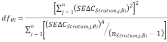
Where:
| Degrees of freedom for calculating the confidence interval for the net greenhouse gas abatement within the project area for reporting period |
| Standard error for the change in carbon stocks for the |
| Number of plots measured for the |
(1) For the first reporting period to reference the project, the change in carbon stocks occurring within the project (![]() ) to the end of reporting period (
) to the end of reporting period (![]() ) must be calculated using the equation:
) must be calculated using the equation:
![]()
Where:
| Change in carbon stocks occurring within the project for the current reporting period |
| Closing carbon stocks for the project at the end of the current reporting period |
| Initial carbon stocks for the project; t CO2e. Refer to Equation 3.1. |
(2) If an offsets report has been previously submitted (i.e. reporting period ![]() ), the change in carbon stocks occurring within the project (
), the change in carbon stocks occurring within the project (![]() ) during the current reporting period
) during the current reporting period ![]() must be calculated using the equation:
must be calculated using the equation:
![]()
Where:
| Change in carbon stocks occurring within the project for the current reporting period |
| Closing carbon stocks for the project at the end of the current reporting period |
| Closing carbon stocks for the project at the end of reporting period |
If the project is in the first reporting period, the standard error in change in carbon stocks occurring within the project to the end of the current reporting period ![]() must be calculated using the equation:
must be calculated using the equation:
![]()
Where:
| Standard error for change in carbon stocks occurring within the project for reporting period |
| Standard error for initial carbon stocks for the project; t CO2e. Refer to Equation 3.2. |
| Standard error for closing carbon stocks for the project at the end of reporting period |
If an offsets report has been previously submitted (reporting period ![]() ), then the error of the change in carbon stocks occurring within the project (
), then the error of the change in carbon stocks occurring within the project (![]() ) during the current reporting period (
) during the current reporting period (![]() ) must be calculated using the equation:
) must be calculated using the equation:
![]()
Where:
| Standard error for change in carbon stocks occurring within the project for reporting period |
| Standard error for closing carbon stocks for the project at the end of reporting period |
| Standard error for closing carbon stocks for the project at the end of reporting period |
The initial carbon stocks for the project must be calculated using the equation:

Where:
| Initial carbon stocks for the project; t CO2e. |
| Initial carbon stocks for the jth stratum; t CO2e. Refer to Equation 3.1. |
| The number of stratum. |
The standard error for the initial carbon stocks for the project must be calculated using the equation:
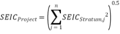
Where:
| Standard error for the initial carbon stocks for the project; t CO2e. |
| Standard error for the initial carbon stocks for the |
(1) Subject to subsection 6.15(4), the closing carbon stocks for the project must be calculated using the equations in subsections 6.15(2) or (3).
(2) If the closing carbon stocks for the project are less than the PPACS value (i.e.:![]() , then the following equation 2.7a must be used:
, then the following equation 2.7a must be used:
![]()
(3) If the closing carbon stocks for the project are equal to or greater than the PPACS value (i.e. ![]() then the following equation 2.7b must be used:
then the following equation 2.7b must be used:
![]()
(4) If the project proponent is applying Option 1 under subsection 5.3(6) then:
(a) the lower bound of the 90% confidence interval for closing carbon stocks in the project at the end of reporting period ![]() must be calculated in accordance with section 6.17; and
must be calculated in accordance with section 6.17; and
(b) the value for ![]() at paragraph (a) must be substituted for the closing carbon stocks for the project
at paragraph (a) must be substituted for the closing carbon stocks for the project ![]() in Equation 2.1 or 2.2 for the purpose of calculating the change in carbon stocks occurring within the project for the current reporting period
in Equation 2.1 or 2.2 for the purpose of calculating the change in carbon stocks occurring within the project for the current reporting period ![]() under section 6.10.
under section 6.10.
(5) In this section:
| Closing carbon stocks for the project at the end of reporting period | |
| Closing carbon stocks for the jth stratum at the end of reporting period | |
PPACS | Predicted project average carbon stocks (PPACS) over the modelling period; t CO2e. Refer to Equation 2.10. | |
| Lower bound of the confidence interval for closing carbon stocks in the project at the end of reporting period | |
|
| |
The standard error for the closing carbon stocks for the project at the end of reporting period ![]() must be calculated using the equation:
must be calculated using the equation:

Where:
| Standard error for the closing carbon stocks for the project at the end of reporting period |
| Standard error for the closing carbon stocks for the |
(1) If a project proponent is applying Option 1 under subsection 5.3(6), the lower confidence bound for closing carbon stocks in the project at the end of reporting period ![]() must be calculated using the equation:
must be calculated using the equation:
![]()
Where:
| Lower confidence bound for closing carbon stocks in the project at the end of reporting period |
| The closing carbon stocks in the project at the end of reporting period |
| Two-sided student’s t-value for the 90% confidence level. Refer to subsection (2). |
| Standard error for the closing carbon stocks in the project at the end of reporting period |
(2) To calculate the degrees of freedom ![]() , using Equation 1.4 in section 6.9, the project proponent must replace the term
, using Equation 1.4 in section 6.9, the project proponent must replace the term ![]() in Equation 1.4 with
in Equation 1.4 with ![]() (Standard error for the closing carbon stocks for the project) before making the calculation.
(Standard error for the closing carbon stocks for the project) before making the calculation.
If the project is a harvest project, the predicted project average carbon stocks over the modelling period must be calculated using the equation:

Where:
| Predicted project average carbon stocks over the modelling period; t CO2e. |
| Predicted project average carbon stocks for the jth stratum over the modelling period; t CO2e. Refer to Equation 2.11. |
If the project is a harvest project, the predicted stratum average carbon stocks (![]() ) for the jth stratum over the modelling period must be calculated using the equation:
) for the jth stratum over the modelling period must be calculated using the equation:
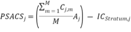
Where:
| Predicted stratum average carbon stocks for the jth stratum over the modelling period years; t CO2e. |
| Predicted carbon stocks of trees and debris for the jth stratum and mth month; t CO2e. Refer to Equation 2.12. |
M | Total number of months in the PPACS modelling period (e.g. for a 100 year modelling period M =1200). |
| Area of the jth stratum (ha). |
| Initial carbon stocks for the |
If the project is a harvest project, the output variables ![]() and
and ![]() , modelled using FullCAM must be converted to tonnes of carbon dioxide equivalent (t CO2e) for the calculation of the Predicted Stratum carbon stocks
, modelled using FullCAM must be converted to tonnes of carbon dioxide equivalent (t CO2e) for the calculation of the Predicted Stratum carbon stocks ![]() using the equation:
using the equation:
![]()
Where:
| Predicted carbon stocks for the jth stratum and mth month; t CO2e. |
| C mass of trees for the jth stratum and mth month as output from FullCAM; tC. |
| C mass of debris for the jth stratum and mth month as output from FullCAM; tC. |
Note Tonnes of carbon (tC) are converted to tonnes of carbon dioxide equivalent (t CO2e) by multiplying by the conversion factor 44/12, where 44/12 is the ratio of the molecular weights of carbon dioxide (CO2) to carbon (C).
(1) If the project trees in the stratum were planted after the declaration date, initial carbon stocks for the stratum must be zero: ![]() .
.
(2) Subject to subsection (1), if project trees in the stratum were planted prior to the declaration date, initial carbon stocks for the stratum must be calculated using the equation:
![]()
Where:
| Initial carbon stocks for the |
| Closing carbon stocks for the |
| Age of project trees in the |
| Difference between the planting start date for the |
(1) If all the project trees in the stratum were planted after the declaration date, the standard error for initial carbon stocks for the stratum is zero: ![]() .
.
(2) If project trees were planted in the stratum prior to the declaration date, the standard error for initial carbon stocks for the stratum must be calculated using the equation:
![]()
Where:
| Standard error for initial carbon stocks for the |
| Standard error for closing carbon stocks for the |
| Age of project trees in the |
| Difference between the planting start date for the |
The closing carbon stocks for the stratum (![]() ) to the end of reporting period
) to the end of reporting period ![]() must be calculated using the equation:
must be calculated using the equation:
![]()
Where:
| The closing carbon stocks in the |
| Mean plot carbon stocks for plots within the |
| Land area occupied by the |
The standard error for closing carbon stocks for the stratum to the end of reporting period ![]() must be calculated using the equation:
must be calculated using the equation:
![]()
Where:
| Standard error for closing carbon stocks in the |
| Standard error for mean plot carbon stocks for plots within the |
| Land area occupied by the |
The mean plot carbon stocks for the stratum (![]() ) to the end of reporting period
) to the end of reporting period ![]() must be calculated using the equation:
must be calculated using the equation:
![]()
Where:
| Mean plot carbon stocks for plots within the |
| Carbon stocks within the |
| Number of plots within the |
The standard error for mean plot carbon stocks in the ![]() th stratum at the end of reporting period
th stratum at the end of reporting period ![]() must be calculated using the equation:
must be calculated using the equation:
![]()
Where:
| Standard error for mean plot carbon stocks in the |
| Standard deviation of mean plot carbon stocks (Equation3.5) for plots within the |
| Number of plots assessed within the |
The carbon stocks in the carbon pools sampled within each plot assessed as part of a carbon inventory must be calculated using the equation:
![]()
Where:
| Carbon stocks in the carbon pools sampled within plot |
| Carbon stocks in the trees within plot |
| Carbon stocks in the roots of harvested trees within plot |
| Carbon stocks in litter within plot |
| Carbon stocks in CWD in plot |
The amount of carbon contained in the biomass of trees within a plot must be calculated using the equation:
![]()
Where:
| Carbon stocks in the trees in plot |
| Carbon fraction of biomass in trees; proportion. A default value of 0.5 must be used. |
| Area of plot |
| Total biomass of trees in plot |
If:
(a) the project is a harvest project; and
(b) the project proponent opts to measure the carbon in roots of harvested trees for a plot;
then the carbon dioxide equivalent of carbon in roots of harvested trees in the plot must be calculated using the equation:
![]()
Where:
| Carbon in roots of harvested trees in plot |
| Carbon fraction of roots of harvested trees; proportion. A default value of 0.5 must be applied. |
| Area of plot |
| Total biomass in roots of harvested trees in plot |
If the project proponent opts to measure the carbon in the litter in a plot in accordance with section 5.30, then the carbon dioxide equivalent of carbon stocks in the litter in the plot must be calculated using the equation:
![]()
Where:
| Carbon stocks in litter within plot |
| Carbon fraction of biomass in litter; proportion. A default value of 0.5 must be applied. |
| Total biomass in litter within plot |
If the project proponent opts to measure the carbon in the litter in a plot in accordance with section 5.29, then the biomass of the litter in the plot must be calculated using the equation:
![]()
Where:
| Biomass in litter within plot |
| Biomass in litter at the hth measurement point within plot p; t.ha-1. |
| Number of measurement points in plot p. |
If the project proponent opts to measure the carbon contained in the coarse woody debris (CWD) in a plot, then the carbon dioxide equivalent of carbon stocks in the CWD in the plot must be calculated using the equation:
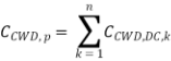
Where:
| Carbon stocks in CWD in plot |
| Carbon stocks in CWD in decay class |
| Number of decay classes |
If the project proponent opts to measure the carbon contained in the coarse woody debris (CWD) in a plot, then the carbon dioxide equivalent of carbon stocks in the CWD within a decay class in the plot must be calculated using the equation:
![]()
Where:
| Carbon stocks in CWD in decay class |
| Volume of CWD in decay class k; m3.ha-1. |
| Density of decay class k; (g. cm-3). |
| Carbon fraction of biomass in CWD; proportion. A default value of 0.5 must be applied (IPCC 2003). |
If the project proponent opts to measure the carbon contained in the coarse woody debris (CWD) in a plot, then the volume of CWD for each decay class k must be calculated using the equation:
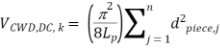
Where:
| Volume of CWD in decay class k; m3.ha-1. |
| Constant equal to the ratio of a circle’s circumference to its diameter; dimensionless. |
| Length of the CWD transect in plot p; m. |
| Diameter of piece j; cm. |
The total biomass of project trees in a plot must be calculated using the equation:

Where:
| Biomass of all project trees in plot |
| Biomass of |
| Number of live trees within plot |
If:
(a) the project is a harvest project; and
(b) the project proponent opts to estimate the carbon contained in roots of harvested trees for a plot;
then the total biomass contained in the roots of harvested trees in the plot must be calculated using the equation:
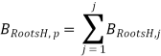
Where:
| Biomass in all harvested trees within plot |
| Biomass of |
| Number of harvested trees within plot |
If:
(a) the project is a harvest project;
(b) the project proponent opts to estimate the carbon contained in roots of harvested trees for a plot; and
(c) the plot is subject to the replant system specified in section 5.26;
then the total biomass contained in the roots of harvested trees in the plot ![]() must be calculated using the equation:
must be calculated using the equation:
![]()
Where:
| Biomass of roots in harvested trees under a replant system, at the end of reporting period; kg. |
| Biomass of roots in harvested trees under a replant system, at the end of the last reporting period before harvest; kg. Refer to Equation 7.5. |
e | Exponential (base of natural logarithms). |
YSH | Years since harvest; years. |
Note Under a replant system, all tree roots are taken to die at the time of harvest. The residual biomass of the roots of harvested trees may be calculated at any time after harvest by applying the decay function specified in this section.
If:
(a) the project is a harvest project;
(b) the project proponent opts to measure the carbon contained in roots of harvested trees for a plot; and
(c) the plot is subject to the coppice system specified in section 5.26;
then the total biomass contained in the roots of harvested trees in the plot ![]() must be calculated using the equation:
must be calculated using the equation:
![]()
Where:
| Biomass of roots in harvested trees under a coppice system, at the end of the last reporting period; kg. |
| Biomass of roots in harvested trees under a coppice system, at the time of the first harvest of the plot; kg. Refer to Equation 7.5. |
Note Under a coppice system, all tree roots are taken to remain alive after harvest, but their biomass is taken not to change after the first harvest.
The emissions from:
(a) fuel use as specified under section 5.31; and
(b) fire events as specified under section 5.32;
during a reporting period (![]() ) must be calculated using the equation:
) must be calculated using the equation:

Where:
| Project emissions for reporting period |
| Fuel emissions for the |
| Fire emissions for the |
| Number of strata; integer. |
The standard error for project emissions (![]() ) must be calculated using the equation:
) must be calculated using the equation:
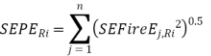
Where:
| Standard error for project emissions for reporting period |
| Standard error for fire emissions for the |
| The number of strata; integer. |
Note It is assumed that there is no error when estimating emissions from fossil fuel use and therefore any error is associated only with estimates of carbon losses due to fire.
The emissions from fuel use for the ![]() th stratum for a reporting period (
th stratum for a reporting period (![]() ) must be calculated using the equation:
) must be calculated using the equation:
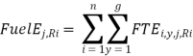
Where:
| Fuel emissions for the |
| The emissions for each fossil fuel type ( |
| Number of different types of fossil fuel ( |
| Number of different gas types ( |
Note It is assumed that the standard error associated with this estimate is equal to zero.
The emissions of carbon dioxide, methane and nitrous oxide resulting from the type of fuel use for the stratum must be calculated using the equation:
![]()
Where:
| Emissions for each fossil fuel type ( |
| The quantity of fossil fuel type ( |
| Energy content factor of fossil fuel type ( |
| Emission factor for each gas type ( |
The methane and nitrous oxide emissions from fire for the ![]() th fire-affected stratum during a reporting period must be calculated using the equation:
th fire-affected stratum during a reporting period must be calculated using the equation:
![]()
Where:
| Emissions from fire for the |
| The amount of CH4 emitted from fire-affected stratum |
| The amount of N2O emitted from fire-affected stratum |
Subject to section 6.46, the amount of methane emitted from fire-affected stratum ![]() for reporting period must be calculated using the equation:
for reporting period must be calculated using the equation:
![]()
Where:
| The amount of CH4 emitted from fire-affected stratum |
| The weight of elemental carbon emitted from fire for fire-affected stratum |
Note As at 16 May 2014, the global warming potential of methane (![]() ) as prescribed in the National Greenhouse and Energy Reporting Regulations 2008 is 21.
) as prescribed in the National Greenhouse and Energy Reporting Regulations 2008 is 21.
The amount of nitrous oxide emitted from a fire-affected stratum ![]() for the reporting period must be calculated using the equation:
for the reporting period must be calculated using the equation:
![]()
Where:
| The amount of N2O emitted from fire-affected stratum |
| The weight of elemental carbon emitted from fire for fire-affected stratum |
Note As at 16 May 2014, the global warming potential of nitrous oxide (![]() ) as prescribed in the National Greenhouse and Energy Reporting Regulations 2008 is 310.
) as prescribed in the National Greenhouse and Energy Reporting Regulations 2008 is 310.
(1) If the mean plot carbon stocks for plots within non-fire-affected stratum ![]() at the end of the reporting period (
at the end of the reporting period (![]() ) is less than the mean plot carbon stocks for plots within fire-affected stratum
) is less than the mean plot carbon stocks for plots within fire-affected stratum ![]() at the end of reporting period (
at the end of reporting period (![]() then methane and nitrous oxide emissions, and the standard errors for these values, are assumed to be zero; i.e. if
then methane and nitrous oxide emissions, and the standard errors for these values, are assumed to be zero; i.e. if ![]() then
then ![]() and
and ![]() .
.
Note Refer to section 6.48, Equation 5.10 for further information on ![]()
(2) In all other cases the weight of elemental carbon emitted as a result of fire from a fire-affected stratum ![]() for reporting period must be calculated using the equation:
for reporting period must be calculated using the equation:
![]()
Where:
| The weight of elemental carbon emitted from fire for fire-affected stratum |
| mean plot carbon stocks for plots within non-fire-affected stratum |
| mean plot carbon stocks for plots within fire-affected stratum |
| Land area occupied by fire-affected stratum |
(3) If the entire stratum in subsection (2) is fire-affected, then mean plot carbon stocks for the stratum from the previous offsets report can be used (![]() ) for the value
) for the value ![]() .
.
The standard error for the methane and nitrous oxide emissions from fire for the ![]() th fire-affected stratum during a reporting period must be calculated using the equation:
th fire-affected stratum during a reporting period must be calculated using the equation:
![]()
Where:
| Standard error for total fire emissions for the |
| Standard error for the amount of CH4 emitted from fire-affected stratum |
| Standard error for the amount of N2O emitted from fire-affected stratum |
The standard error for the amount of methane emitted from a fire-affected stratum ![]() for the reporting period must be calculated using the equation:
for the reporting period must be calculated using the equation:
![]()
Where:
| Standard error for the amount of CH4 emitted from fire-affected stratum |
| Standard error for the weight of elemental carbon emitted from fire-affected stratum |
Note As at 16 May 2014, the global warming potential of methane (![]() ) as prescribed in the National Greenhouse and Energy Reporting Regulations 2008 is 21.
) as prescribed in the National Greenhouse and Energy Reporting Regulations 2008 is 21.
The standard error for the amount of nitrous oxide emitted from a fire-affected stratum ![]() for the reporting period must be calculated using the equation:
for the reporting period must be calculated using the equation:
![]()
Where:
| Standard error for the amount of N2O emitted from fire-affected stratum |
| Standard error for the weight of elemental carbon emitted from fire-affected stratum |
Note As at 16 May 2014, the global warming potential of nitrous oxide (![]() ) as prescribed in the National Greenhouse and Energy Reporting Regulations 2008 is 310.
) as prescribed in the National Greenhouse and Energy Reporting Regulations 2008 is 310.
Subject to section 6.46, the standard error for the weight of elemental carbon emitted as a result of fire from a fire-affected stratum ![]() for a reporting period must be calculated using the equation:
for a reporting period must be calculated using the equation:
![]()
Where:
| Standard error for the weight of elemental carbon emitted from fire-affected stratum |
| Standard error for mean plot carbon stocks for plots within non-fire-affected stratum |
| Standard error for mean plot carbon stocks for plots within fire-affected stratum |
| Land area occupied by fire-affected stratum |
(1) The probable limits of error for the estimate of closing carbon stocks in a project at the end of a reporting period must be calculated using the equation:
![]()
Where:
| Probable limits of error for the estimate of closing carbon stocks in a project at the end of a reporting period |
| Standard error for the estimate of closing carbon stocks in a project at the end of a reporting period |
| Two-sided student’s t-value for the 90% confidence level. Refer to subsection (2). |
| Estimate of closing carbon stocks in a project at the end of reporting period |
(2) To calculate the degrees of freedom ![]() , using Equation 1.4 in subsection 6.9, the project proponent must replace the term
, using Equation 1.4 in subsection 6.9, the project proponent must replace the term ![]() in Equation 1.4 with
in Equation 1.4 with ![]() (closing carbon stocks for the project) prior to making the calculation.
(closing carbon stocks for the project) prior to making the calculation.
The number of plots required to meet the target probable limits of error as specified in section 5.3, may be estimated from the equation:
![]()
Where:
| Number of plots required to meet the precision standard; rounded up to the nearest whole integer. |
| Number of plots assessed initially; integer. |
| Probable limits of error from the plots assessed initially; percentage. Refer to Equation 6.1. |
| Probable limits of error specified by the precision standard; percentage. |
Note If stratified sampling is applied, it is assumed that any increase in the number of plots will be applied proportionately across all strata. For example, if the number of plots in a project must be increased by 30% to meet the precision standard, then the number of plots in any stratum must also be increased by 30%. To safeguard against having insufficient plots to meet the precision standard, it is recommended that the number of plots be increased by > 30% in some or all strata.
Allometric equations must be in the following form:
![]()
Where:
| Response variable, For example: total tree biomass (BT), above-ground biomass (BAGB); kg or litter biomass (Blitter) |
| ≥ 1 predictor measure(s), e.g. stem diameter, crown volume index; dimensions depend on the predictor measure; various dimensions. |
To estimate total tree biomass or above-ground biomass for a dead or burnt tree an additional factor ![]() must be applied in the following form:
must be applied in the following form:
![]()
Where:
| Response variable, e.g. total tree biomass (BT) or above-ground biomass (BAGB); kg. |
| Predicted y derived from the applied allometric function and the measured value of the predictor measure, assuming the tree was not dead or burnt; kg. |
| Fraction remaining, i.e. the proportion of above-ground biomass remaining in a dead and/or burnt tree compared to a live and unburnt tree with the same stem diameter or other equivalent variable for the predictor measure. |
The total biomass for a biomass sample tree or a test tree must be calculated using the equation:

Where:
| Total biomass for the biomass sample tree or the test tree; kg (dry matter). |
| The number of biomass components |
| The biomass for the |
(1) If the root biomass of a tree is the ![]() th biomass component
th biomass component ![]() , estimated in accordance with section 5.25, then Equation 7.3 in section 6.55 must be used to calculate the total biomass for the tree,
, estimated in accordance with section 5.25, then Equation 7.3 in section 6.55 must be used to calculate the total biomass for the tree, ![]() .
.
(2) If the root biomass of a tree is estimated through the use of a root:shoot ratio calculated for the relevant modelling stratum in FullCAM according to section 5.25, then the project proponent must:
(a) add the dry weight of each above-ground biomass component (e.g. stem, crown, dead attached material) so as to estimate total above-ground biomass for a biomass sample tree or a test tree (![]() ) using Equation 7.4;
) using Equation 7.4;
(b) calculate the total root biomass for the biomass sample tree or the test tree (![]() ) using Equation 7.5; and
) using Equation 7.5; and
(c) calculate the sum of the output values from Equations 7.4 and 7.5 using Equation 7.3 by treating (![]() ) and (
) and (![]() ) as two separate biomass components (
) as two separate biomass components (![]() ).
).
The total above-ground biomass for a biomass sample tree or a test tree must be calculated using the equation:
Where:
| Total above-ground biomass for the biomass sample tree or test tree; kg (dry matter). |
| The number of above-ground biomass components within the biomass sample tree or test tree; integer. |
| The biomass for the |
If:
(a) a project tree has not been harvested;
(b) the root:shoot ratio has been estimated using FullCAM in accordance with section 5.25; and
(c) above-ground biomass of the tree has been estimated from an allometric function using Equation 7.1 in accordance with section 6.53;
then the total dry weight of all root biomass components must be calculated using the equation:
![]()
Where:
| Total root biomass for the tree; kg (dry matter). |
| Ratio of below-ground biomass to above-ground biomass; dimensionless. |
| Above-ground biomass for the tree, estimated from Equation 7.1 in accordance with section 6.53; kg (dry matter). |
Note Root biomass components include the tap root or lignotuber and lateral roots.
The dry weight of the biomass component k of a biomass sample tree or test tree must be calculated using the equation:
![]()
Where:
| Total biomass for biomass component |
| The fresh-weight of biomass component |
| Dry-wet weight ratio for biomass component |
| biomass component |
The mean of residuals must be calculated using the equation:
![]()
Where:
| Mean of residuals (measured –predicted); kg biomass. |
| Measured biomass of the ith tree (biomass sample tree or test tree); kg. Refer to Equation 7.3. |
| Predicted biomass of the ith tree (biomass sample tree or test tree), biomass predicted from the applicable allometric function; kg. Refer to Equation 7.1. |
| The number of biomass sample trees or test trees; integer. |
Note In Equation, 7.7 the mean of the residual biomass is calculated as the difference between the measured biomass of biomass sample trees or test trees and the biomass predicted from the allometric function.
For the purpose of apply a weighting factor in accordance with section 5.10, the weighting factor must be of the following form:
![]()
Where:
| The weighting factor applied to the biomass sample tree or the test tree ( |
| Predictor measure of the biomass sample tree or test tree ( |
| Constant derived through regression analysis. |
Greenhouse gas emissions from fuel
(1) A project proponent must retain records, that can be used to estimate the quantity in kilolitres (kL), of each fuel type combusted for when undertaking project activities within a reporting period.
Greenhouse gas emissions from fire
(2) A project proponent must collect data relating to the occurrence of fire events in accordance with Part 3.
A project proponent must ascertain and record the following items, in the manner specified in the Technical Reference Guide where applicable, for the purposes of calculating project removals:
(a) predictor measures for allometric functions;
(b) stratum area, expressed in hectares (ha);
(c) TSP and PSP area, expressed in hectares (ha), and measured each time a plot is established;
(d) predictor measures, collected for each project tree located within each plot assessed;
(e) the number, expressed as a whole number, of project trees located within each plot assessed; and
(f) tree species, recorded for each project tree located within each plot assessed.
For the purposes of subsection 106(3) of the Act, a proponent of an offsets project to which this Determination applies must comply with the monitoring, record‑keeping and reporting requirements of this Part.
(1) For the purpose of monitoring the project:
(a) the measurements must be made as specified in sections 6.62 and 6.63; and
(b) the following may be used to monitor the project:
(i) on-ground inspections and surveys; and
(ii) remote monitoring such as interpretation of aerial or satellite imagery.
(2) Subject to subsection (3), contemporary ortho-rectified aerial imagery of each stratum must be sourced at least once every 5 years after the end of the reporting period for the first offsets report and again at the end of the current crediting period.
(3) If the end of the current crediting period is within 2 years of the date that contemporary ortho-rectified aerial imagery must be sourced for a stratum, the project proponent is only required to source the imagery for the stratum at the end of the current crediting period.
(4) Subject to Part 3, if the project monitoring specified in subsections (1) and (2) indicates that the project requirements specified in subsection 2.3(2) are not met across part or all of a stratum:
(a) the non‑compliant area must not be included in the calculations for the stratum area;
(b) for the purposes of the processes specified in Division 5.1:
(i) the stratum area must be taken to be zero; and
(ii) any carbon stocks for the stratum must be taken to be zero;
(c) a project proponent may redefine stratum boundaries in accordance with subsections 3.3 and 3.9 so that any land that does not meet the project requirements specified in subsection 2.3(2) is no longer defined as part of the stratum area.
Note Subsection 2.3(2) sets out height and crown cover requirements for project trees established within strata and Part 3 sets out the requirements for delineating boundaries.
(5) A project proponent must monitor growth disturbance events within the project area and record the features of these events in accordance with the requirements specified in Part 3 and section 7.26.
Note See paragraph 106(3)(c) of the Act and regulation 17.1 of the Regulations.
For paragraph 17.1(2)(b) of the Regulations, a project proponent must make a record of the information specified in this Division and in Division 7.4.
The following records about stratum descriptions, location, and area must be created and maintained:
(a) spatial data and mapping files stored in a geographical information system; and
(b) original ortho-rectified aerial images.
The following records about each individual project tree assessed during a carbon inventory must be created and maintained:
(a) tree type;
(b) estimated biomass;
(c) the allometric function applied to generate the estimate specified in paragraph (b); and
(d) values of predictor measures.
All input data for, and the result of, each equation set out in Division 6.2 must be maintained.
The following records about allometric functions must be created and maintained:
(a) allometric reports; and
(b) equipment checks.
(1) Sampling plans must be retained as records
(2) Information on project operation must be retained as records including:
(a) the project type and any change of project type;
(b) the management regime and any change to the management regime for project or stratum; and
(c) any natural disturbance for the project area or strata;
(d) date-stamped FullCAM output files (.plo file) used for the estimation of the predicted project average carbon stocks as undertaken in accordance with section 4.9.
Records relating to the following quality assurance and control measures must be created and maintained:
(a) document archiving and versioning;
(b) type of measurement equipment used to collect measures during any of the activities specified in Division 5.1;
(c) calibration of measurement equipment and equipment checks applied when collecting data during any of the activities specified in Division 5.1; and
(d) corrective action taken where the equipment checks specified in paragraph (c) indicate equipment is returning inaccurate values.
Records relating to fuel use, for example invoices, vehicle logbooks, records of project activity, or reports of calculated consumption based on hourly or per hectare consumption rates, must be created and maintained.
Note If records of fuel use for project activities cannot be disaggregated from non‑project activities, estimates may be based on the time spent undertaking project activities and the known average fuel consumption of vehicles or machinery.
(1) For the purposes of paragraph 6.2(j) of the Regulations, this Subdivision sets out the information that is required to be submitted in the first offsets report for a project to which this Determination applies.
(2) The first offsets report for a project must also include the information set out in Subdivision 7.4.2.
The first offsets report for a project must contain:
(a) land title references for land over which the project is located;
(b) geospatial data files detailing the boundary of the project area;
(c) maps showing the boundary of the project area; and
(d) project type (permanent planting or harvest).
The first offsets report must contain the following information in relation to each stratum that it references:
(a) geospatial data files detailing the boundary of the stratum;
(b) maps showing the boundary of the stratum;
(c) a description of the planting method applied within the stratum and records demonstrating that the establishment of project trees has been through planting;
(d) planting start date and planting finish date;
(e) if the planting finish date for a stratum occurred before the declaration date, the number of years between the planting finish date and the declaration date for the stratum; and
(f) a description of the rationale for stratification.
(1) The first offsets report must contain the following information in relation to each stratum that it references:
(a) a written statement confirming the stratum area was clear of non-project forest for at least 5 years before commencement;
(b) if the stratum area was clear of forest at 31 December 1989, a written statement confirming the stratum area was clear of forest at that time;
(c) a description of the land use occurring within the stratum area for at least 5 years before commencement; and
(d) ortho-rectified aerial imagery demonstrating:
(i) ongoing management of land under a cleared regime for at least 5 years before commencement; and
(ii) historic non-project forest cover in relation to the stratum area, including at the times specified in paragraphs (a) and (b).
(2) If the imagery specified in paragraph (1)(d) is indistinct, one or more of the following may also be provided to demonstrate the information specified in subparagraphs (1)(d)(i) and (1)(d)(ii):
(a) farm management plans;
(b) land-use records.
The first offsets report for a project must include documented procedures for the following quality assurance and control measures:
(a) identifying and correcting data transcription errors; and
(b) checking and calibrating equipment.
For paragraph 6.2(j) of the Regulations, this section sets out the information that is required to be submitted in an offsets report for a project to which this Determination applies.
Note The first offsets report for a project must also contain the information specified in Subdivision 7.4.1.
An offsets report must include the following information about the project:
(a) project type (permanent planting or harvest) if different from the previous report;
(b) the current management regime and any changes to the management regime that have occurred since the submission of the previous offsets report;
(c) list of identifiers for strata occurring within the project area at the end of the reporting period;
(d) net greenhouse gas abatement for the project for the reporting period and associated standard error;
(e) change in carbon stocks for the project for the reporting period and associated standard error; and
(f) estimated project emissions for the reporting period and associated standard error.
An offsets report must include the following information about the location and area of strata occurring within the project area at the end of the reporting period:
(a) land area associated with each stratum, in hectares;
(b) written description of the location of each stratum;
(c) maps showing the location and boundary of each stratum; and
(d) if ortho-rectified aerial imagery has been obtained by the project proponent in relation to the stratum area during the reporting period—the imagery or, if not yet collected, the date the imagery is next intended to be collected.
(1) The first time a stratum is referenced in an offsets report, or if a stratum has been redefined in accordance with Part 3 since the last offsets report submitted for the project, the information specified in sections 7.13 and 7.14 must be included in the offsets report.
(2) An offsets report must include the following information about the status of each stratum occurring within the project area at the end of the reporting period:
(a) the time elapsed since the last offsets report which referenced the stratum was submitted to the Regulator;
(b) for project trees, the tree types noted as occurring within the stratum during the reporting period;
(c) anticipated crown cover across the stratum area when project trees are at maturity;
(d) anticipated height at maturity for project trees occurring within the stratum; and
(e) the occurrence of a natural disturbance within the stratum during the reporting period.
An offsets report must include the following information about carbon stocks for each stratum occurring within the project area at the end of the reporting period:
(a) number of years since the last carbon inventory referenced in an offsets report occurred in the stratum ;
(b) if applicable, a written statement confirming a carbon inventory was completed within the stratum during the reporting period and recording or annexing, for the most recent inventory, the following;
(i) dates of the carbon inventory;
(ii) the number of plots assessed within the stratum during the inventory, expressed as the total number of plots assessed and the number of plots assessed per hectare;
(iii) maps showing actual location for plots assessed within the stratum during the inventory;
(iv) estimate of mean project tree height for the stratum at the date of the inventory;
(v) for project trees, the mean number of live trees calculated across all plots in the stratum at the date of the inventory;
(vi) estimate of average crown cover, expressed as a percentage, across all plots in the stratum at the date of the inventory;
(vii) mean, maximum, and minimum values of predictor measures across all plots in the stratum at the date of the inventory;
(viii) mean carbon stocks and associated standard error and probable limits of error calculated across all plots in the stratum at the date of the inventory;
(ix) estimate of stratum carbon stocks, associated standard error and, where calculated, outcomes of the equations in sections 6.21 to 6.26 at the date of the inventory;
(c) estimate of carbon stocks at the declaration date, or at the time the project’s previous offsets report was submitted, whichever is the more recent date;
(d) carbon stock change since the declaration date, or the time the project’s previous offsets report was submitted, whichever is the more recent date; and
(e) a list of allometric functions applied during the current reporting period within the stratum.
An offsets report for a project must include the following information about all plots assessed as part of a carbon inventory occurring during the reporting period:
(a) type of plot (TSP or PSP) and plot identifier;
(b) actual location coordinates of plot;
(c) the date of the most recent carbon inventory on the plot;
(d) dimensions, shape and plot layout option, including an estimate of the land area occupied by the plot;
(e) number of live trees, expressed as trees per hectare, calculated for the plot at the date of the most recent assessment performed;
(f) estimated crown cover as a percentage of the plot area at the date of the most recent assessment performed;
(g) mean value for the predictor measures calculated across the plot at the date of the most recent assessment;
(h) plot carbon stocks calculated at the date of the most recent assessment;
(i) number of project trees represented in the plot; and
(j) allometric functions applied to estimate biomass within the plot.
An offsets report for a project must include information about the following:
(a) the current management regime as specified in section 4.5;
(b) the results of the predicted project average carbon stocks (PPACS) calculation as specified in section 4.9;
(c) the FullCAM data output as specified in section 4.9;
(d) any changes to the management regime; and
(e) any changes to the PPACS modelling or PPACS value;
At the first application of an allometric function to a stratum for the purposes of calculating carbon stocks in accordance with Subdivision 6.2.3, an offsets report must include the following:
(a) a sampling plan detailing the approach to the selection of biomass sample trees used to develop the allometric function, documented in accordance with Subdivision 5.1.2; and
(b) an allometric report documented in accordance with section 5.13.
An offsets report must include the following information about the application of allometric functions:
(a) a list of allometric functions applied within strata during the reporting period;
(b) a description of the allometric domain for all allometric functions applied within strata during the reporting period;
(c) outcomes of the compatibility checks specified in section 5.15, confirming that any allometric function applied during the reporting period is applicable to project trees within strata; and
(d) outcomes of the validation test for regional allometric functions specified in section 5.16, where the regional allometric functions have been applied during the reporting period.
An offsets report for a project must include sampling plans developed in accordance with Subdivision 5.1.2 for any carbon inventory, biomass sample tree, or test tree assessment undertaken during the reporting period.
An offsets report for a project must include the following information about any growth disturbance events that occur during the reporting period:
(a) date of, and the time elapsed since, the disturbance event;
(b) stratum area affected by the disturbance event, including maps of affected areas and supporting geospatial data;
(c) nature and severity of the disturbance event, including a statement detailing the project proponent’s opinion on the likely long-term impact on carbon stocks, and the anticipated time until the affected area has recovered;
(d) any action taken to separate the affected land area as a disturbance-affected stratum or a fire-affected stratum;
(e) actions taken to restore carbon stocks;
(f) details of any monitoring activities, and the outcomes of those activities; and
(g) calculations for methane (CH4) and nitrous oxide (N2O) emissions associated with any fire-affected stratum.
An offsets report for a project must include the following information about quality assurance and control measures:
(a) any updates, since the first offsets report for the project, of documented procedures for identifying and correcting data transcription errors;
(b) outcomes of data transcription error checks and a description of corrective actions taken; and
(c) any updates, since the first offsets report for the project, of documented procedures for checking equipment and calibrating equipment.
An offsets report for a project must include the following information:
(a) an estimate of fossil fuel used to deliver project activities; and
(b) calculated emissions arising from that fossil fuel use.
Note
1. All legislative instruments and compilations are registered on the Federal Register of Legislative Instruments kept under the Legislative Instruments Act 2003. See http://www.frli.gov.au.