
October 2018
 Prepared by Prepared for


West Block and the Dugout Heritage Management Plan 2022

I, Ben Morton, make the following plan under section 341S of the Environment Protection and Biodiversity Conservation Act 1999.
The name of this plan is the West Block and the Dugout Heritage Management Plan 2022.
Dated 7 March 2022
Ben Morton
Special Minister of State

West Block and the Dugout Heritage Management Plan 2022
Date | Document status | Reviewed by |
June 2018 | Incomplete draft for comment | Peter Lovell Director and Founding Principal, Lovell Chen |
July 2018 | Draft for review | Adam Mornement Associate Principal, Lovell Chen |
August 2018 | Complete draft | Adam Mornement Associate Principal, Lovell Chen |
August 2018 | Report for review by the Australian Heritage Council | Adam Mornement Associate Principal, Lovell Chen |
| | |
Cover: Oblique aerial photograph looking south-east at West Block (then Secretariat no. 2) from Commonwealth Avenue, 1928
(Source: National Archives of Australia)
West Block and the Dugout Heritage Management Plan Prepared for Geocon October 2018 |
TABLE OF CONTENTS
LIST OF FIGURES
PROJECT TEAM
ACKNOWLEDGEMENTS
EXECUTIVE SUMMARY
1.0 INTRODUCTION
1.1 Background and brief
1.2 Identification of the place
1.2.1 Note regarding orientation
1.3 Parliamentary Zone
1.4 Methodology and document structure
1.5 Statutory heritage controls
1.5.1 Environment Protection and Biodiversity Conservation Act 1999
1.6 Non-statutory heritage listings and classifications
1.6.1 National Trust of Australia (ACT)
1.6.2 Register of the National Estate
1.6.3 Register of Significant Twentieth Century Architecture
1.7 Consultation with Aboriginal and Torres Strait Islander people
1.8 Social values
1.9 Limitations
2.0 UNDERSTANDING THE PLACE
2.1 Pre-European settlement
2.2 The Griffin plan for Canberra
2.3 Early planning for Canberra (1912-1925)
2.3.1 Walter Burley Griffin, Federal Capital Director of Design and Construction (1913-20)
2.3.2 The Federal Capital Advisory Committee (1921-24)
2.3.3 Federal Capital Commission (1925-30)
2.4 The Parliament House Secretariat group (1922-28)
2.4.1 Design and construction
2.4.2 John Smith Murdoch (1862-1945)
2.4.3 Landscaped setting
2.4.4 Charles Weston (1866-1935)
2.5 West Block, 1927-38
2.5.1 Alterations, 1927-38
2.6 World War II, 1940-45
2.6.1 The Dugout
2.6.2 Alterations and additions, 1940-46
2.7 Post-World War II 1946-60s
2.7.1 Alterations and additions, 1946-60s
2.8 Refurbishment, 1970s-80s
2.8.1 Alterations and additions, 1970s-80s
2.9 Recent history, 1988-present
2.10 Existing conditions
2.10.1 Site overview
2.10.2 West Block
2.10.3 The Dugout
2.10.4 Landscaped setting
2.10.5 Views and visual relationships
3.0 ASSESSMENT OF SIGNIFICANCE
3.1 Assessment of historic value
3.1.1 The Commonwealth of Australia
3.1.2 Canberra as the National Capital
3.1.3 The Dugout
3.1.4 Associations
3.2 Assessment of aesthetic value
3.2.1 The Federal Capital style
3.2.2 Landscaped setting
3.3 Assessment of social value
3.4 Assessment against Commonwealth Heritage criteria
3.5 Statement of significance
3.5.1 Summary Statement of Significance
3.5.2 Comment
3.6 Attributes related to significance
4.0 OPPORTUNITIES AND CONSTRAINTS
4.1 Implications arising from significance
4.2 Legislation
4.2.1 Environment Protection and Biodiversity Conservation Act 1999 (Australia)
4.2.2 Commonwealth Heritage List
4.2.3 Australian Capital Territory (Planning and Land Management) Act, 1988 (Commonwealth)
4.2.4 Parliament Act, 1974 (Commonwealth)
4.2.5 Utilities Act 2000 (ACT)
4.2.6 National Construction Code (BCA) compliance
4.2.7 Disability Discrimination Act, 1992
4.3 Crown Lease
4.4 Stakeholders
4.4.1 Department of the Environment and Energy
4.4.2 National Capital Authority
4.4.3 Aboriginal and Torres Strait Islander people
4.4.4 Associations and special interest groups
4.4.5 General public
4.5 Condition and presentation of built fabric
4.6 Condition and presentation of setting
5.0 CONSERVATION POLICIES AND MANAGEMENT GUIDELINES
5.1 Definitions
5.2 General policies
5.3 Conservation policies
5.4 Use, adaptation and change
5.5 Management policies
5.6 Implementation plan
5.6.1 Monitoring of implementation
BIBLIOGRAPHY
ENDNOTES
APPENDIX A HERITAGE CITATIONS
APPENDIX B HISTORIC DRAWINGS AND DOCUMENTATION
LIST OF FIGURES
Figure 1 Aerial view of the Parliamentary Triangle: West Block is indicated (17 March 2018)
Figure 2 Plan of survey for Block 3, Section 23 Parkes (part)
Figure 3 Aerial view of West Block and its setting: the Dugout is indicated
Figure 4 The Parliament Zone is hatched
Figure 5 The Government Group: detail of the Griffin’s competition entry, 1911
Figure 6 View looking south along the Land Axis from Mount Ainslie, rendering by Marion Mahony Griffin for the 1911 competition
Figure 7 The Departmental Board plan for Canberra, 1912 (part)
Figure 8 Aerial view of south Canberra, 1928: the National Triangle (part) is visible to the left
Figure 9 View of West Block from the north-west, 1929: note the corner balconies and verandahs
Figure 10 View looking south from Mount Ainslie, 1927: the area now known as Anzac Parade is in the centre-ground, with East and West blocks to either side of the Provisional Parliament House
Figure 11 Detail of ‘Permanent Planting for the Governmental Group’, 1928, Commonwealth Avenue (part) is to the left: ‘10’ indicates Cedrus deodara (Himalayan cedar) and ‘9’ indicates Cedrus atlantica (Atlantic cedar)
Figure 12 View looking south-east along Commonwealth Avenue, c. 1940s, with cedar plantings maturing: West Block is visible to the rear
Figure 13 Oblique aerial looking south-west over the Parliamentary Gardens, c. 1928: West Block is visible to the rear of the Provisional Parliament House
Figure 14 Detail of the oblique aerial c. 1928: note the avenue of trees aligned to the north elevation of West Block, and the symmetrically-positioned sentinel poplars either side of Queen Victoria Terrace
Figure 15 Oblique aerial, 1928
Figure 16 Aerial view of West Block, 1950
Figure 17 Public servants in the Prime Minister's Department, West Block, 1928
Figure 18 Plans for the National Library at West Block, 1926
Figure 19 Proposed temporary building for the Cables Branch (unbuilt), 1943
Figure 20 ‘D Block’, pictured 1954, as viewed from the south-east
Figure 21 Proposed additional office accommodation and new main entrance, West Block, 1945
Figure 22 New main entrance to West Block in 1959, showing the original signage ‘Commonwealth Office West Block’
Figure 23 Ventilation and heating was installed at the ‘Dugout’ in 1943, for the adaptation of the air raid shelter to accommodate a Typex decoding machine
Figure 24 East elevation of B Block, 1944: an external staircase provided access into the building from the Dugout
Figure 25 West block – site plan, 1948, showing the extensions made to A block
Figure 26 Sequential development of West Block, ground floor
Figure 27 Sequential development of West Block, First Floor
Figure 28 Sequential development of West Block, Second Floor
Figure 29 Sequential development of West Block, Third Floor/Roof Plan
Figure 30 Ventilation and heating was installed at the ‘Dugout’ in 1943, for the adaptation of the air raid shelter to accommodate a Typex decoding machine
Figure 31 Dugout: view looking north, with the original west elevation at right, and the 1980s screen wall at left
Figure 32 West elevation of the Dugout: the 1980s screen wall is in the foreground
Figure 33 Tree-lined vista extending north from A Block: view looking south to West Block
Figure 34 Native plantings to the east and south-east of West Block
Figure 35 View of West Block from the car park to the east
Figure 36 View of West Block from Commonwealth Avenue, looking south
Figure 37 View of West Block, south elevation, from the slip road to State Circle
Figure 38 West Block (north elevation) as seen from the tree-lined pathway to the north
Figure 39 Typex cypher machines of the type housed in the Dugout, operated by the Women's Auxiliary Air Force (UK)
Figure 40 Mount Stromlo Observatory, established 1924
Figure 41 Albert Hall, Canberra, 1928
Figure 42 Melbourne and Sydney buildings, Civic (1926-27)
Figure 43 Detail of Howard’s vision for a ‘Garden City’
Figure 44 Designated Area Precincts: the Parliamentary Zone is identified as precinct 1
Figure 45 Parliamentary Zone, Indicative Development Plan, detail of the Parliamentary Executive, Campus A (‘H’ is Magna Carta Place, and ‘I’ is Constitution Place)
Figure 46 Perspective view of the Parliamentary Zone ‘campuses’ looking south-west: West Block is indicated
Figure 47 Significant trees and landscape character areas
Figure 48 West Block: heritage curtilage, showing the curtilage extending toward East Block
Figure 49 West elevation of West Block (part), c. 1928: the pull-down awnings in boxed casings were an early addition
Figure 50 West elevation of West Block (part), 1972
Figure 51 Aerial view of West Block: the location of an indicative building envelope is in pink
Figure 52 Lettering reading ‘Commonwealth Offices West Block’ was added over the main entrance in the early post-World War II period
Figure 53 Detail of ‘Permanent Planting for the Governmental Group’, 1928, with the original structured arrangement indicated
Figure 54 Existing interpretation at West Block
PROJECT TEAM
Adam Mornement, Associate Principal, Lovell Chen
Peter Lovell, Director and Founding Principal, Lovell Chen
Felicity Strong, Heritage Consultant, Lovell Chen
Michael Cook, Heritage Consultant, Lovell Chen
Brigitte Samwell, Graphic Design, Lovell Chen
ACKNOWLEDGEMENTS
Eric Martin, Managing Director, Eric Martin and Associates
EXECUTIVE SUMMARY
This Heritage Management Plan (HMP) for West Block and the Dugout (generally referred to here as West Block) at Block 3, Section 23 Parkes (part), Canberra was commissioned by the Geocon Group. The company signed a 99-year Crown Lease for the property on 20 November 2017. It plans to adapt the redundant three and four-level office building at the site as a hotel.
West Block is included in the Commonwealth Heritage List (CHL place ID 105428), which is established under the Environment Protection Biodiversity Conservation Act 1999 (EPBC Act). This HMP has been prepared in accordance with Schedule 7A of the Commonwealth Environment Protection Biodiversity Conservation Regulations, 2000: ‘Management Plans for Commonwealth Heritage Places’. The overarching objective of Schedule 7A of the EPBC Act is to provide frameworks to inform the future conservation and management of the cultural heritage values of places included in the Commonwealth and National heritage lists. This document also follows the principles and processes set out in heritage best practice guidelines, including the Burra Charter (2013).
Overview of the asset
West Block was designed in 1925, built in 1926-27 and was in use from August 1927. It formed part of the Parliament House Secretariat group, which also includes East Block and the Provisional Parliament House.
West Block comprises a series of four three-storey wings (or blocks) of varying footprint connected on a north-south axis. It was designed in the interwar Stripped Classical style (also referred to as Modern Renaissance). Distinguishing characteristics of the architectural language include horizontal massing, symmetrical façades divided into vertical bays, classical proportions and a general absence of applied detail. It was a pragmatic and well-resolved solution to the challenge of accommodating a variety of official uses and operations within a tight timeframe. The building has been subject to incremental change since 1937-38, when the first major works were carried out, including infilling of the original corner verandahs and balconies. The last phase of external alterations was completed in 1948.
There is a triangular at-grade car park to the west of the building, which is contemporary with the site’s establishment and is within Block 3, Section 23 Parkes (part). A larger car park to the east of West Block, which dates from the late-1950s and is located on higher ground, is not within the site boundary. There is a service road to the west of the West Block, separating the building from the triangular integral car park.
An embankment to the east of the office building dates to 1925-26, when the site was partially levelled. The Dugout, a 1942 air raid shelter, is built into the embankment. At the beginning of 1943, the shelter was adapted to accommodate a Typex cypher machine, used for coding and decoding cables. The Typex machine enabled Prime Minister John Curtin to communicate directly with British Prime Minister Winston Churchill and American President Franklin Roosevelt during World War II. The building has been in use as a substation since 1945.
The landscape treatment to the north and west of West Block, including around the triangular car park, was established in the 1920s, as part of the broader landscaping for the south end of the Parliamentary Triangle. Remnants of the formal 1920s landscape treatment, including mature deciduous trees and some hedges, are extant both within the subject site and addressing both sides of Queen Victoria Terrace. The native plantings to the south and south-east of West Block are generally more recent.
The site includes no significant objects or items of moveable heritage.
Findings
The assessment of significance undertaken for this HMP has found that West Block satisfies the CHL threshold for: Criterion A (historical significance), Criterion D (principal characteristics), Criterion E (aesthetic significance), Criterion F (creative/technical significance) and Criterion H (significant associations).
West Block is of historical significance to Australia for its association with Federation. The building is a component of the Parliament House Secretariat group, the first premises purpose-built for Australia’s democratic government. The principal component of the group is the Provisional Parliament House itself, as reflected in its siting on the Land Axis, and its visual prominence within the national capital. West and East blocks were supporting elements. The primary role of these multi-purpose buildings was office accommodation. The buildings within the Parliament House Secretariat group were conceived as temporary, pending the construction of a permanent Parliament House, completed in 1988.
The Dugout is of historical significance as the building from which Prime Minister Curtin communicated with Australia’s allies during World War II, using a Typex cypher machine. The building is also significant as a remnant of the World War II defences introduced within the Parliamentary Zone during World War II.
West Block is significant for demonstrating the principal characteristics of the Federal Capital style, an interpretation of interwar Stripped Classicism which is now strongly associated with Canberra’s establishment phase. Internal evidence of the building’s original/early character and layout is generally limited.
The buildings that make up the Parliament House Secretariat group are symmetrically positioned within a large-scale landscape (the Parliamentary Triangle, south of King Edward Terrace) that was conceived in the 1920s as the centrepiece of the Federal Capital. The landscape of the Parliamentary Triangle, although much altered, is of aesthetic significance. The formality of the planned landscape provides an appropriately distinguished setting for the Provisional Parliament House. It also contributed to the establishment of Canberra’s ‘Garden City’ identity.
The Parliament House Secretariat group is located at the southern end of the Land Axis (Parliament House Vista), a key symbolic and planning component of Walter Burley Griffin’s concept for the National Capital. The three buildings were designed by the office of J S Murdoch, Chief Architect of the Commonwealth Department of Works and Railways, and were sited to reinforce the formal qualities of the Land Axis. The landscape treatment was designed and planted by Thomas Weston, with input from Murdoch. Collectively, the planning and presentation of the Parliament House Secretariat group as a key component of Land Axis is a work of creative (technical) significance.
West Block is significant for its associations with Walter Burley Griffin, J S Murdoch and Charles Weston, each of whom, variously, contributed to the planning, design and setting for the building.
Recommendations
The core recommendations of this HMP are summarised below:
Conservation
Conservation objectives for West Block include:
- Maintaining the external presentation of West Block as a free-standing structure with a general consistency of character and details expressive of the Federal Capital style.
- Conserving original/early (pre-1950) internal features and fabric specifically: the north-south axis that connects the four blocks on each level; the two staircases in B Block; timber ceiling panels where extant in A, B and C blocks, including a section that is known to survive on the ground floor of B Block; and timber structural framing on levels 1 and 2, which provide an insight into the ‘temporary’ (provisional) nature of the building.
- Conserving the Dugout, to the extent of fabric dating to the 1940s, and exploring opportunities to enhance an understanding of the building’s historical significance.
- Maintaining key structural landscape elements, including the original integral car park and the service road to the west of West Block, including a mixed plantation of exotic specimens to the north and west of West Block and native plantings to the east and south-east.
- Maintaining landscape characteristics as established in the 1920s.
- Maintaining trees dating to the 1920s.
Management
- Geocon should comply with all applicable legislation in the management of West Block’s Commonwealth heritage values, including the EPBC Act.
- Programs of priority maintenance, remedial works and cyclical maintenance should form the basis for on-going care of the significant built fabric at West Block.
- The heritage curtilage for West Block should be understood as extending beyond the boundaries of Block 3, Section 23 Parkes (part) to include elements that connect West Block to the broader planned landscape,
- Future uses of West Block, including adaptation as a hotel, should be compatible with the assessed values of the place so that its cultural significance is maintained and conserved. These values are both tangible (built fabric and landscape setting) and intangible (historical significance). The values that relate to tangible elements can be maintained through conservation works and on-going management. The historical values can be maintained through conservation of the original/early (pre-1950) building fabric and landscape elements, supplemented by on-site interpretation.
- Alterations to the Dugout to reveal its original form should be encouraged, supported by in-situ interpretation (see also final bullet point below).
- The extent of change at West Block since 1927 is such that reconstruction to an earlier or original form would be neither viable nor appropriate – the building’s evolved form should be understood as part of its historical significance. There is, however, potential for that process of evolution to continue, subject to the recommendations of this HMP.
- The introduction of new buildings at the subject site should be sensitive to the heritage values of the place, including the presentation of West Block and its siting in relation to the Land Axis.
- Small-scale additions to support a viable and sustainable new use for West Block, such as pergolas or a porte-cochère, should be of generally light weight construction and set clear from the historic building fabric.
- The cultural heritage values of West Block and the Dugout should be actively promoted through a comprehensive package of heritage interpretation.
The character and presentation of Commonwealth Avenue has been subject to almost wholesale change, with the removal of trees to the median strip and to both sides. In response, the NCA has initiated a proposal to re-establish aspects of its original and early character. [6]
This Heritage Management Plan (HMP) has been prepared for the Geocon Group, lease holder of West Block and the Dugout at Block 3, Section 23 Parkes (part). NG Landholdings Hotel Pty Ltd signed a 99-year Crown Lease for West Block on 20 November 2017 and plans to adapt the existing three and four-level office building at the site as a hotel. The site is owned by the West Block Trust (WBT), a discretionary trust the beneficiaries of which are Nick Georgalis, founder and managing director of Geocon, and associated entities/persons. The trustee of WBT is West Block Pty Ltd. Nick Georgalis is the sole director, member and office holder of West Block Pty Ltd.
West Block and the Dugout (generally referred to here as West Block) is included in the Commonwealth Heritage List (CHL) as Place ID: 105428 (see Appendix A for citation). As noted in the CHL citation for the property, West Block satisfies the following criteria Commonwealth Heritage criteria: ‘A, Processes’, ‘B, Rarity’, ‘D, Characteristic values’, ‘E, Aesthetic characteristics’, ‘F, Technical achievement’ and ‘H, Significant people’.
This HMP has been prepared to satisfy Clause 2 ‘e’ part (ii) (a) which requires that the lessee must:
… not later than the day which is 12 months after the date of commencement of the Lease, carry out and provide to the Department of the Environment and Energy a final version of the Heritage Management Plan for its review and approval …
It is consistent with the requirements of Schedules 7A and 7B of the Commonwealth Environment Protection Biodiversity Conservation Regulations, 2000, respectively ‘Management Plans for Commonwealth Heritage Places’ and ‘Commonwealth Heritage management principles’ (see also Section 1.4).
This document supersedes an HMP dated 2014 (but substantially drafted in 2010) for West Block prepared by Eric Martin and Associates Architects.
The primary objectives of this HMP are to:
- Confirm the cultural heritage significance of West Block and the Dugout;
- Provide policies for the conservation of the place, taking into account the care of significant fabric, the appropriate management of hazardous materials and the use and management of the site; and
- Provide a heritage framework to inform future management of the place, including guidance on new works and development.
West Block is located to the south-west of the Provisional Parliament House at the southern apex of the Parliamentary Triangle (Figure 1). The office building was constructed in 1926-27 and in use from August 1927 as part of the Parliament House Secretariat group. East Block and the provisional Parliament House itself are the other components of the group. The three buildings were designed by John Smith Murdoch, Chief Architect of the Commonwealth. West Block, which was originally known as Secretariat No. 2, has been subject to incremental change and evolution over the past 90 years. Its current extent is shown at Figure 2.
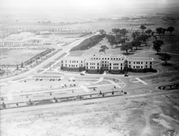
The Dugout is a small, single-storey electrical substation to the east of the West Block (Figure 3). It was built in 1942 as an air raid shelter. The building’s significance derives from its adaptation in 1943 to accommodate a Typex cypher machine which enabled secure coded communication between Prime Minister John Curtin and the leaders of Australia’s key allies, British Prime Minister Winston Churchill and American President Franklin Roosevelt.
An approximately triangular at-grade carpark is located to the west of Block 3, Section 23 Parkes, and there are remnants of the original 1920s landscaping treatment to all sides of West Block, as well as more recent native plantings to the east and south-east. The subject site covers an area of 1.689ha and includes three easements (see Figure 3).
The axis connecting the four blocks that comprise West Block is oriented on a diagonal to true north – technically north-northeast to south-southwest. For ease of understanding, the elevation facing Queen Victoria Terrace is referred to in this report as north; the elevation oriented to Commonwealth Avenue as west; the elevation facing the embankment and the large car park south-east of the Provisional Parliament House is east; and the elevation oriented towards the New Parliament House is south.

Figure 1 Aerial view of the Parliamentary Triangle: West Block is indicated (17 March 2018)
Source www.nearmap.com, 18 April 2018

Figure 2 Plan of survey for Block 3, Section 23 Parkes (part)
Source: LANData Surveys Pty Ltd, Canberra, May 2017

Figure 3 Aerial view of West Block and its setting: the Dugout is indicated
Source: ACTmap, actmapi.act.gov.au, accessed 18 April 2018
The term Parliamentary Zone in this document, consistent with the Parliament Act 1974 and as amended by the Parliamentary Precincts Act 1988 (Schedule 2, Section 3), captures:
… the area of land bounded by a line commencing at a point where the eastern boundary of Commonwealth Avenue intersects the inner boundary of State Circle and proceeding thence in a northerly direction along the eastern boundary of Commonwealth Avenue until it intersects the southern shore of Lake Burley Griffin, thence in a generally easterly direction along that shore until it intersects the western boundary of Kings Avenue, thence in a south westerly direction along that boundary until it intersects the inner boundary of State Circle, and thence clockwise around that inner boundary to the point of commencement.[7]
This area is illustrated at Figure 4.

Figure 4 The Parliament Zone is hatched
Source: Parliament Act 1974
This HMP broadly follows the principles and processes set out in the Burra Charter: The Australia ICOMOS Charter for Places of Cultural Significance, 2013 (The Burra Charter) and its Practice Notes. The Burra Charter establishes a standard of practice for those involved in assessing, managing and undertaking works to places of cultural significance.
Specifically, the report has been prepared in accordance with Schedule 7A of the Commonwealth Environment Protection Biodiversity Conservation Regulations, 2000: ‘Management Plans for Commonwealth Heritage Places’. As a Commonwealth Heritage place, an HMP for West Block must address a range of issues identified in the Regulations to the EPBC Act, at Schedules 7A and 7B. The purpose of these issues is to ensure that the place meets the Commonwealth Heritage Management Principles set out in the Regulations.
Table 1 below sets out the EPBC Act Regulations requirements for management plans and provides a comment about how the requirements are satisfied in the present HMP.
Table 1 EPBC Act Regulation requirements for management plans
EPBC Act Regulations, 2000, Schedule 7a | Relevant section(s) of this HMP |
(a) establish objectives for the identification, protection, conservation, presentation and transmission of the Commonwealth Heritage values of the place | Objectives to identify and conserve the cultural heritage significance of West Block were informed by best practice guides, notably the Burra Charter. These objectives are discussed at Section 1.4, and chapters 4 and 5 of this HMP. |
(b) provide a management framework that includes reference to any statutory requirements and agency mechanisms for the protection of the Commonwealth Heritage values of the place | Statutory requirements and agency mechanisms for the protection of the Commonwealth Heritage values of West Block are identified in chapter 4 with particular reference to the EPBC Act. |
(c) provide a comprehensive description of the place, including information about its location, physical features, condition, historical context and current uses | A description of West Block as it exists is at Chapter 2 ‘Understanding the Place’. A contextual history at Chapter 2 refers to notable changes to West Block, the Dugout and the site’s landscape setting over time. |
(d) provide a description of the Commonwealth Heritage values and any other heritage values of the place | An assessment of significance, including a description of West Block’s Commonwealth Heritage values is at Chapter 3 |
(e) describe the condition of the Commonwealth Heritage values of the place | A description of the site’s historic and aesthetic values is in Chapter 2. |
(f) describe the method used to assess the Commonwealth Heritage values of the place | The assessment of the Commonwealth Heritage values of West Block is based on an understanding of the place (site history and physical description, Chapter 2). |
(g) describe the current management requirements and goals, including proposals for change and any potential pressures on the Commonwealth Heritage values of the place | The proposed adaptation of West Block as a hotel, and issues arising in relation to anticipated change at the place are addressed in policies 15, 16, 17 and 18, Chapter 5. |
(h) have policies to manage the Commonwealth Heritage values of a place, and include in those policies, guidance in relation to the following: | A suite of conservation policies and management guidelines have been prepared to manage the identified Commonwealth Heritage values of West Block. See Chapter 5. |
(i) the management and conservation processes to be used | See ‘General policies’, Section 5.2, Chapter 5. |
(ii) the access and security arrangements, including access to the area for Indigenous people to maintain cultural traditions | See Policy 24. |
(iii) the stakeholder and community consultation and liaison arrangements | Policy 6 in Chapter 5 relates to the requirement for community consultation with the stakeholders identified in Chapter 4. (A draft of this HMP was placed on public exhibition from 9 November to 7 December 2018, through an advertisement in the Australian newspaper (page 33) and the website of Geocon. This opportunity for the community and/or interested parties to comment on the document did not yield any responses). |
(iv) the policies and protocols to ensure that indigenous people participate in the management process | Policy 6, Chapter 5 outlines the requirement for stakeholder consultation, with the Indigenous identified as a stakeholder in section 4.4.3 in Chapter 4 |
(v) the protocols for the management of sensitive information | See Policy 7, Chapter 5. |
(vi) the planning and management of works, development, adaptive reuse and property divestment proposals | Section 5.4 generally relates to the use, adaptation and change, see particularly policies 17 and 18. |
(vii) how unforeseen discoveries or disturbance of heritage are to be managed | Policy 26, Chapter 5 relates to the management of archaeological discoveries on site. |
(viii) how, and under what circumstances, heritage advice is to be obtained | See Policy 4, Chapter 5. |
(ix) how the condition of Commonwealth Heritage values is to be monitored and reported | See Policy 12, Policy 14 and Policy 21, Chapter 6. |
(x) how records of intervention and maintenance of a heritage places register are kept | See Policy 21, Chapter 5. |
(xi) the research, training and resources needed to improve management | See Policy 23, Chapter 5. |
(xii) how heritage values are to be interpreted and promoted | See Policy 25, Chapter 5. |
(i) include an implementation plan | See Section 5.6, Chapter 5 |
(j) show how the implementation of policies will be monitored | See Section 5.6.1, Chapter 5 |
(k) show how the management plan will be reviewed | See Policy 8, Chapter 5. |
West Block and the Dugout is included in the Australian Heritage Council’s CHL as a Listed Place (Place ID: 105428). It has been assessed as satisfying the following criteria: ‘A, Processes’, ‘B, Rarity’, ‘D, Characteristic values’, ‘E, Aesthetic characteristics’, ‘F, Technical achievement’ and ‘H, Significant people’. The citation is included at Appendix A.
West Block is included in the National Trust of Australia’s (ACT) Register of Classified Places. The citation is included at Appendix A.
West Block and the Dugout were included in the Register of the National Estate in August 1987 (RNE 100476). Following amendments to the Australian Heritage Council Act 2003, the RNE was frozen on 19 February 2007, which means that no new places can be added, or removed. Since 2012 the RNE has been maintained on a non-statutory basis as a publicly available archive. The citation is included at Appendix A.
‘West Block Government Offices’ is included in the Register of Significant Twentieth Century Architecture (RSTCA), maintained by the Australian Institute of Architects (RSTCA, place no. R067). It was included in the RSTCA in December 1983 as a place of national significance. The citation is included at Appendix A.
The outcomes of consultation with Representative Aboriginal Organisations (RAO) undertaken in December 2013 have been relied upon for this HMP. The consultation process followed at that time included a meeting on site attended by: Dr Peter Dowling, a consultant engaged in the preparation of an HMP for West Block on behalf of the Department of Finance; Wally Bell of Buru Ngunawal Aboriginal Corporation; and James Mundy of Ngarigu Currawong Clan. A site walk was preceded by discussion of traditional land use and the site’s history generally.
As recorded in the HMP (2014) for West Block:
The consensus of opinion was that there were no concerns regarding Aboriginal cultural heritage for the area. But a need was agreed that the use of the area as a pathway from Black Mountain to the site occupied by New Parliament House should be acknowledged.[8]
Had the outcomes of the 2013 consultation process yielded outcomes that were contested or otherwise contentious, Lovell Chen would have initiated report-specific consultation with RAOs.
No formal appraisal of social values, as might be informed by a community consultation process, was undertaken in the course of this HMP. It is, however, contended that neither West Block nor the Dugout satisfy the CHL threshold for social value. See further discussion at Chapter 3, Section 3.3.
The Dugout is in use as an electrical substation by ActewAGL. During research for this HMP it was not possible to gain access to the building.
As a consequence, it has not been possible to establish the extent to which the building interior has the ability to demonstrate its World War II-era use for coding/decoding messages from key allies.
Commentary regarding the building’s condition in this report is based on external visual inspection.
The following presents a chronological history of key events in the conception, construction, use and development of West Block, with a particular emphasis on the built fabric and landscape setting. Consistent with the Burra Charter, the aim is to gather information about the place sufficient to understand significance.[9]
Architectural drawings relating to the various phases of development are at Appendix B.
Canberra is located on underlying sedimentary and volcanic rock formed over the past 450 million years. Considerable evidence exists in the region of Indigenous occupation, primarily dating to the mid-late Holocence. The Australian Capital Territory is located within the traditional boundary of the Kamberri, a Walgalu-speaking group who occupied the Murrumbidgee west and south west of Lake George at the time of European arrival in the region in the 1820s.[10]
At the time of European settlement, the site of the national capital was native grassland with eucalypt forest on the surrounding hills. With the introduction of pastoral activities in the early nineteenth century, the natural vegetation was largely destroyed by overstocking and clearing of the forests which caused extensive soil erosion. By the time the site was selected for the new capital (discussed below) the land had become degraded and some of the surrounding hills had been largely denuded of tree cover.
Even before Australia became a federated nation, the need for a national capital for the colonies was apparent. A direction to hold land for a capital was included within the Australian Constitution (1901), and in 1908 the area of Yass-Canberra was named as the site of the federal capital. After an extensive survey, the current location of Canberra was selected.
In April 1911 the Minister for Home Affairs, on behalf of the Commonwealth Government, initiated an international competition for designs for the layout of the federal capital. The 137 entries were judged by a three-man panel comprising James Alexander Smith (engineer), John Kirkpatrick (architect) and John Montgomery Coane (licensed surveyor). On 14 May 1912, two of the panel members, (Smith and Kirkpatrick) selected Walter Burley Griffin's entry as the winner, and on 23 May 1912 the Minister for Home Affairs concurred with the majority decision and Griffin was awarded first prize. Entries by Eliel Saarinen (Helsinki) and Alfred Agache (Paris) placed second and third respectively.
It was not the Government’s intention to fully implement the winning design. Rather, the terms of the competition were that, ‘the premiated designs shall become the property of the Government for its unrestricted use, either in whole or in part.’[11] Accordingly, the three winning entries, as well as the scheme placed first by Coane (prepared by Sydney practice Griffiths, Coulter and Caswell) were purchased by the Government.
The Griffin scheme – planned by Walter and rendered by his wife Marion Mahony Griffin – was distinguished by an intimate relationship with the landscape. The central component of the proposal was an equilateral triangle (the National Triangle) whose corners were aligned on topographic outcrops or elevated land, specifically Mount Vernon in the north-west, Mount Kurrajong in the south, and the saddle between Russell Hill and Mount Pleasant in the north-east. The sides of the triangle formed the major avenues connecting the three primary centres of activity in the new city: the national government at the apex, and the municipal and market centres at the east and west of the base respectively.
A series of axes provided a further organisational underpinning for the plan, specifically the Land Axis, Water Axis and the Municipal Axis. The Land Axis formed the central alignment of the plan. The line extended from Mount Ainslie to distant Mount Bimberi via Mount Kurrajong, bisecting the central triangle and tying the city to its site. The formality and definition of this broad central axis was reinforced by the symmetrical siting of buildings at major intersections.
Griffin’s plan for Canberra envisaged the government complex as a symmetrical group of buildings overlooked by Parliament House on Camp Hill at the south (Figure 5). Historian Paul Reid has described the composition:
Griffin’s concept for government is simple: Parliament at the head, courts of justice at the foot and departments on the flanks. The geometric response to topography [however] causes a response. The keyhole-shaped government site has two parts: one dominant (the Kurrajong circle), and the other subordinate (the triangle including Camp Hill). With the axial layout of the Griffin plan, Kurrajong became absolutely dominating. It is the climax of the whole city design, the obvious site for Parliament …[12]
Griffin located Parliament House on the Land Axis, with the Senate and the House of Representatives clearly expressed to east and west of the building mass. Ornamental ponds extended along the balance of the Land Axis to the lake, giving Parliament House a degree of prominence in the city (Figure 6). Capitol Hill (Mount Kurrajong) was terminus of the ensemble, with accommodation for the Governor-General and the Prime Minister either side of a central administration building.[13]
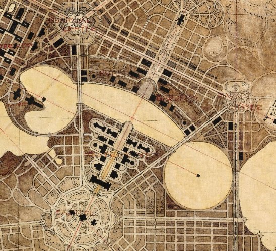
Figure 5 The Government Group: detail of the Griffin’s competition entry, 1911
Source: National Library of Australia, NAA A710, 38
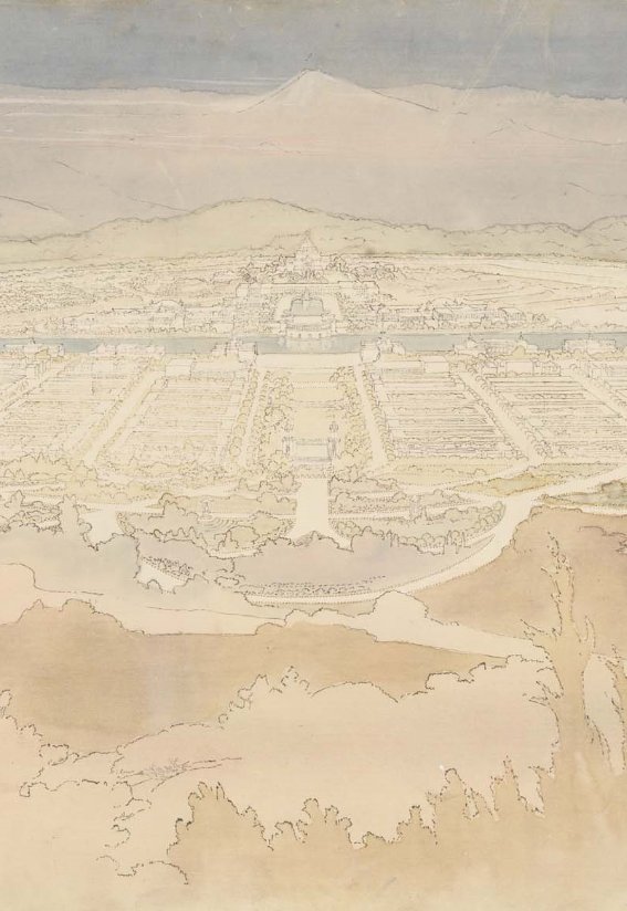
Figure 6 View looking south along the Land Axis from Mount Ainslie, rendering by Marion Mahony Griffin for the 1911 competition
Source: National Archives of Australia, NAA A710 49
Between 1912 and 1925, when the layout of the city of Canberra and its environs was gazetted, the plan for the federal capital was the subject of numerous modifications and revisions. The first of these, in November 1912, was a plan prepared by the Departmental Board, a body charged with implementing the city structure (Figure 7). The Board’s plan, which was approved in 1913, retained Griffin’s Land Axis and the axial siting of Parliament house, but generally incorporated very little of Griffin’s scheme, which was deemed extravagant, costly and impractical.
The first peg of the city was driven on 20 February 1913, six months before the Griffins arrived in Australia (18 August 1913), at the invitation of William Kelly who followed King O’Malley as minister responsible for the national capital following a change of government.
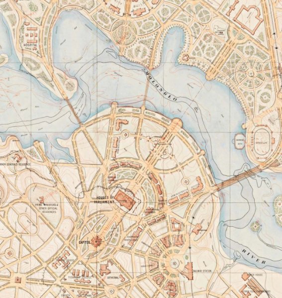
Figure 7 The Departmental Board plan for Canberra, 1912 (part)
Source: National Archives of Australia, NAA A767 1
On 26 August 1913, the Departmental Board met with Walter Burley Griffin in Melbourne and expressed a number of fundamental concerns about the proposal, including its scale and siting.[14] Griffin revised his scheme later that year, seeking to address a number of the matters raised by the Board, but the distance between the architect’s vision and that proposed by the government officials remained significant. The working relationship between the two was also increasingly dysfunctional. Forced to choose between the two, Minister Kelly disbanded the Board in October 1913 and appointed Griffin as Federal Capital Director of Design and Construction on a three-year contract (the contract eventually expired at the end of 1920). Also in 1913, Kelly revoked the approval of the Board plan and formally sanctioned support for Griffin’s revised plan. As noted by heritage consultant Duncan Marshall:
This plan now became the basic planning document, informing all of the Griffins’ later revisions, including the final version of the design prepared in 1918. The final version served, in turn, as the model for the official gazetted plan of 1925 which was to have a long-lasting effect.[15]
In the revised scheme Griffin’s original vision for the central National Triangle was re-established, as was the symmetrical composition of the Government Group to either side of the Land Axis.
Griffin’s tenure as Federal Capital Director of Design was mired by tensions between government officials and departments and hampered by changes in government. In addition, the Great War of 1914-18 was a significant distraction and drain on resources.
The tensions between Griffin and government officials were addressed in a Royal Commission on Federal Capital Administration (1916-17), which found that Griffin had been obstructed.[16] Following the Royal Commission, responsibility for the national capital shifted from the Department of Home Affairs to a new branch within the Department of Home and Territories under Griffin’s control, allowing him a freer rein in his remaining years as the Federal Capital Director of Design.[17]
The pace of development in Canberra between 1913 and the mid-1920s was slow. In the period to 1924, a total of £3.4 million was invested in the construction of the city,[18] and in 1916 and 1917 annual expenditure on capital works was only £8,000.[19] By 1920 development in the city included the Power House complex at Kingston (1916), the brickworks at Yarralumla (1913), Cotter Dam (1912), sewerage works and transmission lines. As noted by Reid, by the time Griffin left Canberra at the end 1920, ‘[his] design was apparent only in some road forming and finishing east of [Mount] Vernon and west of Kurrajong’.[20]
The Federal Capital Advisory Committee (FCAC) was established in January 1921 to advise the Government on the development of Canberra. The Committee recommended a three-phase approach:
- The transfer of Parliament and essential departments to Canberra;
- The development of rail connections, engineering works and the establishment of the central administration of other government departments; and
- The damming of the Molonglo River and construction of major architectural projects.[21]
The FCAC’s role was primarily advisory. Works were undertaken by the executive officers of the Departments of Home & Territories and Works & Railways, and subsequently by the Federal Capital Commission (FCC, Section 2.3.3).
Planning for the transfer of Parliament commenced in 1921. From the outset, there was broad acceptance that the new Parliament House would be temporary. Construction of a permanent structure would be both costly (a pertinent consideration in the context of managing post-war debt) and time-consuming, potentially delaying the transfer of Parliament for many years. Options canvassed in 1921 and 1922 included construction of a Conference Hall that could be augmented for use as a Parliament House when required, and a building of demonstrably temporary character – perhaps built of corrugated sheet metal, fibro-cement of weatherboard – that might serve for 10-20 years before replacement.[22] Discussion also focused on whether the city would evolve around the temporary building, or whether the location of the permanent structure would be the key determinant for the city’s evolution. This question required consideration of how temporary the provisional Parliament House would be. That is to say, would it be removed or repurposed when the permanent structure was completed?
In February-March 1923, a Parliamentary Standing Committee on Public Works considered the issue and interviewed approximately 50 witnesses. The outcome was a report in July 1923 with two options: a nucleus of permanent buildings for Parliamentary use located on Camp Hill, to be expanded as required; and a provisional structure on the north-facing slope of Camp Hill. In August 1923 the Government, anxious to expedite the relocation of Parliament, selected the provisional option, for which a design was already underway (see 2.4).[23] The first sod was turned on 28 August 1923.[24]
The Government established the Federal Capital Commission (FCC) under the Seat of Government (Administration) Act of 1924. The FFC’s immediate task was to oversee the relocation of Parliament from Melbourne to Canberra. The FCC was also responsible for the gazettal of the Griffin plan of 1918.
Griffin’s plan was, in the main, ignored by the FCC, as was his recommended pattern of settlement. The FCC chose to focus on the delivery of isolated buildings; Griffin’s intent had been to concentrate development around the Municipal Axis (Constitution Avenue). The FCC promoted the development of an ‘Initial City’ to the south of the Molonglo River flood plain, close to the Civic Centre indicated on the Departmental Board plan of 1913; Griffin had recommended that the core of the city be located around Mount Vernon, the Civic Centre indicated on his original competition entry.
The FCC was a dynamic, fast-acting agency which oversaw the first concerted wave of development at Canberra. By the time it was wound up in 1930 development delivered by the FCC south of the Molonglo River valley included, but was not limited to:
- The ‘Initial City’, including the present suburbs of Kingston, Griffith, Barton and Forrest
- The Provisional Parliament House and two Secretariat buildings (East and West blocks), collectively the Parliament House Secretariat group (see Section 2.4)
- Albert Hall
- Hotel Canberra
The 1923 decision to relocate Parliament from Melbourne to Canberra was the catalyst for an enormous logistical exercise of bureaucracy and construction. Within the space of only four years Canberra was transformed from two nascent communities (or villages) either side of the Molonglo River valley into the seat of national government with facilities and amenities to support the population influx.
The provision of office space to accommodate Government departments was considered from early 1923. An early option, put forward by the FCAC, was for the construction of 18 temporary buildings connected by walk-ways and with a central refectory on a site to the north-west of the provisional Parliament House.[25] The proposal was not supported by the Public Works Committee (PWC) which in July 1923 recommended to Parliament the construction of two two-storey buildings to the south of the provisional Parliament House. The PWC’s advice was for:
… two units of two-storied brick or concrete buildings on the east and west of the two blocks to the north of the proposed Parliament House … If this is to be done [the Committee considered that] two units of permanent buildings [would] be available approximately 1,000 feet [c. 350 metres] apart, and a similar distance from the permanent Parliament House site on Camp Hill, and in positions allocated for office purposes on the accepted plan.[26]
The FCAC did not support the PWC’s recommendation, and instead drafted competition terms for one permanent administration building, on a site to the north-east of the provisional Parliament House. A design competition for this building was held in 1924 and was won by Sydney architect George Sydney Jones.[27] His design was modified extensively after his sudden death in 1927.[28] The Administrative Building, now known as the John Gorton Building, was not completed until after World War II and was the largest office building in Australia at the time.[29]
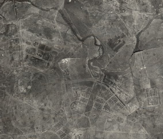
Figure 8 Aerial view of south Canberra, 1928: the National Triangle (part) is visible to the left
Source: National Library of Australia, nla.obj-232839573
As the new permanent Administration Building could not be completed before the first session of Parliament a ‘Secretariat Scheme’ was put forward as an alternative. This would see a nucleus of each Department temporarily relocated to Canberra to assist with Parliamentary work.[30] Although it was recognised that this arrangement may cause some additional administrative burden for the departments, it was considered the best way to balance the requirement for space and the conflicting views about permanence of new buildings.[31]
This scheme was approved by the Minister and the recommendations made by the PWC in 1923 were ultimately implemented – although the buildings as completed were primarily of three levels, not two.
As noted, the Parliament House Secretariat group is comprised of: the provisional Parliament House, East Block and West Block. Each was designed by the Public Works Department under the leadership of Commonwealth Architect John Smith Murdoch and built between 1922 and 1928 (see Section 2.4.2). They were the first buildings completed in the Parliamentary Triangle.
The decision to construct a provisional Parliament House on the Land Axis below (to the north of) Camp Hill, leaving Camp Hill itself for a permanent Parliament building, had a bearing on the height and massing of the temporary structure; views along the Land Axis were to be unimpeded by the temporary building. It also influenced the character and massing of East and West blocks.
In 1924, Murdoch described the Secretariat buildings to the Parliamentary Standing Committee for Public Works:
The two buildings will remain a symmetrical balance with the Provisional Parliament House. While being architecturally sympathetic with the Provisional Parliament House their size will be subordinated to the larger structure. The style is Modern Renaissance, to which the British and Americans are now working. It is a style which depends on proportions and lines rather than details.[32]
Additional information about the design approach was provided by Colonel P T Owen, Director General of Works and Railways in evidence to the Standing Committee:
The general idea is to avoid the domestic in favour of the Official style so far as may be compatible with reasonable expenditure …. A tiled roof for an official building would be regarded as ‘fussy’ although it would be quite correct for hotels and residences … I believe the flat roofs of the Secretariat buildings can be made very beautiful in this way.[33]
Of the two, the building now known as East Block, was completed first, in 1927. ‘Secretariat No. 1’ provided 2,579 square metres (27,760 square feet) of floor space and accommodated a telephone exchange, post office and space for 150 staff. It was anticipated that the building might eventually be used as offices for Members of Parliament.[34] Today it houses the National Archives of Australia.
In January 1925 the FCC Architects Branch reported that the construction of West Block had commenced:
Steady progress has been made by the contractors, Messrs Hutcherson Bros, in the erection of West Block (Secretariat No. 2), and the completion of the central blocks and south block should be affected by the end of July. In order to give proper divisions for the various Departments who will be occupying this building, a large amount of coke breeze partitions [a light concrete building block made with cinder aggregate] have been erected and Ministerial Office(s) have been panelled. The various mechanical services covering lifts, heating, electrical installation, and fire alarm system, are well advanced, and in some cases are now completed.[35]
It is assumed that construction would have been preceded by excavation works to level the sloping site, creating the embankment that remains to the east of West Block.
Although there was a preference for the two Secretariat buildings to be completed in time for the official opening of Parliament in May 1927, only East Block was ready in time.[36] The fit-out of West Block was at least partially completed in August 1927, as reported in the ‘Canberra News’ section The Week periodical.[37]
Distinguishing characteristics of the architectural language adopted by Murdoch for the two buildings included the following (see Figure 9 and 1926 drawings at Appendix A):
- Horizontal massing
- Symmetrical façade divided into vertical bays
- Classical proportions
- Plinths and ground level treatments of face brickwork, with the upper levels rendered and painted white
- Corner balconies and verandahs
- A general absence of applied details, an exception being the Greek-pattern metal railings to the balconies and verandahs
- Screened courtyards
- Flat roof areas concealed by parapets
The design response was a pragmatic and well-resolved solution to the challenge of accommodating a variety of uses quickly. The buildings are architecturally unpretentious, adopting a neutral, or official character; by the mid-twentieth century, the two buildings were recognised as early and influential examples of the Federal Capital style. See Section 3.2.1 for discussion of the Federal Capital style in Chapter 3).
While the two buildings were not mirror images in plan – possibly relating to their original uses, which were quite distinct (see discussion of West Block’s original occupants at Section 2.5) – both East Block and West Block are arranged on a north-south axis with main entrances on the east-west axis, perpendicular to the Land Axis, from which they are equidistant (Figure 10). The arrangement of blocks of varying sizes on an axial alignment provided for a degree of flexibility, enabling change and alterations without abstracting the formal presentation and architectural character of the building complexes.
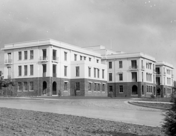
Figure 9 View of West Block from the north-west, 1929: note the corner balconies and verandahs
Source: National Archives of Australia, NAA A3560, 5426
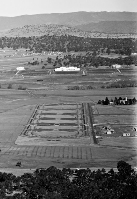
Figure 10 View looking south from Mount Ainslie, 1927: the area now known as Anzac Parade is in the centre-ground, with East and West blocks to either side of the Provisional Parliament House
Source: National Archives of Australia, NAA A3560, 908
The majority of buildings for Canberra’s establishment phase (1920s) were designed by Public Works Department (PWD) staff based in Melbourne and Melbourne-based architectural practices. Among them, the principal voice was John Smith Murdoch, a Scottish architect who migrated to Victoria in 1885. Murdoch joined the Commonwealth Department of Home Affairs in 1904, as a senior clerk in the Public Works Branch. Ten years later he was promoted to the title of Commonwealth Architect, and in 1919 he became Chief Architect of the Commonwealth Department of Works and Railways.[38]
Murdoch and his department were prolific during the early decades of the twentieth century, designing Commonwealth facilities across the country in a variety of styles. Murdoch’s design for the Commonwealth Offices in Treasury Place, Melbourne – the first purpose-built premises of the Commonwealth Treasury and Cabinet departments – was inspired by the Edwardian Baroque. Murdoch, as the senior Commonwealth architect, was also closely involved in planning for the federal capital.
His work in Canberra adopted a quite distinct idiom, a synthesis of revivalist and overseas styles including neo-Georgian, Colonial Revival, Spanish Mission and the Prairie Style. This synthesis has come to be known as the Federal Capital style.
Works attributed to Murdoch in Canberra, aside from the provisional Parliament House and the two Secretariat buildings, include: the Canberra and Kurrajong hotels (1924 and 1926 respectively), to accommodate public servants required to relocate to the Canberra; the Kingston Power House (1916); and the first buildings at the Mount Stromlo Observatory. The residential suburbs of Reid, Ainslie, Forrest and Barton also evolved from the same cycle of construction.[39]
The original landscaping treatments to the west, north and north-east of West Block were among the earliest in Canberra. The works were arranged and planted by Charles Weston, officer-in-charge of afforestation at the national capital, with support and advice from others (see Section 2.4.4).
A key reference for the following section is a 1928 plan of ‘permanent plantings’ within the ‘Government Group’ at Appendix A (see also detail at Figure 11). Photographs c. 1928 confirm that West Block’s setting was initially planted to a layout which accords with what is shown in the 1928 plan.
A discussion of existing landscape conditions at, within and around West Block is at Section 2.10.4.
Commonwealth Avenue
Plantings to either side of Commonwealth Avenue were established from the beginning of 1922. The median strip was planted with two rows of Himalayan cedar (Cedrus deodara) with a single row of Atlantic cedar (Cedrus atlantica) in the centre. Further rows of Himalayan cedar were planted to the east and west sides of the Avenue with rows of Chinese elms (Ulmus chinensis) behind. The outcome was both a formal avenue and a wind break to protect the Parliamentary Administrative Area (Figure 12). Weston also introduced shrubs and ground covers, including roses in the area.[40] The 1920s planting treatment and landscape character of Commonwealth Avenue has been all but lost over time.
The Parliamentary Triangle, including West Block
The FCAC considered the landscape treatment of the south end of the Parliamentary Triangle (also referred to as the Parliamentary Gardens), including West and East blocks, as the centrepiece of the Federal Capital.[41] The approximately 35-hectare area bounded by Kings and Commonwealth avenues, State Circle and King Edward Terrace was almost entirely denuded, with the exception of some native vegetation on Mount Kurrajong and Camp Hill (discussed below). Beautification was required to provide a suitably distinguished setting for Parliamentary proceedings, and to manage the prevailing winds.
As noted by John Gray in this doctoral thesis on Charles Weston, ‘[By 1924] the Federal Capital Advisory Committee decided the design of the gardens should reflect the formality of the Provisional Parliament House [then under construction], be on … strictly formal lines and include a body of ornamental water’.[42] Plantings were used to framed vistas and create ‘outdoor rooms’ (Figure 13).
The selection of plantings and their final arrangement was the work of Weston, with input from Murdoch, who had instructed the use of poplars to define the Land Axis, key entrances to the Parliamentary Triangle and intersections within it.[43] Murdoch’s preference was for the balance of the trees to be lower than the poplars and widely-spaced, ‘… the idea being that the comparatively flat buildings will not be unduly dwarfed or views of them too much obscured by trees’.[44]
The poplars were introduced between June and August 1925, with the balance of planting assumed to have been completed by November 1926, when Weston retired. Planted in pairs or fours to address major axial pathways and intersections, each poplar was situated in a square or roughly squared enclosure, edged with low privet hedges.[45]
The selection of poplars as a primary species effectively denied any potential for the gardens to develop a distinctly Australian character, as had been contemplated by the FCAC and others. Native trees and shrubs were, however, selected for new plantings in the vicinity of Camp Hill and Mount Kurrajong (see discussion below), and were employed by Weston in tertiary roles within the Parliamentary Triangle’s tree plantings.
While Weston’s selection of specimen conifers for many of the structural plantings within the Parliamentary Triangle landscape, including Deodar cedar (Cedrus deodara) and Atlantic cedar (Cedrus atlantica), was at odds with Murdoch’s preference for low-growing specimens, it was consistent with his own vision for the city. As noted at Section 2.4.4, Weston had anticipated that cedars would form the chief arboreal feature of the city in 1917.[46] Another variation to Murdoch’s preferred outcome was the density of plantings, with rows of closely-planted trees sometimes four deep. John Gray suggests that, ‘[Weston’s deliberate over-planting] had in mind a quick effect and possible species performance difficulties. He may have assumed a thinning in about 20 years’.[47]
The landscape treatments around East and West blocks were critical to the overall composition of the Parliamentary Gardens landscape. As described by Eric Martin et al, ‘[They form] symmetrical anchors behind and either side of the 1927 Provisional Parliament House … the longitudinal axis of each block is extrapolated further with each northern pavilion [A Block at West Block] addressing an extended axial vista’ (Figure 14).[48] Each block was situated to relate to the Provisional Parliament House and to its corresponding formal axis, while being largely invisible from each other as a consequence of the topography of the Camp Hill situated between them.
At West Block, fast-growing Lombardy poplars (Populus nigra ‘Italica’, described in the 1928 Plan of Permanent Planting as Populus pyramidalis) were planted in accordance with Murdoch’s instruction, in small square planting beds, serving to mark and extend the axial vista, and to frame views of the building’s north elevation. The pairing at the north end of West Block mirrored an identical planting already established across Queen Victoria Terrace to the north. To the west, similar pairs of Lombardy Poplars, also planted earlier, addressed the intersection of the Terrace with Commonwealth Avenue.
One of the original Lombardy poplars marking the northern axis survives within the West Block curtilage, although the pair of square landscape enclosures have been removed. On the north side of Queen Victoria Terrace, the corresponding pair of trees has been replaced in their original locations with new Poplar specimens, and the square enclosures have been maintained with the low hedging as originally conceived. The pair of Lombardy poplars once located at the north end of the West Block car park, aligned with Commonwealth Avenue, have not survived.
Along both sides of Queen Victoria Terrace, between these landmarks and extending to the east, mixed avenue plantings of White poplar (Populus alba), Pin oak (Quercus palustris) and Lawson’s cypress (Chamaecyparis lawsoniana) reinforced the precinct’s formality. Some of these avenue trees appear to have survived to the present day; others have been replaced.
Around West Block itself, a variety of poplars, elms and cypress trees were planted, and eucalypts (Eucalyptus globulus) were introduced in the courtyards to the east and west of B Block.
The other key feature of the West Block precinct was the integral car park to the west. This triangular space was surrounded by a pedestrian walkway. Beginning at the centre of this triangular space, an inner ring of shade trees was planted within the periphery of the car park surface, consisting of alternating American elms (Ulmus americana) and Black ash (Fraxinus nigra, then described as Fraxinus sambucifolia). Beyond this ring, the perimeter beds located between the car park and the pedestrian walkways were planted with two distinctive treatments. The north and east sides of the car park were closely planted with Pin oaks, developing a visual screen to reduce the prominence of the car park in views from the landscape west of Parliament House and from West Block itself. Meanwhile, the south-west side of the car park triangle was completed with a broadly spaced row of alternating Atlantic cedar and Giant redwood (Sequiadendron giganteum, then described as Sequoia gigantea), continuing a more extensive double row of these trees which was planted on the next landscaped block along Commonwealth Avenue to the northwest. This broadly-spaced treatment, in contrast to the density of plantings on the sides of the car park proximate to Queen Victoria Terrace, provided a degree of visual permeability to drivers on Commonwealth Avenue during their final approach to the Parliamentary Triangle.
An additional row of American Elms was established on the western boulevard of the service road, directly opposite West Block, interplanted with mixed pairs of Mountain Ash (Sorbus aucuparia, then described as Pyrus acuparia) and Mexican Cypress (Cupressus lusitanica, then described as Cupressus knightiana).
The aerial photographic record indicates that a reconfiguration of the car park layout occurred at some stage after 1985. Despite this, portions of the original car park planting layout have been retained to the present day, either in the form of original trees planted in the late 1920s, or as sympathetic replacements established somewhat later in the place of deceased original stock. These retentions include much of the Pin Oak screen on the Queen Victoria Terrace side of the car park (likely comprising a mix of original and replacement stock), as well as a small number of mature Elm trees on the western boulevard of the service road which appear to represent the original American Elm planting. The inner ring planting of elms and ash within the original triangular car park has been retained in a fragmentary form after the recent reconfiguration, represented by a small number of Elm trees located on the perimeter of the paved area and in island beds within it. Some of these trees are certainly later replacement plantings some may be original American Elms.
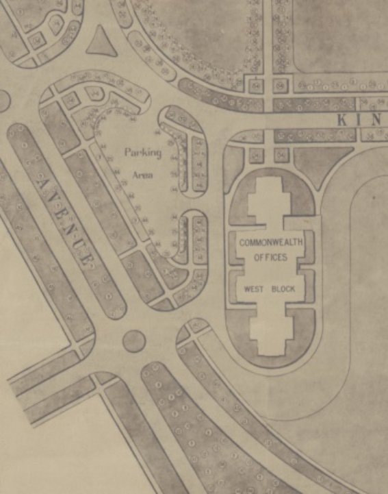
Figure 11 Detail of ‘Permanent Planting for the Governmental Group’, 1928, Commonwealth Avenue (part) is to the left: ‘10’ indicates Cedrus deodara (Himalayan cedar) and ‘9’ indicates Cedrus atlantica (Atlantic cedar)
Source: National Library of Australia, nla.obj-230044722
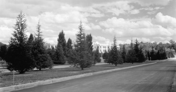
Figure 12 View looking south-east along Commonwealth Avenue, c. 1940s, with cedar plantings maturing: West Block is visible to the rear
Source: National Archives of Australia, NAA A3560, 3182
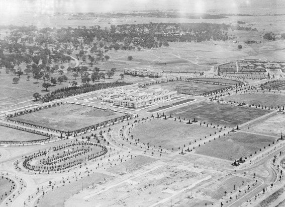
Figure 13 Oblique aerial looking south-west over the Parliamentary Gardens, c. 1928: West Block is visible to the rear of the Provisional Parliament House
Source: National Archives of Australia, NAA A3560, 3268
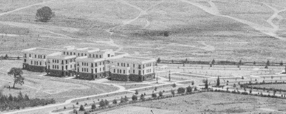
Figure 14 Detail of the oblique aerial c. 1928: note the avenue of trees aligned to the north elevation of West Block, and the symmetrically-positioned sentinel poplars either side of Queen Victoria Terrace
Source: National Archives of Australia, NAA A3560, 3268
Figure 15 Oblique aerial, 1928
Source: National Archives of Australia, NAA A3560 7712
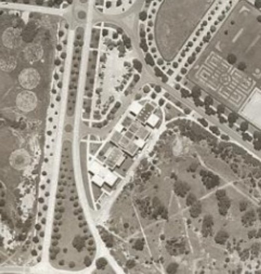
Figure 16 Aerial view of West Block, 1950
Source: ACT Planning and Land Authority
The 1920s planting treatment was generally extant in 1950, as shown in aerial view at Figure 16. Today, a fraction of the original plantings survive. As is the case elsewhere within the Parliamentary Gardens, the extant plantation is conspicuously thinner and also less diverse, having consolidated from the original experimental plantation to those trees which have proven most hardy to the local climate and planting conditions.
As in other places in Australia, certain trees have proved to have generally shorter lifespans than in their indigenous conditions, including the Giant redwoods which the photographic record shows were initially successful in the West Block planting. As a consequence of either their planting position or of the impact of climate stressors and periods of drought, these trees have been lost within the West Block planting, excepting a single specimen which may be a somewhat younger replacement planting for a failure in the original stock.[49] In a similar fashion, the formal plantings of Lombardy poplar have performed to their typical lifespan as a fast-growing species in Australia, and deceased trees in the formal arrangement have in some places within the Parliamentary Triangle been appropriately replaced with new stock (as has been done on Queen Victoria Terrace opposite West Block).
Despite these challenges, a number of original specimens have been retained within the planted landscape integral to West Block. In addition to the single Lombardy poplar, the four surrounding Arizona cypresses are original trees which maintain the formal setting of the building in relation to the formal axis. Atlantic cedars retained adjacent to Commonwealth Drive similarly maintain a sense of the original treatment of this face of the site, along with the single Giant redwood survivor. Although the car park has been altered relatively recently, retained or replanted specimens and groups of Pin Oak and Elm continue to serve as the amenity and screening planting for which they were originally conceived.
Camp Hill and Mount Kurrajong
In contrast to the Beaux Arts-inspired formality of the Parliamentary Administrative Area, the FCAC adopted the principle of retaining the existing open landscape of indigenous trees on Mount Kurrajong and Camp Hill, respectively located to the south-east and east of West Block (see Figure 13),[50] and reinforcing this with further plantings of native trees, shrubs and groundcovers. The front edge of Camp Hill, facing the provisional Parliament House, may have been mass planted with the ‘Mixed Acacias’ labelled on the 1928 plan; a massed planting in this location is certainly visible in c. 1928 views across the precinct (Figure 13) and was later extended to the embankment immediately east of West Block[51] before gradual attrition and loss to subsequent developments and changing land management practices.
Despite the construction of the new Parliament House and the Federation Mall land bridge connecting the old and new Parliament Houses, and a modern car park to the immediate east of West Block, this landscape character and its rationale endures.
During the early 1920s, the character of Canberra as a city in the landscape was given form by horticulturalist Thomas Charles George Weston (generally known as Charles). Weston was officer-in-charge of Afforestation (later Parks and Gardens) at the national capital from 1913 to 1926. He was an island of continuity during a period of rapid change in the management and administration of the emerging city.
Weston’s challenge, as noted in the Australian Dictionary of Biography, was:
… to create an urban landscape [at the remote, infertile, windy and rabbit infested location] consonant with the capital city to be built at Canberra. He was also expected to establish a local forestry industry. Weston set down on paper his four objectives: to establish a first-class nursery, to raise stocks of plants likely to prove suitable, to reserve all local hilltops and improve their tree cover, and to seek out and procure useful seeds.[52]
His work in Canberra fell into two phases. The first, from 1913 to 1920, was focussed on the establishment of nurseries and plant propagation. The second, from 1920 to 1926, was focussed on planting and landscape development.[53]
In general, Weston favoured conifers as a key structure planting. In 1917 he stated that three cedars, Deodar, Atlantic and Lebanon (Cedrus deodara, Cedrus atlantica and Cedrus libani) would be useful as the chief arboreal feature of the city.[54] He also pioneered the use of several eucalypts such as Brittle Gum (Eucalyptus mannifera) and Argyle Apple (Eucalyptus cinerea).
Weston’s approach to formal avenue plantings was to use one predominant species, often adding a smaller scale tree that would give seasonal colour, such as an avenue of Blue Gum (Eucalyptus bicostata) with Flowering Cherry Plum (Prunus cerasifera ‘Nigra’). A variation on this approach was to use a conifer, such as a cypress, cedar or pine, as the major planting. In some instances a Kurrajong (Brachychiton populneus) was used as the smaller tree.[55]
Weston planted parks and reserves in a less formal manner. The style of planting employed in these reserves followed the Garden City style and was a notable departure from Griffin’s intentions for the city.[56] In this regard. Weston is likely to have been influenced by John Sulman (1849-1934), an architect who was prominent in shaping ideas on town planning in Australia during the period leading to Canberra’s inception. He served as chairman of the FCAC from 1921 to 1924. As noted by the late landscape architect Peter Harrison, author of Walter Burley Griffin: Landscape Architect (1995) Sulman, ‘required that Griffin's conception of the capital as a city of monumental buildings be modified, that it should be regarded in the early period of its existence more as a Garden Town, the erection of the permanent buildings being deferred … until economic conditions might be more favourable’.[57]
The first departments transferred from Melbourne to West Block were the Prime Minister’s Department, the Department of Home and Territories, the Department of the Treasury, the Attorney General’s Department and the Official Secretary to the Governor-General (Figure 17). The National Library was accommodated in A Block, at the north end of the building.[58] The inclusion of office space for the Prime Minister’s Department was due to the distance of Yarralumla House from Canberra’s administrative centre.
Although the first Cabinet meeting in Canberra was held at Yarralumla on 30 January 1924, the first Cabinet meetings after the Provisional Parliament House was opened in May 1927 were held in West Block.[59] The use of West Block for Cabinet meetings outside sitting weeks – when the Cabinet Room in Parliament House was used for its convenient location adjacent to the Prime Minister’s office – persisted until 1932, when the Lyons’ Government transferred it permanently.[60] The location of the space at West Block that hosted Cabinet meetings between 1928 and 1932 is not annotated on historic drawings and has not been identified during research for this HMP.
The relocation of the National Library from Melbourne to Canberra coincided with the transfer of Parliament to the Provisional Parliament House. The first incarnation of the national library was the Commonwealth Parliamentary Library in 1902, which was attached to the Victorian Parliamentary Library in Melbourne.[61] The Victorian parliamentary librarian acted as a ‘librarian on loan’ to the Commonwealth government until the library was relocated to Canberra in 1927.[62]
From 1927 to 1936 the National Library was housed in A Block at the north end of West Block, and occupied all levels (Figure 18). At the time, it was primarily a parliamentary library, rather than a national cultural institution.[63]
The ‘sparse and restricted services of the National Library’ were criticised in a 1934 report on libraries in Australia. [64] The following year, the Prime Minister’s Department provided supplementary funding to the library, and in 1936, the library relocated. Purpose-built premises for the National Library were completed, enabling the co-location of all collections and staff within one building in the Parliamentary Triangle.
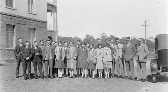
Figure 17 Public servants in the Prime Minister's Department, West Block, 1928
Source: National Archives of Australia, NAA A3560 7557
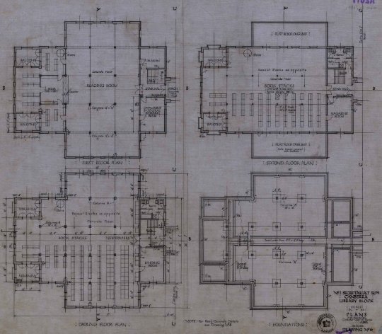
Figure 18 Plans for the National Library at West Block, 1926
Source: National Archives of Australia, A2617 Section 14/1411
Major alterations to West Block were required to accommodate the new External Affairs Department and for the relocation of the Auditor-General’s department, which was to be moved to Canberra from Melbourne.[65]
Works undertaken in 1927-38 included:
- Enclosure of the corner balconies and verandas to create additional office space[66]
- An additional level on top of the two-storey wings to A and C Blocks, bringing the whole building to the same level. This change resulted in the removal of original windows
- The closure of the open links between the central block (B Block) and A and C blocks
See plans, elevations and sections of changes at West Block in 1927-38 at Appendix B.
Floor plans illustrating the incremental development of West Block are at Figure 26, Figure 27, Figure 28 and Figure 29.
The most radical alterations to Murdoch’s original design occurred as a consequence of World War II, which triggered a significant influx of civil servants to Canberra. A key implication for West Block was the expansion of the Cables Branch.
In January 1943, Prime Minister Curtin wrote to the Minister of the Interior, J S Collins, expressing concern at overcrowded working conditions in West Block. The increase in the number of staff in the Cables Branch was highlighted as particular problem.[67] It was also noted that the increased number of female employees during wartime meant that the toilet facilities had become inadequate.
A Parliamentary Standing Committee on Public Works report in 1943 noted that while small additions had been made, with the conversion of corridors and balconies into offices, more space was required. Several solutions were proposed, including enclosing the courtyards to the east and west of A Block, adding an additional story to the building; extending West Block to the north; and the erection of a new temporary building for the cables section (Figure 19).[68] By June 1943, Cabinet decided that a brick addition to the south-west of the building should be considered, ‘comprising first, second and part of third floor, level with an in architectural harmony with the existing building’.[69] This directive was delivered in the form of D Block (1944), a new wing at the south end of the longitudinal axis designed in the same architectural style as the original building (Figure 20). The original occupant of D Block was the Department of External Affairs.
With the construction of D Block, the pneumatic tube connections that were installed in 1940-41 to connect the Provisional Parliament House with the Secretariat buildings were moved to the wing. The original sending and receiving terminal was located on the first-floor east corner of B Block, connecting underground to the first floor of East Block. [70] A second pneumatic tube service then connected East Block to Parliament House. The connection was altered in 1944 to connect to the second floor of the east corner of D Block (see drawings in Appendix B). It is possible that the underground tubes, or sections of them, survive, but no investigation has been undertaken.
In 1945, the courtyard entrance to the east of B Block was enclosed and an automatic telephone exchange installed. The alteration created the present configuration of a light well between the new office space and the central lobby in B Block. In 1946, the open courtyard to the west of B Block was similarly enclosed to create a new cruciform lobby and entrance to the building (Figure 21). This change resulted in the present configuration, although the signage on the western elevation has since changed from ‘Commonwealth Offices West Block’ to simply ‘West Block’ (Figure 22).
Air raid shelters and trenches were introduced within the Parliamentary Triangle in 1942, following the fall of Singapore (February 1942). Early in 1943, one of the air raid shelters, dug into the embankment east of West Block, was adapted to accommodate a Typex cypher machine, used for coding and decoding cables (Figure 23). The Typex machine enabled Prime Minister John Curtin to communicate directly with British Prime Minister Winston Churchill and American President Franklin Roosevelt. It was accommodated in a freestanding structure because of the highly sensitive nature of the cables. In 1944, a metal staircase was added to the rear (east) elevation of West Block, to enable direct transfer of cables between the two buildings (Figure 24).
In 1945, no longer required to accommodate secret cables or provide shelter during an air attack, the former air raid shelter was adapted for use as an electrical substation in 1945, a use that it still serves.
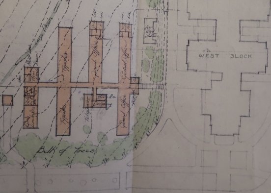
Figure 19 Proposed temporary building for the Cables Branch (unbuilt), 1943
Source: National Archives of Australia, NAA CT86/1 474A
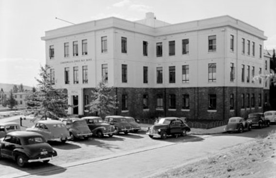
Figure 20 ‘D Block’, pictured 1954, as viewed from the south-east
Source: National Archives of Australia, NAA A1200 11207749
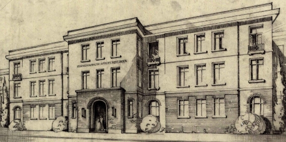
Figure 21 Proposed additional office accommodation and new main entrance, West Block, 1945
Source: National Archives of Australia, NAA A2617, Section 14/16260

Figure 22 New main entrance to West Block in 1959, showing the original signage ‘Commonwealth Office West Block’
Source: National Archives of Australia, NAA A1200, L32282
Figure 23 Ventilation and heating was installed at the ‘Dugout’ in 1943, for the adaptation of the air raid shelter to accommodate a Typex decoding machine
Source: National Archives of Australia (Department of the Interior, Works Branch, 30 December 1942, M7439C)
Figure 24 East elevation of B Block, 1944: an external staircase provided access into the building from the Dugout
Source: National Archives of Australia, NAA A2617 Section 14/15165
1940-41 Pneumatic tube installed linking the Secretariat buildings and Parliament House
c.1942 An air raid shelter was constructed to the east of West Block. The building was adapted in 1943 for use as a secure communications facility
1944 D Block was constructed at the south end of the building in the same architectural style as the original building
1945 Conversion of air raid shelter to electrical substation
1945 Open courtyard enclosed on east side of B Block and automatic telephone exchange installed
1946 Open courtyard enclosed on west side of B Block, creating a new entrance to the building. New cruciform lobby created at centre of B Block
Floor plans illustrating the incremental development of West Block are at Figure 26, Figure 27, Figure 28 and Figure 29.
After the end of the war, the building was still undergoing expansion. Despite the creation of additional office space in the enclosing of the courtyards in B Block, the building required further expansion. The major change was extensions made to A Block in 1948. The eastern and western sides were extended out to match the massing of the newly constructed D Block (Figure 25).
After the major renovations in the 1940s, only small changes were made to the building in the 1950s and 1960s. A private telephone exchange was installed in 1949, and in 1951, tenders were called for the installation of automatic gear to modernise the building’s lifts.[71]
In 1961, the balcony areas were further modified and in 1968, a top flight of stairs was removed from B Block.
1947/48 Additional office space created with extensions to the eastern and western side of A Block to similar plan form and elevations of D block
c. 1949 Private telephone exchange installed
c. 1951 Lifts automated
1961 Balcony areas modified
1968 Top flight of stairs removed from B Block
Floor plans illustrating the incremental development of West Block are at Figure 26, Figure 27, Figure 28 and Figure 29.
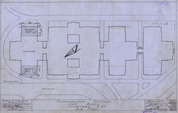
Figure 25 West block – site plan, 1948, showing the extensions made to A block
Source: National Archives of Australia, NAA: A2617, SECTION 14/17556
By the 1970s, the building was in need of refurbishment. In the mid-1970s a Cabinet budget submission for $5 million was made for the construction of an office block annex to West Block, to provide additional accommodation for the Department of Prime Minister and Cabinet.[72] It was ultimately withdrawn and replaced by another submission, however the supporting documents describe the space pressures of West Block occupants. At this time, the Department occupied approximately 7,250 square metres, in addition to another 1,020 square metres at three other locations in Canberra. Another 930 square metres of West Block were also occupied by the Commonwealth Actuary and the Royal Commission on Security and Intelligence.[73] The submission outlined the Prime Minister’s proposal to make West Block the permanent location of the Department of Prime Minister and Cabinet and a desire to undertake a large-scale refurbishment of the building.
West Block was vacant from late 1977 until 1979, after an appraisal found that the office accommodation was substandard, with poor fire protection and electrical services.[74] During this period, the Department of Prime Minister and Cabinet was moved to the Edmund Barton Building. West Block’s location near both the provisional Parliament House and the proposed location of the new permanent Parliament House ensured that it continued to be used as government administration building.
A Cabinet Paper in 1978 furthered the proposal from the first budget submission and ultimately resulted in the 1980s refurbishment of West Block. This refurbishment was the second major period of change for the building and was undertaken for the Department of Administrative Services by architects, Fowell, Mansfield, Jarvis and Maclurcan. The original steel windows and the later wooden frames on balcony infill windows, were replaced with low profile aluminium frame windows. A National Trust assessment of the building in 1986 noted that the introduction of single pane windows dramatically altered the external appearance of the building.[75]
The enclosed courts of B Block were covered by glazed tubular steel framed hipped roofs and is entry lobby was rearranged. Balcony areas were again modified, and office space converted to open plan. Internal joinery was changed to updated to more closely match the original stained timber and brass fittings. The first and second floors over the east link to the north building were infilled and the building was upgraded to include fire doors. In the mid-1980s, the building was occupied by the Department of the Special Minister of State and the Economic Planning Advisory Council.
1981 Enclosed court roof of B Block refurbished, with new glazing
Central lobby rearranged (B Block)
Internal walls demolished (B Block)
Link between A Block and B Block was covered over
Extension to Dugout & screen wall
1982-84 All windows modified to a low-profile aluminium frame
Floor plans illustrating the incremental development of West Block are at Figure 26, Figure 27, Figure 28 and Figure 29.
After the permanent Parliament House was opened in 1988, the requirement for West Block to provide accommodation for the departments was superseded by the purpose-built accommodation in the new building. The close proximity to the provisional Parliament House was no longer a central feature of the location of West Block. Equally, the size of government and its supporting administration had also outgrown the extent of the West Block and has continued to expand.
A review of the Parliamentary Zone by the National Capital Authority in 2000 predicted that the working population of Parliament House was probably close to twenty-five percent higher than it was predicted to be in the 1980s.[76] It highlighted the possibility of using the carparks of East and West Block on either side of Federation Mall to accommodate the required growth, predicting the need for three storey buildings, with multilevel basement car parking desirable.[77]
When the National Capital Plan was updated in 2016, the first comprehensive review since 1991, the use of the carparks was reaffirmed.[78] The proposed amendments included a recommendation to change the zoning of the land within the Parliamentary Triangle, specifically of West Block and East Block, to allow for commercial uses such as hotels and offices.[79]
In 2015, a scoping study was undertaken by the Federal Government, which considered the future of six government-owned buildings within the Parliamentary Triangle. The possibility of private ownership of the six buildings – the John Gorton building, Treasury building, ANZAC Park East, ANZAC Park West and the two former Secretariat buildings – was considered in the review.[80] The study recommended that four of the six buildings could be considered for private ownership – the two ANZAC Park buildings and East and West Block.[81]
The proposal to sell the four public buildings was met with some concern from the community, particularly relating to the two former Secretariat buildings. Historical societies and heritage groups expressed concern about the change of the buildings within the Parliamentary Triangle to private ownership, with the Griffin Society questioning whether the integrity of the Parliamentary Triangle was threatened by the sale.[82] Territory politicians also questioned the sale and in September 2017, the ACT Government passed a motion to work with Federal Government to explore alternatives to the outright sale of the buildings.[83]
Despite the community concern, West Block was the first building to sell, with Geocon purchasing the property for $6.25 million in September 2017. The two ANZAC Park buildings and East Block were sold in December 2017, for a combined $122.5 million, including a development site on Constitution Ave.[84]
In 2018, the new owners Geocon, were presented with a $100,000 sculpture of Winston Churchill honouring the historic links between West Block and the secret communications during World War II.[85]

Figure 26 Sequential development of West Block, ground floor

Figure 27 Sequential development of West Block, First Floor

Figure 28 Sequential development of West Block, Second Floor

Figure 29 Sequential development of West Block, Third Floor/Roof Plan
The following provides a description of West Block, the Dugout and their setting as they existed in May/June 2018.
West Block is an office building that comprises a series of four three-storey wings (or blocks) of varying footprint connected on a north-south axis. – A Block is at the north, with D Block at the south. There is a triangular at-grade car park to the west of the building, which is contemporary with the site’s establishment and is within Block 3, Section 23 Parkes (part). A larger car park to the east of West Block, which dates from the late-1950s and is located on higher ground, is not within the site boundary.
An embankment (c. 3m high) to the east of the main building dates to c. 1926, when the site was partially levelled. The Dugout, a 1942 air raid shelter that has been in use as a substation since 1945, is built into the embankment, as is a gas main screened by a brick enclosure (built in the 1980s). The asymmetrical site slopes approximately five metres down from east to west, following the gradient of Camp Hill.
The immediate interfaces of the subject site are as follows:
- To the north of the site is Queen Victoria Terrace (originally Kingston Street), with the enclosed rose garden of the Provisional Parliament House to the north-east. The north elevation of A Block is set back approximately 15 metres from Queen Victoria Terrace;
- A modern slip road giving access to State Circle from Commonwealth Avenue is to the south, with a very shallow set-back from D Block (approximately three metres at its closest point);
- To the east, at the top of the embankment, is the c. late-1950s car park, which was extended to its present dimensions in the 1980s; and
- Commonwealth Avenue is to the west, with Embassies and High Commissions on the west side of the Avenue.
There is a service road to the west of the West Block, separating the building from the triangular car park. This has been a cul-de-sac since the late-1980s, but originally extended to Commonwealth Avenue. Access to the rear (east) of West Block is via a sealed laneway to the north of A Block.
Remnants of the formal 1920s landscape treatment, including mature deciduous trees and some hedges, are evident to the north and east of the subject site, addressing both sides of Queen Victoria Terrace and surrounding the triangular car park. The native plantings to the south and south-east of West Block are generally more recent.
The site includes no significant objects or items of moveable heritage.
West Block is raised on a brick plinth, to bring the parapet up to approximately the same height (AHD 581.1) as East Block, which is located 450 metres to the east. The top of the parapet is approximately 13.5 metres above ground level. Small basement areas and rooftop plant are located to B and D Blocks, and a residence for the caretaker is centrally positioned on the roof of B Block.
The building is constructed of load bearing brick. The ground level is face brickwork, and the upper levels are finished in painted render surmounted by a prominent projecting cornice. As built, the parapet concealed the roof. Alterations carried out in the 1980s have resulted in the roof form being partly visible at the north end of the building (A Block).
While West Block was designed to be seen ‘in the round’, with each elevation maintaining the same language and proportions, in practice the west elevation is the building’s principal address, with services, outbuildings and the Dugout located to the rear.
Blocks A, B and C (built in 1926-27) are carried on a reinforced concrete slab with reinforced concrete beams and columns – A, B and C Blocks are planned on a seven square foot grid (2.13m x 2.13m). The upper levels are timber post and beam, with timber floor boards. The extensive use of timber in the building was consistent with the temporary (or provisional) nature of the building.[86] D Block, which was built in 1944, is all concrete.
The entrances, the corner verandahs (enclosed in 1937-38) and the internal elevations of the full-height light wells are formed with semicircular brick arches. This approach originally extended to the forecourt screens to either side of B Block, removed in the 1940s. Openings on the upper levels are rectangular and have flat brick lintels. Verandah railings featured simple Greek-inspired patterns
Changes to the building over time have generally sought to create more office space while minimising impacts on the external appearance. This approach was generally compatible with Murdoch’s analysis of the Modern Renaissance style, which he considered to be reliant on ‘proportions and lines rather than details’ (see Section 2.4.1). Key formal characteristics of the evolved building exterior include: symmetrical massing, division into vertical bays and an overall sense of visual coherence derived from a consistency of materials and a uniform parapet line.
Changes dating to the 1930s and 1940s were generally reverential to the original design. Later changes, including works to the interior, were driven by functional requirements and budgetary prudence. The original finishes have either been removed or concealed by the 1981/82 fit out. A Block was originally open plan, to accommodate the National Library. B and C Blocks were fitted out as office space. Mechanical, hydraulic and electrical services have been updated over time.
A summary of key alterations to the exterior of West Block is at Table 2, and details of original elements and fabric to the building interior are at Table 3.
Table 2 Summary of alterations to West Block exterior
Elevation/space | Alterations | Photographs/elevations |
North elevation (A Block) | Corner verandahs throughout the building were filled in 1937-38. Some were filled with brick spandrel panels with glazing above. Others were infilled with full-height glazing, including the openings at ground level on the north elevation of A Block. The steps up to the verandahs survive, however the balcony railings to Level 1 have been removed. The three windows in the centre of the north-facing elevation have been dropped to ground level, with a door installed to the western-most opening. Steel-framed windows have been replaced with aluminium frames throughout (1980s). The 1930s-40s extensions to the side wings, which were originally two levels high and a single bay deep, have resulted in significant change to the north elevation. | 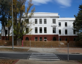
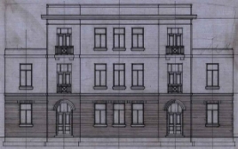
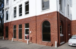
|
West elevation, B Block | The massing of the main entry to the building, in the centre of B Block’s west elevation, was inverted in the 1940s, when the recessed loggia was replaced with a three-level infill projecting from the main building line. These works also resulted in the loss of the original screen wall, with three punched arch-headed openings. The original external elevation of the central bay is extant within the enclosed courtyard. The introduction of sun shading to the west elevation was an early change, and there have been at least two iterations of pull down awnings in boxed casings at the building over time (since removed). Penetrations and flashing lines associated with these awnings are evident throughout. Naming signage mounted over the main entry dates to the 1944-45 alterations. As is the case throughout the building: - the corner verandahs and balconies have been infilled (1937-38);
- balcony railings to Level 1 have been removed; and
- steel-framed windows have been replaced with aluminium frames throughout
| 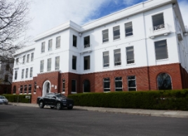
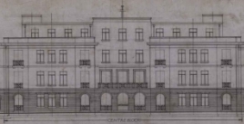
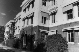 1972 view (ACT Heritage Library) 1972 view (ACT Heritage Library)
|
Link elements | As built, the link elements that connected the three blocks were used as supplementary entrances (see right column, elevation detail). They were also open to the elements. Today, the links are enclosed with a variety of treatments, including glazing and brick spandrel panels to the west elevation and sections of solid masonry to the east elevation. The link elements remain in use as secondary entrances. As is the case throughout the building balcony railings to Level 1 have been removed. | 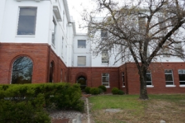
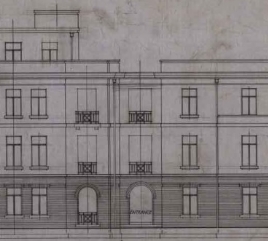
Link between blocks B and C, west elevation, 2018 (centre) and 1926 (below) 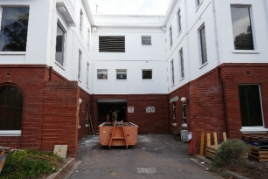
Link between blocks A and B, east elevation |
D Block | D Block (1944) is intact at built. Unlike the 1926/27 blocks, verandahs and balconies were not a part of D Block and its footprint (comparable to A Block) has never been extended. As is the case throughout the building, steel-framed windows have been replaced with aluminium frames throughout (1980s). The gradient of the land to the south-west of D Block was modified (raised) in the 1980s, associated with the construction of the slip road to State Circle. | 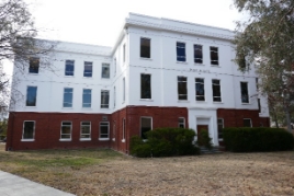
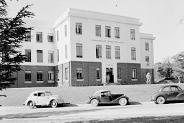
|
East (rear) elevation | The east elevation has been subject to incremental change over time, notably as associated with the link elements (see also discussion above). These changes generally relate to the operation of the east elevation as the rear (or service) elevation. In terms of loss of fabric, the history of the east elevation is comparable to the west elevation, with the principal change being the replacement of the recessed loggia with a three-level infill projecting from the main building line. | 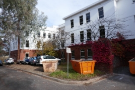
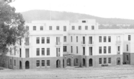
|
Table 3 Original elements and fabric to West Block interior
Original element/fabric | Comment | Photographs |
North-south axis | The axis (or spine) links the four blocks over all levels. Evidence of original details and decorative treatments is negligible. | 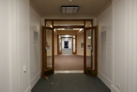
|
B Block staircases | The two original staircases in B Block include their original moulded timber handrails and balustrades. The raised brass handrails fixed with brackets may date to the 1980s. | 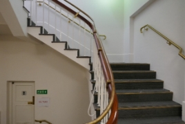
|
Strong rooms | Four strong rooms were provided within B Block in 1926/27. They survive, including fire resistant steel doors, door furniture and the manufacturer’s label (Ajax Manufacturing Company Ltd, Sydney). The strong rooms provide an insight into the building’s original use, whereby official functions required security. | 
|
Original timber ceiling panels | Original (or early) timber ceiling panels survive above dropped ceilings in some sections of the building, including the west side of the ground floor of B Block (pictured). It is possible that the use of timber ceiling panels denotes an eminent use or occupant of these spaces. | 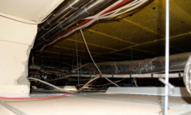
|
Timber columns and beams to levels 1 and 2 of A, B and C Blocks | The upper levels are timber post and beam, with timber floor boards. The extensive use of timber reflected the temporary nature of the building. | 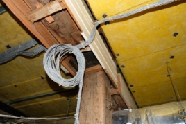
|
A single-storey brick air raid shelter was constructed in the embankment to the east of West Block in 1941/42, almost aligned to the central east-west axis of B Block. It was part of the World War II era defences introduced within the Parliamentary Zone.
At the beginning of 1943, the shelter was adapted to accommodate a Typex cypher machine, used for coding and decoding cables. Documentation dated 30 December 1942 indicates that a small brick addition was constructed to the rear to accommodate ventilation and heating plant (Figure 23). The Typex machine enabled Prime Minister John Curtin to communicate directly with British Prime Minister Winston Churchill and American President Franklin Roosevelt. It was accommodated in a freestanding structure because of the highly sensitive nature of the cables.
The building was adapted as a sub-substation in 1945 and all equipment associated with its war-time use is assumed to have been removed. Today the single-storey building includes two 500kVa transformers.[87]
A brick screen wall mimicking the composition of the original screen walls to B Block was constructed to the west of the Dugout in the early 1980s, and bike storage provided behind the screen. The substation was also extended, to the south, at that time (Figure 31 and Figure 32).
The building has been re-roofed (metal sheeting) and over-painted. In its present form, it conveys nothing of its war time origins or uses.
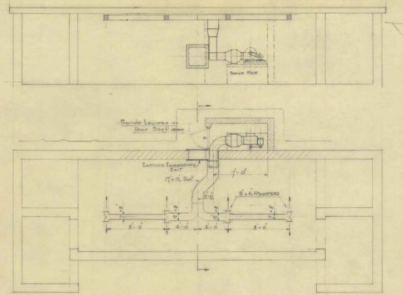
Figure 30 Ventilation and heating was installed at the ‘Dugout’ in 1943, for the adaptation of the air raid shelter to accommodate a Typex decoding machine
Source: National Archives of Australia (Department of the Interior, Works Branch, 30 December 1942, M7439C)
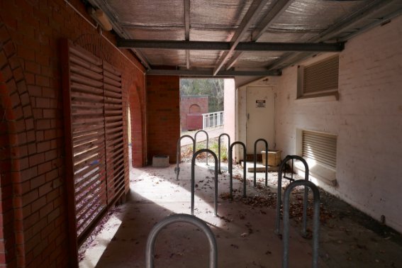
Figure 31 Dugout: view looking north, with the original west elevation at right, and the 1980s screen wall at left
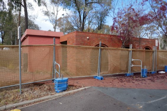
The following provides a summary of key landscape attributes at West Block, specifically those dating to the 1920s treatment for West Block and its setting. A summary of plantings surviving from the 1920s landscape treatment is at Table 4.
Structural elements
The pathways around West Block, indicated on the 1928 landscape plan, have been subject to change over time, in terms of their extent and alignment. However, a number of key structural elements of the landscape are extant, including:
- The integral car park between Commonwealth Avenue and West Block – although an original entry to the car park from Queen Victoria Terrace has been closed
- The service road between West Block and the car park – this road originally returned to Commonwealth Avenue, and was modified to a cul-de-sac in the 1980s
- The tree-lined vista extending north of the subject site on axis with the north elevation of A Block (Figure 33)
Landscape character
North and west of West Block: There is a mixed plantation of exotic specimens to the north and west of West Block, including around the integral car park, which is now enclosed by a hedge. There have been notable changes to the density and diversity of the plantings. However, as described in Section 2.4.3, there is a clear correlation between the existing elements and the 1928 plan of permanent plantings (see Figure 11 and Appendix B), as well as with the photographic record of a maturing planted landscape as captured in archival photography available from the National Archives of Australia. Surviving and reconstituted plantings maintain the spatial arrangements established in the plantings specified and laid out by Charles Weston.
East and south-east of West Block: Remnants of the indigenous woodland were retained on Mount Kurrajong and Camp Hill in the 1920s, supplemented by the planting of new native trees, shrubs and groundcovers. Despite significant changes in this area over time, including the addition of the new Parliament House and the land bridge connecting the old and new Parliament houses across Camp Hill, this rationale endures (Figure 34).
West of West Block: The original plantings to the median strip and to either side of Commonwealth Avenue have been removed, relating to the major road works completed in the late-1980s. However, retained Atlantic cedar trees and a Giant redwood within the inner band of planting adjacent to the car park are suggestive of the original treatment of the larger avenue.
Figure 33 Tree-lined vista extending north from A Block: view looking south to West Block
Figure 34 Native plantings to the east and south-east of West Block
Table 4 Summary of original plantings at West Block
Original element/fabric | Photographs |
Lombardy poplar (Populus nigra ‘Italica’) to the north of West Block | 
|
Arizona cypresses (Cupressus arizonica) (x4) to the north of West Block, two either side of the façade | 
|
Atlantic cedars (Cedrus atlantica) (x2) to the west side of the integral car park | 
|
White poplars (Populus alba) (x3) on Queen Victoria Terrace | 
|
Giant redwood (Sequoiadendron giganteum) (x1) at the north-west of the integral car park | 
|
Pin oaks (Quercus palustris) (x6) around the integral car park correspond to the original planting and may be either the original specimens or a mid-century replacement planting (or a combination thereof). | 
|
Some of the elms located in various positions around the car park and in the south-east boulevard zone opposite West Block may be original American elms (Ulmus americana). | 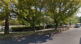
|
The planned relationship between East and West blocks and the Provisional Parliament House is best appreciated from the air. As experienced at ground level, the distance between East and West blocks, as well as the tree plantings and the natural camber of the land (originally Camp Hill and now Federation Mall, the land bridge between the Provisional and permanent parliament houses), means that East Block is essentially imperceptible from West Block (Figure 35). The rear of the Provisional Parliament House is, however, visible to the north-east.
The clearest views of West Block today are from Commonwealth Avenue (Figure 36 and Figure 37).
The north elevation of West Block also remains the southern terminal view for the formal axial pathway which extends through the Parliamentary Gardens north of Queen Victoria Terrace (Figure 38).
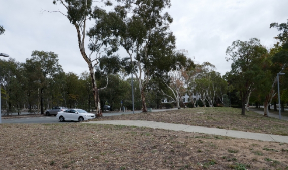
Figure 35 View of West Block from the car park to the east
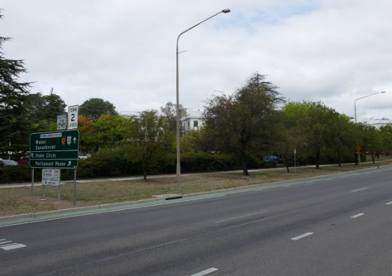
Figure 36 View of West Block from Commonwealth Avenue, looking south
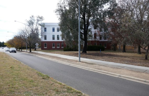
Figure 37 View of West Block, south elevation, from the slip road to State Circle
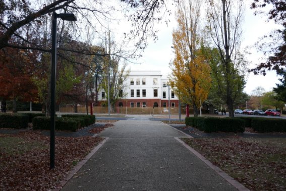
Figure 38 West Block (north elevation) as seen from the tree-lined pathway to the north
This chapter provides an assessment of the cultural heritage values associated with West Block against the Commonwealth Heritage criteria. It draws on evidence presented in Chapter 2 ‘Understanding the Place’. An assessment of the place against the CHL criteria is at Section 3.4, and the CHL ‘Summary Statement of Significance’ and ‘Official Values’ for West Block and the Dugout are reviewed at Section 3.5.1.
The assessment has regard for the definitions of values in the ‘Understanding and assessing cultural significance’ Practice Note to the Burra Charter 2013. Of the five values identified in the Burra Charter (historic, aesthetic, social, spiritual and scientific) it is considered that historic and aesthetic values are of greatest relevance to West Block, as discussed below.
The ‘Understanding and assessing cultural significance’ Practice Note to the Burra Charter 2013 provides the following definition of historic value:
Historic value is intended to encompass all aspects of history – for example, the history of aesthetics, art and architecture, science, spirituality and society. It therefore often underlies other values. A place may have historic value because it has influenced, or has been influenced by, an historic event, phase, movement or activity, person or group of people. It may be the site of an important event. For any place the significance will be greater where the evidence of the association or event survives at the place, or where the setting is substantially intact, than where it has been changed or evidence does not survive. However, some events or associations may be so important that the place retains significance regardless of such change or absence of evidence.
To help understand the historic value of a place, ask:
> Is the place associated with an important event or theme in history?
> Is the place important in showing patterns in the development of history locally, in a region, or on a state-wide, or national or global basis?
> Does the place show a high degree of creative or technical achievement for a particular period?
> Is the place associated with a particular person or cultural group important in the history of the local area, state, nationally or globally?
Historic value as related to West Block includes consideration of:
- The association between West Block, and the Parliament House Secretariat group generally, with the Federation of the Australian colonies;
- The association between the Parliament House Secretariat group and the establishment of Canberra as the national capital;
- The Dugout as evidence of a strategic means of communication between Australia and her allies during World War II; and
- Associations between West Block and individuals and organisations who have made notable contributions both to the establishment of Canberra and to processes of Government.
Even before Australia became a federated nation, the requirement for a national capital was apparent in the colonies. Political steps were to be taken to choose the capital using grand ideas of democracy. The intent was to create a federal capital free from the political or commercial domination of any single state or colony.[88]
The Australasian Federation Conference (Melbourne, 1890) and National Australasian Convention (Sydney, 1891) were held to determine how the colonies should federate, but were fraught with inter-colonial rivalry. The location of the future national capital was the source of heated debate during the 1890s, but the ultimate decision was left to the future parliament following federation.
The coastal locations of all of the colony’s capital cities was considered a potential security risk, so an inland location was suggested. By the time of the National Australasian conventions in 1897-98, there was consideration that the selected site should be ‘central, accessible, defensible and healthy’.[89]
Although there are twentieth century capital cities around the world that are comparable to Canberra in terms of expressing progressive and nationally-specific urban planning principles, the creation of Canberra is unique in that it was the first example ‘[in the] history of the world when one nation has owned a whole continent and has been able to create a city of its own will for the purpose of a capital’.[90]
Further, the design and planning of Canberra as the administrative and political centre of the country embodied aspirations as a national showcase. The city was intended to represent Australian design in the twentieth century, and to be understood as a ‘model city’ made by the people of Australia to show the world.
The Parliament House Secretariat group, including West Block, provides tangible evidence of federation. The group was purpose-built to facilitate the operation of the Commonwealth Government following the decision to relocate the operations of government from Melbourne to Canberra.
While West Block, East Block and the Provisional Parliament House have been subject to incremental change over time, related in the main to changes of use and occupants, the buildings and their planned, historical and architectural relationships remain unchanged.
By 1925, when the FCC assumed responsibility for relocating Parliament to Canberra, the ‘bush capital’ had become a small country town. As noted at Chapter 2, the FCC was charged with – among other tasks – relocating departments and public servants from the capital cities of Australia (primarily Melbourne and Sydney) to the infant capital. The next two years saw a flurry of activity and decision-making, and the federal Parliament officially opened in Canberra on 9 May 1927, 26 years to the day after the opening of the first federal Parliament in Melbourne.
In its planning and composition, the Parliament House Secretariat group provides evidence of this intense period of development in the new capital. In many respects, the completion of the grouping represented the culmination of Canberra’s ‘establishment’ (or ‘inaugural’) phase’. Further, the scale of West Block and East Block provides an insight into the times. For a period of more than 50 years, these two buildings were the epicentre of Australian Parliamentary bureaucracy and were fundamental to the administration of Federal political power.
The Parliament House Secretariat group were also the first buildings completed in the Parliamentary Triangle, the central feature of the Griffin’s plan for the city. While Griffin’s plan was not implemented as per his vision, some characteristics were delivered including: the siting of Old Parliament House on the Land Axis with expansive views to the north, and the symmetrical positioning of departmental offices to either side of the Land Axis.
The construction of a group of buildings for the administration of a territory, region or State in Australia is uncommon. A more typical sequence is for the construction of a principal parliament (or equivalent) building, with support facilities delivered incrementally over a period of time as required. An exception to this pattern is the Commonwealth and State offices group in Brisbane, also planned and designed by J S Murdoch. The context in Canberra was, of course, unique with Canberra being the only Australian city designed and constructed to function as the political and governmental centre of the nation.
In 1942, following the Japanese attacks on Darwin, trenches were dug within the Provisional Parliament House precinct, including to the south-east of West Block. Air raid shelters were also provided, including one in the embankment to the east of West Block. The embankment was partially dug out to enable construction and, presumably, to provide some degree of blast protection.
The air raid shelter was of standard design and construction, with a narrow central chamber and flanked at either end by deeper entries (see Figure 28).
At the beginning of 1943, the air raid shelter was adapted to accommodate a Typex cypher machine, used for coding and decoding cables – the Cables Department was based at West Block. The machine enabled Prime Minister John Curtin to communicate directly with British Prime Minister Winston Churchill and American President Franklin Roosevelt. It was accommodated in a freestanding structure because of the highly sensitive nature of the cables.
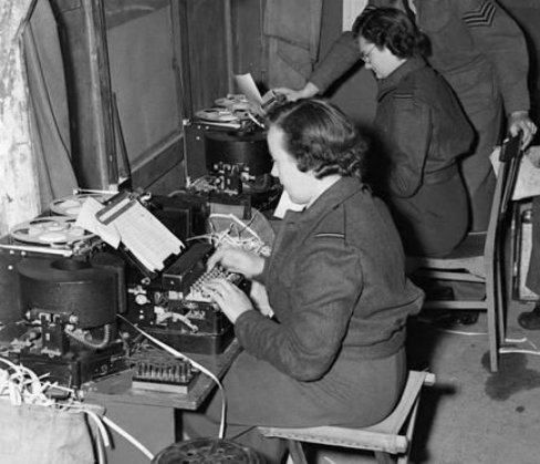
Figure 39 Typex cypher machines of the type housed in the Dugout, operated by the Women's Auxiliary Air Force (UK)
Source: www.pinterest.co.uk, accessed 4 July 2018
The building was adapted as a substation in 1945, following World War II.
The Dugout provides tangible evidence of a strategic means of communication between Australia and her allies during World War II. It also provides evidence of the defence measures that were introduced in Canberra during World War II. The building as it presents today conveys nothing of its war time uses.
In reflecting on historical value, the Burra Charter Practice Note encourages consideration of a site’s association with a people or groups that are ‘important in the history of the local area, state, nationally or globally’.
West Block is associated with:
- J S Murdoch, Chief Architect of the Commonwealth Department of Works and Railways. Murdoch’s Department was responsible for the three buildings within the group, as well as a great many others in Canberra in the period leading up the end of the 1920s. Murdoch has been credited with the development of the Federal Capital style, of which West Block, East Block and the Provisional Parliament House were early examples (see also Section 3.2.1). Murdoch also expressed strong views about the landscape treatment for the Parliamentary precinct and is credited with the selection of poplars for the principal intersections and boundaries.
- Charles Weston, officer-in-charge of Afforestation (later Parks and Gardens) at the national capital from 1913 to 1926. Weston established nurseries and propagated plants suited to the conditions in Canberra. He also oversaw the planting and landscape development of the city. His varied concepts and approaches are expressed in the divergent characters of the landscape to all sides of West Block. See Section 2.4.4 in Chapter 2).
- Walter Burley Griffin, winner of the international competition for the design of the federal capital and Federal Capital Director of Design and Construction from 1913 to 1920. As noted, Griffin’s plans for the Parliament House group were implemented to the extent that he envisaged the Parliamentary Triangle as the seat of government, and for buildings within the triangle to be sited symmetrically on either side of the Land Axis.
The ‘Understanding and assessing cultural significance’ Practice Note to the Burra Charter 2013 provides the following definition of aesthetic value:
Aesthetic value refers to the sensory and perceptual experience of a place—that is, how we respond to visual and non-visual aspects such as sounds, smells and other factors having a strong impact on human thoughts, feelings and attitudes. Aesthetic qualities may include the concept of beauty and formal aesthetic ideals. Expressions of aesthetics are culturally influenced.
In considering aesthetic value, ask:
> Does the place have special compositional or uncommonly attractive qualities involving combinations of colour, textures, spaces, massing, detail, movement, unity, sounds, scents?
> Is the place distinctive within the setting or a prominent visual landmark?
> Does the place have qualities which are inspirational or which evoke strong feelings or special meanings?
> Is the place symbolic for its aesthetic qualities: for example, does it inspire artistic or cultural response, is it represented in art, photography, literature, folk art, folk lore, mythology or other imagery or cultural arts?
> Does the place display particular aesthetic characteristics of an identified style or fashion?
> Does the place show a high degree of creative or technical achievement?
In the case of West Block, the aesthetic values of the place are considered to be:
- Architectural, deriving from the design qualities of West Block itself, as well as its formal relationship with East Block and the Provisional Parliament House; and
- Aesthetic, relating to the landscaped setting.
Alongside East Block and the Provisional Parliament house, West Block is an early example of the Federal Capital style, a term used to describe early Canberra architecture (the period from 1913 to World War II). The name derives from the Federal Capital Commission, the government agency responsible for the construction and administration of Canberra from 1 January 1925 to 1 May 1930, when it was disbanded.
Buildings overseen by the FCC during its first two years of operation (1925-1927) included the Provisional Parliament house, East Block and West Block (designed by the Commonwealth Department of Works and Railways, of which John Smith Murdoch was Chief Architect), the Lodge (Oakley and Parkes), Albert Hall (J Hunter Kirkpatrick), Mount Stromlo Observatory (Murdoch, Figure 40), the Forestry School (Kirkpatrick) and the Melbourne and Sydney buildings (John Sulman, Figure 42).
Federal Capital architecture was generally conservative in character; the flamboyance of the Federation era was not seen to be appropriate to the federal capital. It was also delivered in a climate of financial constraint, where the private sector had little interest in the construction of the ‘bush capital’.
As noted by Ken Charlton, author of Federal Capital Architecture, Canberra 1911-1939, the Federal Capital style was a synthesis of revivalist styles (neo-Georgian, Colonial Revival and later Tudor Revival), interwar stripped classicism and overseas influences (including Spanish Mission, the Prairie Style, Stripped Classicism and Art Deco).[91] Major figures in the development of the Federal Capital included:
- Sir John Sulman (1849-1934), an architect active in the Arts and Crafts movement in England before emigrating to Australia in 1885. He was influential in shaping ideas on town planning in Australian the years leading to Canberra’s inception. He served as chairman of the Federal Capital Advisory Committee (predecessor to the FCC) from 1921 to 1924;
- Leslie Wilkinson (1882-1973), Australia’s first Professor of Architecture and a noted advocate of climate responsive design;
- William Hardy Wilson (1881-1955), an influential architect and writer who was a proponent of Colonial Revival architecture. His seminal work, Colonial architecture in New South Wales and Tasmania was published in 1924;
- Walter Burley Griffin (1876-1937), an exponent of Prairie style design principles; and
- John Smith Murdoch (1862-1945), Australia’s first Commonwealth Government Architect, and designer of a number of key works in Canberra’s Inaugural Phase (1911-1927)
While not the earliest examples of buildings in the Federal Capital style, the Parliament House Secretariat group performed a significant role in refining and consolidating the style. This arose as a consequence of the buildings being the seat of government and being the first buildings in the Parliamentary Triangle.
Further, as a pragmatic and well-resolved solution to the challenge of accommodating a variety of official uses and operations quickly, West Block (and East Block) can be seen as representative of the times. The buildings are architecturally unpretentious and designed in a style that could accommodate change and alterations without detrimental impact on its formal presentation.
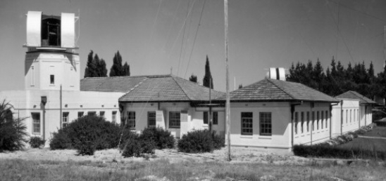
Figure 40 Mount Stromlo Observatory, established 1924
Source: ACT Heritage Library
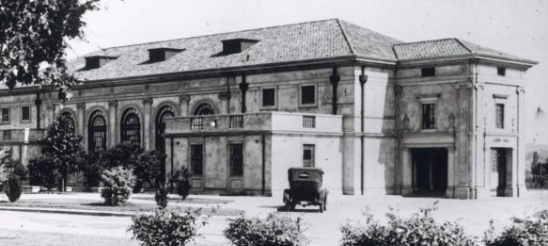
Figure 41 Albert Hall, Canberra, 1928
Source: ACT Heritage Library
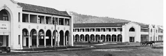
Figure 42 Melbourne and Sydney buildings, Civic (1926-27)
Source: ACT Heritage Library
As noted by Professor Ken Taylor, a former professor of landscape architecture at Canberra University and author of Canberra, City in the Landscape (2006), the years leading up to the development of Canberra saw the, ‘birth of the town and country planning movement as the forerunner of modern urban planning’.[92] During this period two planning principles dominated: the City Beautiful movement and the Garden City movement. Although distinct in emphasis and expression the two shared common objectives, specifically a rejection of the squalid and unhealthy living conditions created by unplanned and opportunistic urban development that proliferated during the Industrial Revolution.
The City Beautiful movement, informed by Renaissance planning principles, was concerned with urban aesthetics and order. It is characterised by axes and vistas lined with monumental civic buildings connecting gardens and public spaces. A leading proponent of City Beautiful principles at the end of the nineteenth century was American architect and urban planner Daniel Burnham. The influence of Burnham’s plan for the 1893 World Columbian Exposition in Chicago on a young Walter Burley Griffin has been well documented.[93] The Exposition plan was distinguished by a strong sense of geometry, tree-lined boulevards, axes lined with classical buildings and a central water court. Burnham subsequently worked on the McMillan Commission (1901), which resulted in the completion of the National Mall in Washington DC and in 1909 he prepared a comprehensive city plan for Chicago, described by Professor Taylor as having, ‘an emphasis on civic design, a system of highways and avenues, public transport and a great park system’.[94]
The emphasis of the Garden City movement, as promoted by English reformer Ebenezer Howard from the late 1890s, was on achieving a balance between contemporary urban forms and traditional patterns of rural settlement. Hygiene and cleanliness were dominant precepts, and locations on the urban fringe were identified as ideal locations to demonstrate the benefits of Garden City principles.
The centre point of Howard’s ideal garden city was a large circular public park. Avenues radiating from the park were linked by concentric streets, lined with residential development. The central ring (Grand Avenue) was a broad linear green space (Figure 43). Throughout the city, public open spaces and private gardens contributed to the health and welfare of residents. The underpinning principle was of urban planning as an instrument of social reform. Further underpinning the urban planning philosophy was an ideal to introduce ‘nature’ into the new city. With both the British Garden City and the City Beautiful (particularly as interpreted in Europe), a key component in the successful implementation of the planning model was landscape architecture. In the case of Canberra, on the treeless Limestone Plains, the design and planting of the landscape was critical.
Charles Weston
Charles Weston was appointed Horticulturalist Superintendent of Parks, Gardens and Afforestation in Canberra (later Superintendent Parks and Gardens) at the national capital. He was simultaneously Director of City Planning from 1921-1926. As noted, his work in Canberra can be divided into two phases: testing and propagation in the distinct conditions of the Limestone Plains; and planting.
Tree trials were conducted at the Acton Nursery (now submerged by Lake Burley Griffin) over a period of several years. Other trial sites which remain as a record of Weston’s approach include Westbourne Woods and Yarralumla Nursery. In the trial plantings, Weston tested both exotic and native species At Westbourne Woods one section was, ‘an exclusive area for the cultivation of our Australian trees etc, and to demonstrate the tractability of such to cultivation and not leave such object lessons to South Africa and California’.[95] The second was for, ‘trees that create the glorious Spring and Autumn effects for which the cool temperate countries of the world are justly noted’.[96] The third was, ‘to bring together a magnificent collection of trees and sub-trees which are included under the name of conifers or cone bearers’.[97]
Weston sought to define the new city through plantings, rather than through buildings. It was recognised that planting could define the ground plane of the city much more quickly that the building program could, particularly given the financial constraints of the period. Expenditure on capital works in Canberra was cut from £101,533 in 1916-17 to £8,000 over the next three years,[98] and in the years to 1924, Australia invested only £3.4million in the development of Canberra.[99] ‘
In general, Weston favoured conifers as a key structure planting. In 1917 he stated that three cedars, Deodar, Atlas and Lebanon (Cedrus deodara, C. atlantica and C. libani) would be useful as the chief arboreal feature of the city.[100] He also pioneered the use of several eucalypts such as Brittle Gum (Eucalyptus mannifera) and Argyle Apple (Eucalyptus cinerea); 36 species of eucalypts were trialled at Yarralumla in 1917.
The landscape treatment delivered by Weston at the Parliamentary precinct established the template for Canberra’s interpretation of ‘Garden City’ principles. The treatment was formal and used plantings to frame vistas, define boundaries and create ‘outdoor rooms’. The treatments around East and West blocks operated on two levels: as self-contained landscape settings for the buildings in their own right, including triangular car parks as landscaped buffers from the main axes; and as components of the larger landscape setting, to which they are connected in terms of symmetry and by means of the tree-lined vistas extending from their northern-most blocks.

Figure 43 Detail of Howard’s vision for a ‘Garden City’
Source: Ebenezer Howard, Garden Cities of Tomorrow (1902)
The ‘Understanding and assessing cultural significance’ Practice Note to the Burra Charter 2013 provides the following definition of scientific value:
Social value refers to the associations that a place has for a particular community or cultural group and the social or cultural meanings that it holds for them.[101]
The social value of a heritage place has been described as, ‘the special meanings attached to places by groups of people (rather than by individuals)’.[102] A critical consideration in establishing the social significance of a place is its value to the present community. This sense of communal attachment is typically associated with places that are publicly accessible, or have otherwise been, ‘appropriated into the daily lives of people’.[103] Places recognised as having social value include those that:
- Provide a spiritual or traditional connection between past and present
- Tie the past affectionately to the present
- Help give a disempowered group back its history
- Provide an essential reference point in a community’s identity or sense of itself
- Loom large in the daily comings and goings of life
- Provide an essential community function that over time develops into a deeper attachment that is more than utility value
- Have shaped some aspect of community behaviour or attitudes
- Are distinctive – the old clock tower in a town or an architectural folly – features that lift a place above the crowd, making it likely that special meanings have been attached to that place
- Are accessible to the public and offer the possibility of repeated use to build up associations and value to the community of users
- Places where people gather and act as a community, for example places of public ritual, public meeting or congregation, and informal gathering places[104]
Indications of a community’s attachment to a place might be reflected in a history of communal action to protect the place from development; inclusion in local walking tours; and representation in postcards or websites for the area.
Social significance or value is typically established through community consultation, sometimes in the form of survey questionnaires, interviews with members of the relevant communities or public discussion workshops. Opinion pieces in the local print media, and views expressed in talk-back radio shows can also be forums for the expression of community sentiment. Community consultation is rarely a ‘scientific’ process, although it is generally the case that the broader the cross-section of the community invited to express opinions, the greater the certainty about the outcomes.
As noted at Chapter 1, no formal appraisal of social values was undertaken in the course of this HMP. Such a process has the potential to indicate that a community or group has some degree of social attachment to the building. However, that is not considered to be sufficiently probable to warrant the undertaking. Places or work (like an office) and utility (like a supermarket) are not typically considered to be places of social value. In general terms, they do not relate to or express a ritual or ceremonial function that stimulates a strong sense of attachment.
Further, in the context of the Parliament House Secretariat group (which includes the Provisional Parliament House, East Block and West Block), it is considered the communal attachment associated with the ceremonial functions of the governance of the nation is more likely to reside in the Provisional Parliament House than either East or West Block, which provided a supporting role for the operations of Parliament.
Having regard to the above analysis, the following assessment against the Commonwealth Heritage criteria.
(a) the place has significant heritage value because of the place's importance in the course, or pattern, of Australia's natural or cultural history
West Block (designed in 1925, built in 1926-27 and in use from August 1927) is of historical significance to Australia for its association with Federation. The building is a component of the Parliament House Secretariat group, the first premises purpose-built for Australia’s democratic government. The principal component of the group is the Provisional Parliament House itself, as reflected in its siting on the Land Axis and its visual prominence within the national capital. West and East blocks (originally Secretariats no. 2 and 1 respectively) were supporting elements. The primary role of these multi-purpose buildings was office accommodation. The buildings within the Parliament House Secretariat group were the first to be constructed within the Parliamentary Triangle. All were conceived as temporary, pending the construction of a permanent Parliament House, completed in 1988.
The Dugout (built 1942, adapted in 1943 and 1945) is of historical significance as the building from which Prime Minister Curtin communicated with Australia’s allies during World War II, using a Typex cypher machine. The building is also significant as a remnant of the World War II defences introduced within the Parliamentary Zone during World War II.
(b) the place has significant heritage value because of the place's possession of uncommon, rare or endangered aspects of Australia's natural or cultural history
The construction of a group of buildings for the administration of a territory, region or State in Australia is uncommon. The contextual rationale for this approach is of historical significance to Australia (see Criterion A above).
The origins and evolution of Canberra as a purpose-built capital city in an isolated bush setting is a singular phenomenon in Australia, and demanded an uncommon (unique) response to its planning, construction and development, including the construction of a group of buildings for the practice and operation of government. A more typical sequence is for the construction of a principal parliament building, with support facilities delivered incrementally over a period of time as required. An exception to this pattern is the Commonwealth and State offices group in Adelaide Street, Brisbane (completed in 1936), also planned and designed by J S Murdoch.
(c) the place has significant heritage value because of the place's potential to yield information that will contribute to an understanding of Australia's natural or cultural history
The subject site is not considered to satisfy this criterion.
Block 3, Section 23 Parkes (part) was partially excavated in the mid-1920s, to establish a level site for the construction of West Block. This activity, as well as grading works for the establishment of the integral car park and the landscape setting generally, means, there is limited potential for subsurface artefacts relating to earlier occupation and/or land use at the site. Exceptions may relate to subsurface evidence of pneumatic tubes that connected the buildings of the Parliament House group during the 1940s, and evidence of World War II-era defences (i.e. trenches). In the event that archaeological remains are discovered at the site, the relevant authorities should be informed before proceeding with work (see also Chapter 5, Policy 22).
(d) the place has significant heritage value because of the place's importance in demonstrating the principal characteristics of:
(1) a class of Australia's natural or cultural places; or
(2) a class of Australia's natural or cultural environments;
West Block is significant for demonstrating the principal characteristics of the Federal Capital style, a generally conservative and unpretentious synthesis of revivalist styles and overseas influences, including Stripped Classicism, which is now strongly associated with Canberra’s establishment phase. Distinguishing characteristics of the style evident in West Block today include: horizontal massing; symmetrical façades divided into vertical bays; and a simple, unpretentious architectural expression, with limited use of decorative elements. Internal evidence of the building’s original/early (pre-1950s) character and layout is very limited. Extant elements and attributes include: the north-south axis that connects the four blocks on each level; the two staircases in B Block; timber ceiling panels where extant in A, B and C Blocks; and timber structural framing on levels 1 and 2, which provide an insight into the ‘temporary’ (provisional) nature of the building.
(e) the place has significant heritage value because of the place's importance in exhibiting particular aesthetic characteristics valued by a community or cultural group
The setting of West Block, as part of the formal landscape for the Parliamentary Triangle, is of aesthetic significance to Australia. The buildings that make up the Parliament House Secretariat group are symmetrically positioned within a large-scale landscape (the Parliamentary Triangle, south of King Edward Terrace) that was conceived in the 1920s as the centrepiece of the Federal Capital. The landscape of the Parliamentary Triangle, although much altered, is of aesthetic significance. The formality of the planned landscape provides an appropriately distinguished setting for the Provisional Parliament House. It also contributed to the establishment of Canberra’s ‘Garden City’ identity.
(f) the place has significant heritage value because of the place's importance in demonstrating a high degree of creative or technical achievement at a particular period
The planning and presentation of the Parliament House Secretariat group within the formal landscape of the Parliamentary precinct is of creative (technical) significance to Australia.
The Secretariat group is located at the southern end of the Land Axis (Parliament House Vista), a key symbolic and planning component of Walter Burley Griffin’s concept for Australia’s federal capital. The three buildings were designed by the office of J S Murdoch, Chief Architect of the Commonwealth Department of Works and Railways, and were sited to reinforce the formal qualities of the Land Axis. The landscape treatment was designed and planted by Thomas Weston, with input from Murdoch. Collectively, this composition is of creative significance.
(g) the place has significant heritage value because of the place's strong or special association with a particular community or cultural group for social, cultural or spiritual reasons
No evidence to indicate that West Block is of value to a particular community or cultural group came to light during research for this HMP. Further, research revealed no evidence that would indicate that analysis of the potential for the building to be of social value to a particular community or cultural group is required. This is consistent with the use of the building (office accommodation). Places of work and utility are not typically considered to be of social value. In general terms, they do not relate to or express a ritual or ceremonial function that stimulates a strong sense of attachment. In the event that evidence indicating that West Block may be of social value to a particular community or cultural group were to be revealed this approach may be reviewed.
(h) the place has significant heritage value because of the place's special association with the life or works of a person, or group of persons, of importance in Australia's natural or cultural history
West Block is significant for its association with Walter Burley Griffin, J S Murdoch and Charles Weston. These figures made significant contributions to the planning, design and setting for the building.
Griffin’s plan for Canberra established the city’s core structure and zoning. His plans for the Parliament House group were implemented to the extent that he envisaged the Parliamentary Triangle as the seat of government, and for buildings within the triangle to be sited symmetrically on either side of the Land Axis.
J S Murdoch, Chief Architect of the Commonwealth Department of Works and Railways, was responsible for the three buildings within the Parliament House Secretariat group. Murdoch also expressed strong views about the landscape treatment for the Parliamentary precinct and is credited with the selection of poplars for the principal intersections and boundaries.
Charles Weston, officer-in-charge of Afforestation (later Parks and Gardens) at the national capital, established nurseries and propagated plants suited to the conditions in Canberra. He also oversaw the planting and landscape development of the city. His varied concepts and approaches are expressed in the divergent characters of the landscape to all sides of West Block.
(i) the place has significant heritage value because of the place's importance as part of Indigenous tradition.
West Block does not satisfy this criterion.
For the purposes of this HMP, the existing CHL entry for West Block is accepted, including the gazetted Statement of Significance (transcribed below) and the ‘official’ values.
West Block is a significant component of the Parliament House Secretariat group, which also includes East Block and the Provisional Parliament House. The group is located at the southern end of the Parliamentary Triangle and is an integral component of the significant Parliamentary Triangle landscape, exhibiting the skilful handling of planning and architectural forms within a designed landscape of related buildings and spaces. The group forms essential and important axial planning elements with the Parliamentary Triangle. The planning principles of the group are as established by Walter Burley Griffin, and the architectural resolution of the group is as established within the office of John Smith Murdoch, Director-General of Works. (Criterion F1)
West Block is important for its association with Federation, being part of the Provisional Parliament House group, which formed the essential Government facilities in the early development of Canberra as the Nation's Capital. The Secretariats are a remnant of the relocation phase of the Federal Capital when they formed the seat of Federal and political power. (Criterion A4) Australian Historic Themes: 4.3, Developing Institutions, 7.4 Federating Australia.
The Dugout is significant as a purpose-built World War II bomb shelter. Along with West Block it is important for accommodating strategic international communication functions of Australia's war time activities. (Criterion 4) Australian Historic Themes 7.7 Defending Australia).
The building is a fine example of Federal Capital Architecture, a version of Inter-War Stripped Classical style. It exhibits classical style proportions and features of arcaded entrance screens and courtyard arrival points. (Criterion D2)
The unpretentious style of the building with its low horizontal massing, the role of the building as part of a group linked by architectural style and function, and the contribution of the building group as a feature of the designed landscape of the Parliamentary Triangle, are significant aesthetic qualities now greatly valued. (Criterion E1)
The group of government buildings is uncommon. Only one other similar formal grouping exists in Australia, and that is the Commonwealth and State offices group in Brisbane, also designed by John Smith Murdoch. (Criterion B2)
West Block has associations with the formative days of the National Library, the relocation phase of the Federal Capital, the planning and architecture of John Smith Murdoch and Walter Burley Griffin, and the evolution of Federal Government administration in Canberra. (Criterion H1)
In addition to the Statement of Significance, the following observations – informed by research and analysis undertaken for this HMP – are considered relevant to an appreciation of West Block’s cultural heritage significance.
- The contribution of Charles Weston in establishing the landscape setting for West Block and the broader Parliamentary Gardens precinct should be acknowledged (Criterion E, ‘aesthetic significance’ and Criterion H ‘associations’).
- The physical evolution of West Block should be acknowledged, notably the significant iterative changes to the building’s external appearance and massing carried out between 1937 and 1948. While the building is demonstrative of key aspects of the Federal Capital Architecture, it is not an intact example. There is also very limited internal evidence of original/early (pre-1950s) fabric/attributes.
- It would be appropriate to place greater weight on the contribution of West Block to the planned landscape of Parliamentary Zone. That is to say, West Block was planned with its own landscape setting, which was connected to a broader landscape setting for the Parliamentary Zone through common plantings and circulation networks.
Table 5 identifies attributes and features that relate to the heritage values described in the ‘Assessment against Commonwealth Heritage criteria’ (Section 3.4) and the gazetted Statement of Significance.
Table 5 Summary of heritage values and related attributes
Commonwealth Heritage List criteria | Attributes |
(a) the place has significant heritage value because of the place's importance in the course, or pattern, of Australia's natural or cultural history | External fabric dating to the period 1926-48 (i.e. the building’s external envelope in its evolved form) Original/early (pre-1950s) internal features and fabric specifically: the north-south axis that connects the four blocks on each level; the two staircases in B Block; timber ceiling panels where extant in A, B and C Blocks; and timber structural framing on levels 1 and 2 The planned relationship (operational, stylistic and planned) between West Block and the other components of the Parliament House Secretariat group (East Block and the Provisional Parliament House) All of the original form and fabric of the Dugout |
(d) the place has significant heritage value because of the place's importance in demonstrating the principal characteristics of: (1) a class of Australia's natural or cultural places; or (2) a class of Australia's natural or cultural environments; | External fabric dating to the period 1926-48 |
(e) the place has significant heritage value because of the place's importance in exhibiting particular aesthetic characteristics valued by a community or cultural group | The external presentation of West Block and its landscaped setting within the context of the Parliamentary Triangle |
(f) the place has significant heritage value because of the place's importance in demonstrating a high degree of creative or technical achievement at a particular period | West Block as a component of the planned Parliamentary Triangle landscape (generally), and the other components of the Parliament House Secretariat group (specifically). The arrangement is distinguished by symmetrical planning on the Parliament House Vista (Land Axis) and a consistency of architectural form. |
(h) the place has significant heritage value because of the place's special association with the life or works of a person, or group of persons, of importance in Australia's natural or cultural history | West Block and its setting |
The following establishes a framework for the conservation and management policies at Chapter 5. It addresses issues arising from:
- The statutory recognition of West Block and the Dugout for heritage reasons;
- The application of planning and building regulations and controls;
- The aspirations of the lease-holder and building operator;
- The interests of stakeholders;
- The condition of the building fabric (West Block and Dugout); and
- The condition of the landscape setting and its constituent elements.
The intent is to provide a context for the development of policies (Chapter 5), which address the conservation of the place, while equally recognising that the future of West Block depends upon having a sustainable and viable future use.
The Statement of Significance at Chapter 3 confirms that West Block (designed in 1925, built in 1926-27 and in use from August 1927) is of historical significance to Australia for its association with Federation. The building is a component of the Parliament House Secretariat group, the first premises purpose-built for Australia’s democratic government. The principal component of the group is the Provisional Parliament House itself, as reflected in its siting on the Land Axis, and its visual prominence within the national capital. West and East blocks were supporting elements. The primary role of these multi-purpose buildings was office accommodation. The buildings within the Parliament House Secretariat group were conceived as temporary, pending the construction of a permanent Parliament House, completed in 1988. (CHL criterion A)
The Dugout (built 1942 and adapted in 1943 and 1945) is of historical significance as the building from which Prime Minister Curtin communicated with Australia’s allies during World War II, using a Typex cypher machine. The building is also significant as a remnant of the World War II defences introduced within the Parliamentary Zone during World War II. (CHL criterion A)
West Block is significant for demonstrating the principal characteristics of the Federal Capital style, an interpretation of interwar Stripped Classicism which is now strongly associated with Canberra’s establishment phase. Distinguishing characteristics of the style evident in the building exterior today include: horizontal massing; symmetrical façades divided into vertical bays; and a simple, unpretentious architectural expression, with limited use of decorative elements. (CHL criterion D). Internal evidence of the building’s original/early character and layout is very limited and includes: the north-south axis that connects the four blocks; the two staircases within B Block; strong rooms in B Block; and a section of timber ceiling panelling in B Block, and potentially other sections of ceiling panels that have been concealed above dropped ceilings within A, B and C Blocks (all levels).
The buildings that make up the Parliament House Secretariat group are symmetrically positioned within a large-scale landscape (the Parliamentary Triangle, south of King Edward Terrace) that was conceived in the 1920s as the centrepiece of the Federal Capital. The landscape of the Parliamentary Triangle, although much altered, is of aesthetic significance (CHL criterion E). The formality of the planned landscape provides an appropriately distinguished setting for the Provisional Parliament House. It also contributed to the establishment of Canberra’s ‘Garden City’ identity.
The Parliament House Secretariat group is located at the southern end of the Land Axis (Parliament House Vista), a key symbolic and planning component of Walter Burley Griffin’s concept for the National Capital. The three buildings were designed by the office of J S Murdoch, Chief Architect of the Commonwealth Department of Works and Railways, and were sited to reinforce the formal qualities of the Land Axis. The landscape treatment was designed and planted by Thomas Weston, with input from Murdoch. Collectively, the planning and presentation of the Parliament House Secretariat group as a key component of Land Axis is a work of creative (technical) significance to Australia (CHL Criterion F).
West Block is significant for its associations with Walter Burley Griffin, J S Murdoch and Charles Weston, each of whom made significant contributions to the planning, design and setting for the building (CHL Criterion H).
Implications arising from this assessment are that key aspects of the place should be conserved to retain this significance. The key features requiring conservation include:
- The external presentation of West Block, as a free-standing structure with a general consistency of character and details demonstrative of the Federal Capital style
- Original/early (pre-1950) internal features and fabric specifically: the north-south axis that connects the four blocks on each level; the two staircases in B Block; timber ceiling panels where extant in A, B and C Blocks, including a section that is known to survive on the ground floor of B Block; and timber structural framing on levels 1 and 2 (see Chapter 2)
- Structural landscape elements, including the integral car park between Commonwealth Avenue and West Block, the service road between West Block and the car park and the tree-lined vista extending north on axis with the north elevation of A Block
- Trees and landscape characteristics dating to the 1920s, including trees around the integral car park to the west of West Block
- The Dugout, to the extent of fabric dating to the 1940s
- The broadly symmetrical relationship with East Block located to the east side of the Land Axis
EPBC Act provides a legal framework to protect and manage nationally and internationally important flora, fauna, ecological communities and heritage places.[105] It is the principal legislation that applies to the management of West Block.
Under the Act, the owner or operator of the site is required to ensure that its Commonwealth Heritage values are protected. An action that will have or is likely to have a significant impact on the environment requires approval from the Minister for the Environment and Energy.
Significant impact is defined as follows:
A ‘significant impact’ is an impact which is important, notable, or of consequence, having regard to its context or intensity. Whether or not an action is likely to have a significant impact depends upon the sensitivity, value, and quality of the environment which is impacted, and upon the intensity, duration, magnitude and geographic extent of the impacts. You should consider all of these factors when determining whether an action is likely to have a significant impact on matters of national environmental significance.[106]
An action may be:
- a project
- a development
- an undertaking
- an activity or a series of activities
- or an alteration of any of these things.[107]
If a proposed action at West Block is likely to have a significant impact on the environment a referral must be made under Section 68 of the EPBC Act. The Minister for the Environment and Energy will then decide whether there is a requirement for the action to be approved under the Act (Section 75 of the EPBC Act).
West Block and the Dugout at Block 3, Section 23 Parkes (part) is included in the CHL (ID 105428). The citation for this listing is included in Appendix A and reproduced at Chapter 3. As well as the site-specific values attributed to West Block, the citation acknowledges the significance of ‘the location and appearance of West Block in relation to East Block, Old Parliament House and [the] Parliamentary Triangle and the Land Axis’.[108] In this regard, there is alignment between the CHL entry for West Block and the Dugout and the CHL entry for the Parliament House Vista (ID 105466).
West Block forms part of the Parliament House Vista, a large area extending from the Australian War Memorial to the new Parliament House (Griffin’s Land Axis), that forms the spine of the national capital and has been assessed as a place of historical, aesthetic and social significance to Australia. As noted in the citation for the Vista:
The spatial setting of the buildings as features in the landscape reflects Beaux Arts planning concepts and the building masses and their careful location complement the significance of the overall landscape pattern. Across the Parliamentary Triangle, the buildings of Old Parliament House, and East and West Blocks provide a distinctive Stripped Classical architectural patterned horizontal band, that contributes to the symmetrical overall patterning of the landscape.[109]
The HMP for the Parliament House Vista includes policies of relevance to West Block including, but not limited to, the following:
New Development
Policy 49 General provisions relating to new development
The following general provisions will be implemented:
- new permanent development will not impact on the heritage values of the area nor on important spatial relationships between individual buildings and open spaces (eg. the relationship between the High Court and National Gallery, or between the Gallery and Sculpture Garden);
- new permanent development in the area will be part of a planned approach which is in keeping with the values of the area. Ad hoc development will be avoided … [110]
The Australian Capital Territory (Planning and Land Management) Act 1988 establishes the National Capital Authority (NCA) and requires the NCA to establish and administer a National Capital Plan (NCP). The NCP, first gazetted in 1990, identifies and defines Designated Areas. These are areas of the ACT that have been identified as having the special characteristics of the National Capital. Policies for land use and conditions of planning, design and development within Designated Areas are set out in the NCP. Approval from the NCA is required for all works proposed within a Designated Area.
National Capital Plan
The Parliamentary Zone is a Designated Area as identified in the NCP (Figure 44). The following is an extract from Section 4.2.1 ‘The Parliamentary Zone and its Setting’ of the NCP:
The National Capital and Seat of Government is the legislative, judicial, administrative, executive, ceremonial and symbolic centre of the nation.
The role of Canberra as the National Capital warrants high environmental and aesthetic standards for development generally. It also requires that national functions are located where they may operate effectively and efficiently.
Areas that clearly exhibit the special characteristics of the National Capital primarily have the Parliamentary Zone and its setting as their focus. They embrace the main National Capital uses and national institutions, and other centrally located areas of National Land, diplomatic areas, and nearby lands where planning, design and development are critical.
The core of those areas is the Parliamentary Zone – the physical manifestation of Australian democratic government and the home of the nation’s most important cultural and judicial institutions and symbols.
The area ensures that the essential relationships between Parliament and its setting are planned, developed and conserved in an integrated way, with the Commonwealth providing the requisite leadership of design and ensuring that construction and maintenance operations are carried out to the highest standards.[111]
Conditions of planning, design and development in the Parliamentary Zone of particular relevance to the proposed adaptation of West Block as a hotel are set out in the NCP (Section 4.1.2) and summarised at Table 6.

Figure 44 Designated Area Precincts: the Parliamentary Zone is identified as precinct 1
Source: National Capital Plan, May 2016, Figure 10
Table 6 Parliamentary Zone: conditions of planning, design and development (summary)
Issue | Conditions of planning, design and development (NCP Section 4.1.2) |
Land use | Land uses will comprise: Parliamentary Uses and National Capital Uses, including national legislative, judicial and executive functions, and Commonwealth cultural institutions such other uses, including a limited range of commercial uses and tourism facilities that complement and enhance the function and character of the area. |
| Special consideration will be given to community, cultural, residential, tourism, entertainment and leisure uses which complement and enhance the function and character of the Designated Area. |
Urban design | The urban design of the area is to achieve an integrated design of the highest quality by managing building height and bulk, and by encouraging building forms and layouts on consistent building alignments which enhance the structure of the Griffins’ plans. |
Development | Development must be guided by the principles, policies and Indicative Development Plan for the Parliamentary Zone set out in the Parliamentary Zone Precinct Code [see discussion below, Parliamentary Zone Precinct Code]. |
| New development should seek to respect the design and character of adjacent buildings in terms of scale, colour, materials, massing and frontage alignment. |
| Individual development proposals will be assessed on their merits in respect to sunlight penetration, amenity, pedestrian and vehicle access. No buildings taller than RL617 will be permitted in the Designated Area, but the general building height will be 3-4 storeys except where the National Capital Authority determines otherwise. |
| Buildings in the area must show an appropriate quality of architectural design consistent with their location in this area of special national importance |
Landscape | Landscaping is to enhance the visual setting of the Designated Area and integrate the buildings with their landscape setting. This will be carried out in accordance with a landscape masterplan to be prepared by the National Capital Authority which particularly emphasises the following landscape themes: a. the formal and consistent landscaping of Main Avenues and mall spaces b. the combination of formal and informal landscaping which occurs around the Lake’s edge and is the setting for Parliament House and its adjacent area. [Note: During research for this HMP a landscape masterplan for the Parliamentary Zone prepared by the NCA was not located.] |
Parliamentary Zone Precinct Code
With regards to the Parliamentary Zone, core ambitions of the NCP are to give the area, ‘meaning as the place of the people, accessible to all Australians so that they can more fully understand and appreciate the collective experience and rich diversity of this country’.[112] Development and planning within the Parliamentary Zone will be guided by:
- Balancing politics and culture
- Welcoming people
- Celebrating Australian history and society
- Representing Australian excellence
- Emphasising the importance of the public realm
- Making access easy and open
- Reinforcing the integrity of the visual structure
- Strengthening the relationship between buildings and the landscape
- Creating a variety of urban spaces
- Establishing comprehensive design management policies for the future.[113]
The NCP promotes the identification of campuses (or precincts) within the Parliamentary Zone. The intent is for existing buildings to act as ‘anchors’ for new development that serves a ‘compatible function’.[114] Landscaped courts, or campus squares, are proposed to provide a focus for each campus.
The NCP identifies five campuses. West Block is located within the ‘Parliamentary Executive Campus’, Campus A (Figure 45 and Figure 46) – the anticipated functions of the Parliamentary Executive Campus are not expanded upon in the NCP. Within this area, large new building masses equidistant from the Land Axis are proposed to the east of West Block and the west of East Block. As is the case for East and West blocks, the footprints of the new buildings are not identical. A landscaped court, located on the Land Axis, connects the two new building forms.
The Precinct Code for the Parliamentary Zone also places emphasis on the delivery of tree planting within the area, to enhance an appreciation and understanding of Canberra’s ‘enduring design concept’ and the character and structure of the city.[115]
All works proposed within the Parliamentary Zone require the approval of both Houses of Federal Parliament. Development proposals may be either reported or referred to the Joint Standing Committee on the National Capital and External Territories. The Committee is appointed to inquire into and report on:
… matters coming within the terms of section 5 of the Parliament Act 1974 [see discussion below] as may be referred to it by:
(i) either House of the Parliament; or
(ii) the Minister responsible for administering the Parliament Act 1974, or
(iii) the President of the Senate and the Speaker of the House of Representatives;[116]
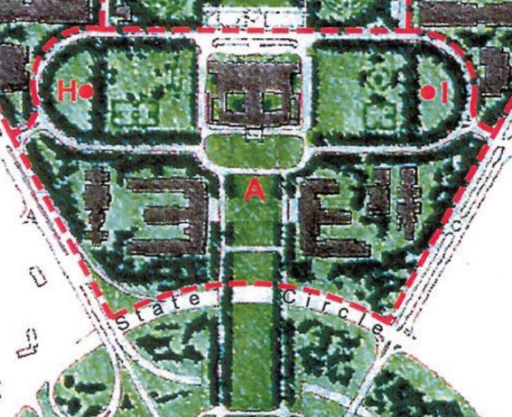
Figure 45 Parliamentary Zone, Indicative Development Plan, detail of the Parliamentary Executive, Campus A (‘H’ is Magna Carta Place, and ‘I’ is Constitution Place)
Source: National Capital Plan, May 2016, Figure 14

Figure 46 Perspective view of the Parliamentary Zone ‘campuses’ looking south-west: West Block is indicated
Source: Parliamentary Zone Review, Outcomes, March 2000, p. 32
Maintenance and/or minor works are typically reported to the Committee. Where proposals are of a greater order of magnitude, either House of the Parliament or a Minister may make a referral to the Committee. In these situations, the Committee may make recommendations for approval.
Section 5 of the Parliament Act 1974 is as follows:
- No building or other work is to be erected on land within the Parliamentary Zone unless the Minister has caused a proposal for the control of erection of the building or work to be laid before each House of the Parliamentary.
- Sub-section (1) does not prevent the carrying out of work by way of maintenance or repair of buildings or works situated on land within the Parliamentary zone, or byway of internal alterations to those buildings or works.
- Sub-section (1) does not apply to buildings and works which have reached the documentation stage by 1 December 1974.[117]
The provisions of the Utilities Act 2000 (ACT) apply to the substation at West Block. The substation is accommodated in the Dugout, a former air raid shelter that is included in the CHL (ID 105428).
The Act requires that ActewAGL personnel have unimpeded and unrestricted access to the building without notice at all times. The principal point of access to the substation is at the south end of the building, west elevation.
Consistent with ActewAGL’s protocols, there must be no built form within five metres of a freestanding substation chamber, as is the case at West Block. Further, the existing easement to the Dugout must be maintained, with no structure or fence built over it.
The intent of the National Construction Code (BCA) is to achieve national standards in the areas of safety, health and amenity. Compliance with the NCC is required for all new works and works to an existing building.
The NCC addresses all building compliance requirements as related to specified classes of buildings. In its formulation and reference to relevant construction standards, the Code has been developed for new construction. In this regard application wholesale to the refurbishment or redevelopment of a heritage building has the potential to have significant impacts, particularly if a ‘full compliance’ with the code is triggered.
In cases of existing buildings undergoing alterations and/or additions, some discretion may be available with regard to upgrading the existing part of the building to meet the NCC.
On 1 May 2011, the Disability (Access to Premises – Buildings) Standards (Premises Standards) took effect under the Disability Discrimination Act 1992. These standards align with the relevant provisions of the NCC.
Access for people with a disability as relevant to future works to West Block are addressed under the Disability Discrimination Act (DDA), 1992, and also under the NCC and the Australian Human Rights Commission ‘Premises Standards’. While the DDA sets out compliance requirements it is a document which also provisions for complaints where these requirements are not met. In the case of the NCC, the requirements under Part D3 are express requirements which must be met under the Deemed to Satisfy provisions or by way of a Performance Solution. Additionally, the Premises Standards provide guidance on both new works and works to existing buildings to meet access requirements.
Having regard to these documents, bringing heritage buildings into compliance typically requires a carefully resolved design response which frequently requires a balancing of access and heritage outcomes. Given the absolute need to provide equitable access design solutions to upgrading and reuse need to be developed in a manner which optimises access points and paths of travel to avoid multiple interventions.
A key issue at West Block is the management of the level change at the main west entry to the building.
NG Landholdings Hotel Pty Ltd (Nick Georgalis, sole director) signed a 99-year Crown Lease for West Block on 20 November 2017. The new owner has an interest in adapting the redundant office building as a hotel.
Matters in the lease with implications for the management of the building from a heritage perspective include the following.
- Clause 3(c): The lessee must not take an action that will have an adverse impact on the Commonwealth Heritage Values without prior written consent of DoEE.
- Clause 3(d). In the event that West Block is removed from the Commonwealth Heritage List the lessee must nominate the place for inclusion in the ACT Heritage Register.
- Clause 3 (e): The lessee must prepare an HMP to protect and conserve the Commonwealth Heritage values of the place. This should be lodged with the DoEE for review and approval within 12 months of first signing the lease (by 16 November 2018) and updated at least once every five years.
- Clause 3 (e): The lessee is responsible for reviewing and updating the HMP in accordance with the EPBC Act.
- Clause 3 (e) The lessee is required to conserve and manage the place in a proper, safe and sound standard of repair and condition in accordance with the HMP and Commonwealth Heritage values
- Clause 3 (h) The lessee must not display any advertising sign or hoarding without the written consent of the NCA
- Clause 3 (i) The lessee must screen and keep screened all service areas to the satisfaction of the NCA and shall ensure that all plant machinery be contained within the premises is suitably screened from public view.
- Clause 3 (j) The lessee is required to seek prior approval from the NCA to erect any building on the land or make any external structural alterations.
While not explicitly a heritage consideration, it is noted that Clause 3(b) of the Crown Lease requires that the aggregate total Gross Floor Area of any building or buildings on the land must not exceed 10,034 [square] metres.
At a general level, stakeholders as related to West Block fall into two categories: statutory and/or services authorities responsible for ensuring the appropriate management of the asset, and individuals or groups with a particular interest in the place.
There are a range of stakeholders with an interest in and concern for West Block including the following:
- Department of the Environment and Energy
- National Capital Authority
- Aboriginal and Torres Strait Islander people
- Associations and special interest groups including but not limited to:
> the Walter Burley Griffin Society (WBGS)
> National Trust of Australia, ACT (NT)
> Australian Institute of Landscape Architects (AILA)
> Australian Institute of Architects (AIA)
> The Winston Churchill Memorial Trust
The Department of Environment and Energy is concerned with the protection and conservation of the identified Commonwealth Heritage values of West Block.
The management of The Parliamentary Zone, including West Block, is on designated land. As such, the NCA is responsible for works approvals for all building and landscape works at the site. The NCA is also committed to promoting an understanding and appreciation Canberra as the National Capital.
Consultation with Representative Aboriginal Organisations (RAO) was undertaken on site at West Block in December 2013 (see Section 1.7). At that time, the consensus of attendees at the site walk and meeting considered that, ‘there were no concerns regarding Aboriginal cultural heritage for the area.’[118] It was, however, agreed that the use of the area occupied by West Block as a pathway between Black Mountain and Mount Kurrajong (New Parliament House) should be acknowledged. This issue is addressed at Policy 23 ‘Interpretation’ in Chapter 5.
A number of professional associations/groups have an interest in West Block, both in its own right and as part of the Parliament House Secretariat group. These include associations/groups whose principal areas of interest relate to heritage, landscape design or architecture, consistent with the heritage significance of West Block and its setting.
It can be anticipated that the WBGS would be concerned with issues related to the legibility of the Griffin Plan for Canberra associated with any proposal for change or works at West Block; the NT and AIA are likely to have a particular interest in the formal architectural qualities and characteristics of West Block itself; while AILA will have regard for the management of the landscape setting.
In 2018, the Winston Churchill Memorial Trust (England) presented a sculpture of Winston Churchill to Geocon on permanent loan, in commemoration of Prime Minister Churchill’s coded correspondence with Prime Minister Curtin during World War II from the Dugout.[119] The Foundation will have an interest in works with the potential to affect an understanding of the association between West Block and Winston Churchill.
West Block is a long-standing feature of the Parliamentary Triangle landscape. Since the removal of the 1920s plantings to Commonwealth Avenue in the 1980s, it has also been a particularly prominent feature in its location at a major point of entry to the Parliamentary Zone.
As reflected in the public debate about the Government’s decision to sell West Block, as well as other assets within the Parliamentary Triangle (see Chapter 2), it can be anticipated that there will be a high degree of public interest in proposals for change, new works and adaptive re-use of West Block.
The external presentation of West Block has not changed significantly since the extensions to A Block in 1948. The various alterations and additions carried out between 1937 and 1948 were generally reverential to the original design intent and architectural language, and despite its much-changed massing, the building still reads as a coherent example of early Federal Capital style design. Major interventions since the mid-twentieth century have generally been internal, including the works completed in the early 1980s.
The building is in sound condition externally, and there are no known impediments to the on-going use of the building or its adaptation as a consequence of structural integrity. One issue of note is structural cracking to D Block, which may be related to the construction of the slip road to State Circle in the 1980s.
An Intrusive Hazardous Material Survey and Management Plan (IHSMP) for West Block was completed by Robson Environment in July 2014. Bonded Asbestos, lead paint, synthetic mineral fibre and Ozone Depleting Substances were all detected during the inspection of the building. The IHSMP made a number of recommendations including: removal of hazardous materials; management of hazardous materials in situ; monitoring and further inspection. These recommendations should be observed, subject to the recommendations of Policy 13 ‘Hazardous materials’.
At West Block, a landscape was delivered with the construction of the building which was both responsive to the function and presentation of the office site, and integrated into the formal systems of the broader Parliamentary Triangle landscape. The strategy deployed by Charles Weston leaned heavily on dense tree plantings deployed on formal lines to achieve an immediate visual and environmental impact, with some expectation that these initial plantings would be thinned over time through attrition and active management.
Within that formal structure, the original plantings were highly diverse, including a variety of exotic deciduous and coniferous trees which, when used in alternation and opposition, contributed a rhythm and texture to the large-scale urban reforesting effort that was being undertaken. The species diversity also responded to the experimental nature of the project that was being undertaken, testing the suitability of a variety of available exotic trees to the local climate and ground conditions at Canberra. Some failure and redundancy within the plant selections and the planting organisation was anticipated.
Partly as a consequence of those design decisions, the original planting treatment at West Block, while altered and reduced, remains discernible. While throughout the site there is a need for regeneration and repair, aspects of the formal planting system remain, including some of the formal arrangements of trees defining vistas and intersections, and the rows of mixed specimen trees defining boundaries and edges. Where trees have been replaced and new plantings added, these have generally been selected sympathetically and located within the structural parameters set in the original planting. The introduction of new native plantings to the east of West Block in the 1980s is also consistent with Weston’s 1920s vision for Camp Hill.
There are 81 trees within Block 3, Section 23 Parkes (part). As assessed in June 2018, a number of the trees which constitute the formal landscape of Zone 1 are in poor health and demonstrate symptoms of stress and decline.[120] This is not unexpected for exotic trees approaching 80-100 years of age in an urban environment and subject to the climate conditions and variations prevalent in Canberra. Trees around the integral car park at the west of Block 3, Section 23 Parkes (part) have also been identified as exhibiting issues consistent with the consequences of soil compaction.[121]
This is an aging landscape which, despite previous modifications and the loss of a substantial fraction of its original tree plantings, retains much of its original planted structure and intended character. The West Block plantings also remain important to the continuity of the formal landscape of the Parliamentary Triangle.
This conservation policy is based on the assessment of cultural significance at Chapter 4 and informed by the opportunities and constraints identified at Chapter 5.
The terminology used in this chapter is of a specific nature. The following definitions are from the Burra Charter, 2013 (Article 1), as endorsed by a large number of statutory and national heritage bodies.
Place means a geographically defined area. It may include elements, objects, spaces and views. Place may have tangible and intangible dimensions.
Cultural significance means aesthetic, historic, scientific, social or spiritual value for past, present or future generations.
> Cultural significance is embodied in the place itself, its fabric, setting, use, associations, meanings, records, related places and related objects.
> Places may have a range of values for different individuals or groups.
Fabric means all the physical material of the place including elements, fixtures, contents and objects.
Conservation means all the processes of looking after a place so as to retain its cultural significance.
Maintenance means the continuous protective care of a place, and its setting.
Maintenance is to be distinguished from repair which involves restoration or reconstruction.
Preservation means maintaining a place in its existing state and retarding deterioration.
Restoration means returning a place to a known earlier state by removing accretions or by reassembling existing elements without the introduction of new material.
Reconstruction means returning a place to a known earlier state and is distinguished from restoration by the introduction of new material.
Adaptation means modifying a place to suit the existing use or a proposed use.
Use means the functions of a place, including the activities and traditional and customary practices that may occur at the place or are dependent on the place.
Compatible use means a use which respects the cultural significance of a place. Such a use involves no, or minimal, impact on cultural significance.
Setting means the immediate and extended environment of a place that is part of or contributes to its cultural significance and distinctive character.
Related place means a place that contributes to the cultural significance of another place.
Related object means an object that contributes to the cultural significance of a place but is not at the place.
Associations mean the special connections that exist between people and a place.
Meanings denote what a place signifies, indicates, evokes or expresses to people.
Interpretation means all the ways of presenting the cultural significance of a place.
Policy 1 Significance as the basis for future conservation and management
The Statement of Significance included in this HMP should be the principal basis for the management and conservation of West Block.
Specific conservation objectives include:
- Managing in accordance with the significance attributed in this HMP (Chapter 4). In general terms, the implications of the identification of significance are as follows:
> Significant elements and attributes should be retained and conserved according to the principles of the Burra Charter (2013). Significant elements and attributes are identified at Section 5.3 ‘Conservation of significant attributes and elements’
> Elements and attributes that are not identified as significant can be retained, re-used or replaced by in a way which has a minimum or no adverse effect on significant elements and attributes
- The retention and conservation of significant elements and attributes in accordance with the policies and recommendations in this HMP; and
- A sensitive and respectful approach to adaptation, new works and future development where significant fabric and elements may be affected.
If alterations or changes are proposed which support an appropriate and viable use for the building (including its operation as a hotel), the works should be undertaken in a manner which has minimal impact on significant fabric and attributes.
Policy 2 Adoption of the Burra Charter
The conservation and management of West Block should be carried out in accordance with the principles of the Burra Charter (2013).
When assessing the suitability of proposed works to significant elements and attributes at West Block, the principles of the Burra Charter and its practice notes should be referenced. These principles provide guidance on the conservation and adaptation of places and elements identified as being of cultural heritage significance.
Policy 3 Adoption of policies
The policies included in this HMP should be endorsed and adopted by the present and future owners, or managers, of West Block and should form the primary guide for its management.
This HMP should inform on-going management and future development of West Block. The present and future owners of the site should adopt and implement the policies of the HMP as the key guiding reference in terms of managing change and future development within the site.
Policy 4 Specialist advice and skills
Advice from qualified heritage practitioners should be sought before any action is proposed or undertaken that could have an impact on the Commonwealth Heritage values of West Block.
Where works to significant elements or attributes are proposed, or where technical advice is needed, it is important to select consultants and contractors with proven experience in the relevant field. This applies to the development of strategic approaches to undertaking works, as well as to the delivery of conservation works.
Policy 5 Compliance with legislation
Geocon should develop and implement protocols for compliance with all applicable legislation, including the EPBC Act.
The development of protocols to ensure compliance with all applicable legislation should include triggers to ensure compliance with the EPBC Act, being the key piece of legislation that applies directly to management of West Block’s heritage values.
In the event that actions with the potential to have a significant impact on the Commonwealth Heritage values of West Block are contemplated, Geocon should consult with the Minister for the Environment.
Policy 6 Stakeholder liaison
Geocon should consult with all stakeholders identified at Chapter 4 (Section 4.4) and other parties/individuals as relevant, on matters affecting the heritage values of West Block.
Individuals and organisations (stakeholders) with a particular interest in West Block and the Dugout should be advised of any proposals with the potential to impact on the identified values of the place and provided with opportunities to comment. This may be conducted via public advertising (general public) or direct contact.
Policy 7 Managing sensitive information
In the event that sensitive information relating to West Block comes to light, Geocon should ensure that it has protocols in place to manage that information appropriately.
As required by the EPBC Act Regulations, 2000, Schedule 7a (h) (v), Geocon should ensure that it has protocols in place to manage information of a sensitive relating to the heritage place appropriately.
Policy 8 Review of the HMP
Consistent with best practice, and the requirements of the EPBC Act, this HMP should be reviewed and updated every five years (by 2023).
Relevant considerations in undertaking a review of this HMP are to incorporate any new information that comes to light, particularly where there is the potential for the new information to result in a reassessment of values. Major physical change to the place would be a trigger for a review of this HMP. Other triggers include instances where: major change occurs as a result of an accident or misadventure (i.e. vandalism or fire); or the HMP is found to be out of date with regard to significance.
Policy 9 Conservation of significant attributes and elements
Significant attributes and elements at West Block should be conserved.
Significant attributes and elements are:
- The external presentation of West Block, as a free-standing structure with a general consistency of character demonstrative of the Federal Capital style. This includes fabric dating to various dates between 1926 (construction) and 1948 (date of the last major external alterations)
- Original internal features and fabric of West Block specifically:
> The north-south axis (spine) that connects the four blocks (A-D) on each level
> The two staircases in B Block
> Original (or early) timber ceiling panels where extant in A, B and C Blocks, including a section that is known to survive on the ground floor of B Block (see Chapter 2)
> Timber columns and beams to levels 1 and 2 of A, B and C Blocks
(Note: Aside from the north-south axis, internal fabric and treatments within D Block (1944) are of little or no significance.)
- The Dugout, to the extent of fabric dating to the 1940s
- Structural landscape elements, specifically:
> The original integral car park
> The service road between West Block and its integral car park (as truncated in the 1980s)
> The axial walkway extending the northern formal axis from across Queen Victoria Terrace to the north face of West Block.
Trees dating to the 1920s (Figure 47), specifically:
> Lombardy poplar (Populus nigra ‘Italica’) to the north of West Block, associated with the axial walkway and a paired poplar planting on the other side of Queen Victoria Terrace
> Arizona cypresses (Cupressus Arizonica) (x4) to the north of West Block, two either side of the façade
> Atlantic cedars (Cedrus Atlantica) (x2) to the west side of the integral car park
> White poplar (Populus alba) to Queen Victoria Terrace
> Giant redwood (Sequoiadendron giganteum) in the integral car park, single specimen at the north end of the car park, adjacent to Commonwealth Avenue (two others recently deceased / removed)
> Possible specimens of American elm (Ulmus Americana) (up to x6) around the integral car park
- Landscape features and characteristics as established in the 1920s, specifically:
> Formal termination of the northern axial walkway at the north face of West Block, by way of a pair of Lombardy Poplars (one survives) located within a surrounding setting of four Arizona cypress specimens.
> A mixed plantation of exotic specimens to the north and west of West Block, including around the car park (‘Zone 1’ at Figure 47) and service road, including multiple bands of structural planting as defined in the 1928 planting plan. Each band of trees was selected and grouped to provide formal structure, amenity shade and visual screening responsive to their respective position relative to the surrounding road network and parliamentary buildings.
> The presence of an informal sector of native landscape to the east and south-east of West Block, referencing the interwar landscape treatment of Camp Hill (‘Zone 2’ at Figure 47). The existing specimens are generally recently planted, and there are no specimens of individual significance.
Implementation of this policy will require recognition of and respect for the attributes and elements identified above on the part of building occupants and managers, and adherence to Policy 4, which recommends engaging the services of professional heritage consultants in planning and designing outcomes that are compatible with West Block’s heritage values. Consistent with the Burra Charter, conservation means all the processes of looking after a place so as to retain its cultural significance, and may include maintenance, preservation and restoration.

Figure 47 Significant trees and landscape character areas
Policy 10 Heritage curtilage
The heritage curtilage for West Block should be defined as Block 3, Section 23 Parkes (part).
The ‘heritage curtilage’ for a building, complex or site has been defined as, ‘the area of land (including land covered by water) surrounding an item or area of heritage significance which is essential for retaining and interpreting its heritage significance’.[122] A heritage curtilage should include all significant elements and establish an area which is managed to ensure the maintenance of heritage significance. Identification of land to be included within a heritage curtilage does not preclude change within this area. Land within a heritage curtilage does, however, need to be managed so as not to adversely impact on setting, presentation or significance of a heritage place.
West Block was planned with its own landscape setting, which was connected to a broader landscape setting for the Parliamentary Zone through common plantings and circulation networks, including the tree-lined vista on axis with West Block’s north elevation and the lozenge-shaped form of Magna Carta Place. These structural elements are balanced on the east side of the Parliamentary and form part of the setting for East Block.
The heritage curtilage for West Block should extend beyond the boundaries of Block 3, Section 23 Parkes (part) to include elements that connect West Block to the broader planned landscape.

Figure 48 West Block: heritage curtilage, showing the curtilage extending toward East Block
Policy 11 Views and visual relationships
Views and visual relationships that support an understanding of the site’s historical and aesthetic significance should be maintained.
West Block is a component of the Parliament House Secretariat group that is sited within the Parliamentary Triangle. The area is characterised by generously-spaced buildings within a formal landscape setting. Buildings are not the dominant features of this significant cultural landscape.
West Block shares a planning relationship with East Block; both are equidistant from the Land Axis. The distance between the two buildings, and the topography of the area in between (Camp Hill) is such that there is little or no visual relationship between the two buildings as experienced on the ground. There is, however, a line of sight between West Block and the rear of Old Parliament House, which should be maintained, at least in part.
As existing, key views of West Block are from Commonwealth Avenue, to the west. This is a relatively recent condition: the dense wind-row plantings to the Avenue introduced by Charles Weston in the 1920s were removed in the 1980s. West Block’s west elevation, visible from Commonwealth Avenue, is the building’s principal façade. While West Block was designed to be seen in the round, and has the same architectural presentation to all sides, the west elevation has always been its principal address.
The view to West Block from the north, as established and framed by an axial walkway and avenue planting through the Parliamentary Gardens, also remains a key formal view to the building. Visual continuity to the north elevation of West Block should be maintained from the axial walkway north of Queen Victoria Terrace.
Policy 12 Cyclical maintenance and remedial works to significant built fabric
Programs of priority maintenance, remedial works and cyclical maintenance should form the basis for on-going care of the significant built fabric at West Block, including the Dugout.
The fabric of historic buildings and fabric will deteriorate over time due to the effects of age, weather and use. Poor maintenance can hasten the decline and decay of fabric, which can be expensive to rectify if not promptly addressed. It may also result in the loss of significant heritage fabric which can in turn impact on the heritage values of the place.
The establishment of a cyclical maintenance programme will help to retard deterioration and, following any refurbishment works, to prevent future deterioration of restored original or introduced new material. Broadly, the approach to maintenance should firstly be to maintain and ensure that the significant original and early fabric does not deteriorate further and secondly to maintain all existing fabric. Ad hoc repairs or patch ups should be avoided.
Regular inspections of the building’s fabric should occur, with an emphasis on susceptible areas such as guttering and downpipes, door and window openings. Generally, day-to-day maintenance work can be carried out in accordance with the conservation policies and without reference to a conservation specialist. However, major maintenance works should be undertaken under the direction of an appropriately qualified conservation practitioner.
The primary aim of repair work should be to retain as much of the historic material as possible. In most cases involving repairs to significant fabric, the advice of a heritage practitioner will be required prior to undertaking the works, to ensure the significant fabric is treated appropriately.
Maintenance
Maintenance addresses all existing components of the place, including fabric and setting. Introducing new elements (such as new structures) or changing and adapting the existing building are not matters of maintenance, and are addressed in policies and recommendations included elsewhere in this HMP.
Typical maintenance works at West Block and the Dugout include:
- Cleaning out drainage systems and other water storage and drainage areas
- Maintaining and securing external wall fabric, glazing and joinery in an appropriate and sympathetic manner (may require specialist input)
- Maintaining building equipment and services
- Replacing or upgrading services (may require specialist input for substantial works)
- Maintaining existing power or pipelines or other services where this involves no alteration to the fabric of the place
Regular monitoring of the condition of significant fabric is an important aspect of maintenance. It will also assist in satisfying Schedule 7a (h)(ix) of the EPBC Act Regulations, which requires monitoring of the West Block’s Commonwealth Heritage values. As summarised at Section 3.6, Table 5 of this report, building fabric is a critical attribute of the majority of the site’s CHL values, including:
- External fabric dating to the period 1926-48
- Early/original internal features and fabric specifically: the north-south axis that connects the four blocks on each level; the two staircases in B Block; timber ceiling panels where extant in A, B and C Blocks; and timber structural framing on levels 1 and 2
- The planned relationship between West Block and the other components of the Parliament House Secretariat group (East Block and the Provisional Parliament House)
- All of the original form and fabric of the Dugout
The condition of these physical elements should be monitored and recorded as part of the on-going maintenance regime for West Block and the Dugout. See also Policy 14 ‘Landscape maintenance’ and Policy 21 ‘Recording’.
With regard to the recommended cyclical inspection and maintenance programme, the following sets out a desirable minimum program for cyclical maintenance.
Annual: Roof cladding, gutters, downpipes, drains and surface drainage, bird-proofing, roof space, security and fire precautions, plumbing, electrical and data cables and appliances, windows and doors and general safety. Ceilings, floors, stairs, joinery, fixtures and fittings, tiling and building services.
4–5 years: External walls, external joinery other than for windows and doors and lighting.
Repairs
From a heritage perspective it is generally recommended that repairs of significant buildings and structures should involve replacing ‘like with like,’ i.e. the replacement of material (missing, deteriorated or broken) with fabric to match the existing. Accepting this principle, it is also important to determine if the material proposed for replacement is appropriate (it may not be original). The advice of a qualified heritage practitioner should be sought on this. Wherever possible, only actual decayed fabric of a heritage structure should be replaced, instead of the whole host element.
Repairs to significant structures should also, in preference, be carried out by appropriately skilled staff or contractors, and may require in some cases prior analysis of the composition of the fabric to be repaired/replaced.
Specialist input may also be required for the identification and eradication of any damage caused by pest infestations. Rectification may involve repair to, or replacement of, damaged fabric.
Policy 13 Hazardous materials
Removal of hazardous materials from West Block should seek to minimise physical impacts on significant values and attributes.
Where hazardous materials are removed, the key consideration from a heritage perspective will be to conduct their removal with minimal physical impacts on the presentation and character of West Block. This includes recording evidence of early decorative treatments where there is a requirement to remove paint.
Policy 14 Landscape maintenance
Original and early tree plantings, and evidence of landscape character areas, should be retained and enhanced.
Plantings dating to the 1920s should be conserved using appropriate arboricultural methods, to prolong their viability and contribution to the visual legibility and amenity of the landscape integral to West Block. Arboricultural assessment and maintenance should be undertaken by a qualified arborist with documented experience in assessing and maintaining heritage-significant exotic trees.
While arboricultural works should be undertaken in general conformance with the appropriate Australian Standard, pruning of heritage significant trees is to be conservative in ambition except where required for the protection of public safety or to address other emergency conditions. Excessive thinning and weight reduction is to be avoided, and these types of actions are only to be undertaken with respect to heritage significant trees based on sound arboricultural advice and planning.
However, pruning of new and replacement trees should be undertaken during establishment and as required thereafter to optimise structural form and aesthetic quality and to correctly integrate new trees into the established canopy.
Aging trees frequently enter a period of deterioration (known as senescence) prior to death, during which structural issues with the tree may multiply to the extent that the tree becomes hazardous to an extent that cannot be mitigated by arboricultural works. Where retention of a given tree is assessed as no longer feasible, the tree should be removed in its entirety and appropriate replacement trees should be established within the existing structure of the planting scheme. As far as possible, trees should be replaced with the same species and in comparable position, with reference to both existing conditions and the 1928 planting plan. Where variation is required, it should be sympathetic to the original planting intent.
A mixed plantation of exotic tree specimens, generally comprised of group plantings in linear rows and perimetric rings, should be maintained to the north and west of West Block, defining the borders and formal landscape arrangements of the place. Rows and groupings should be arranged using monocultural or alternating species plantings, as appropriate to the intention and established in the 1928 plan of permanent plantings.
The plantation should continue to be comprised of species nominated in the 1928 plan, except where these species are not feasibly employed for reasons of commercial availability, climate suitability or because they are now considered noxious or environmental weeds in the ACT. All new and replacement plantings should be managed as appropriate to ensure successful establishment. Where it is not feasible for the above reasons to replace an existing tree with the original species when required (i.e. Giant Redwood), an alternate species should be selected which is sympathetic to the original form and design intent of the 1928 planting and responsive to current conditions.
Native plantings should be maintained to the east and south-east of West Block, consistent with the original treatment of Camp Hill. As noted at Policy 9, the existing native trees to the south-east of West Block are not of individual significance and can be contemplated for removal if required. A key consideration will be to maintain the informal native character of the area, which dates to the interwar period.
Car park management and tree conservation
Changes should be undertaken to the layout, physical kerbing and/or functional arrangement of the integral car park in order to end the practice of parking on grass areas, and to remediate existing soil compaction. Remediation of soil compaction is to be undertaken under the direction of qualified arborists and soil scientists, and in a manner which conserves existing trees.
At such time as substantial tree replacement works are required, it would be appropriate to implement additional measures to remediate and improve the condition of the existing soil, reduce compaction impacts and provide additional rooting volume for surrounding trees.
Further landscape changes to the car park should maintain a surrounding ring of structural and amenity tree plantings consistent with the original and extant character of this landscape, and conserve existing trees to the extent feasible. Improvements to the functional design of the west car park should in all cases be balanced with the conservation of the significant landscape features, including original trees where present.
Shrub and groundcover plantings
Shrub plantings, hedges and groundcovers should be laid out and specified so that these plantings support and are subservient to the structural tree plantings as originally conceived. Plant selection and bed layouts for groundcover and shrub/hedge layers should be sympathetic to the exotic tree palette employed throughout Zone 1.
Plantings in areas immediately proximate to the building should complement and reinforce the aesthetic values of the architecture. These plantings should generally be designed to be sympathetic to the exotic palette established within Zone 1, except where planting beds are directly proximate to the informal native landscape in Zone 2 and should be complementary to the existing character of that area.
Where the opportunity arises to reduce or remove the existing (non-original) perimeter hedges surrounding the car park and the northern elevation of West Block, this action is encouraged.
All staff and contractors who are engaged in the maintenance of West Block’s planted and structural landscape should be inducted as to the heritage values of the place and relevant conservation and management policies (see also Policy 23).
Monitoring
Regular monitoring of the condition of West Block’s landscape setting, both in its own right and as part of the Parliamentary Triangle setting, is required in order to satisfy Schedule 7a (h)(ix) of the EPBC Act Regulations. As noted at Section 3.6, Table 5 of this report, the landscape setting and landscape context are intrinsic to West Block’s ability to satisfy CHL criterion ‘F’. The condition of these landscape elements/attributes should be monitored and recorded as part of the on-going maintenance regime for West Block. See also Policy 12 ‘Cyclical maintenance and remedial works to significant built fabric’ and Policy 21 ‘Recording’.
Policy 15 Use
Future uses of West Block should be compatible with the assessed values of the place so that its cultural significance is maintained and conserved.
West Block was designed for office use, to support a variety of Parliamentary and bureaucratic functions. These functions varied over time and are not overtly expressed in the physical fabric, which was consciously neutral, or ‘official’ to use J S Murdoch’s term.
Continued use of West Block as an office would be compatible with the building’s historic values. It is, however, acknowledged that the building does not meet contemporary needs or expectations as office space, and that this is not a realistic prospect. The building’s location within the Parliamentary Zone, and close to the diplomatic precinct makes a commercial use more likely. This is consistent with the NCP, which supports ‘a limited range of commercial uses and tourism facilities [within the Parliamentary Zone] that complement and enhance the function and character of the area’.
A key consideration in an adaptive re-use will be to ensure that the assessed values of West Block are maintained. These values are both tangible (built fabric and landscape setting) and intangible (historical significance). The values that relate to tangible elements can be maintained through conservation works and on-going management. The historical values can be maintained through conservation of the original/early building fabric and landscape elements, supplemented by on-site interpretation (Policy 23).
Policy 16 Contextual presentation
The contribution of West Block as a prominent and distinctive anchor at a key point of entry to the Parliamentary Zone should be retained and enhanced.
In anticipation of significant change to West Block and its setting as a result of adaptation to a new use, emphasis should be placed on reinforcing the visual prominence and landscaped setting of the historic building in views to the Parliamentary Zone and within it. This is important for the continued interpretation and appreciation of the site.
See also Policy 11 ‘Views and visual relationships’ and Policy 19 ‘Reestablishment of original landscape character and features’.
Policy 17 Changes to buildings and fabric
Physical alterations to significant fabric should be limited to works that do not diminish the cultural heritage values of West Block and the Dugout.
West Block has long history of adaptation and alteration in response to the requirements of its varied occupants. The first significant alterations occurred within a decade of the building’s completion, and the most recent major works were completed in the early 1980s. Further physical and functional change at the building is anticipated. From a heritage perspective this can reasonably be contemplated, providing that the works do not diminish the cultural heritage significance of the place overall.
The Dugout is a physically unprepossessing structure that has been modified, extended and repurposed on two occasions since its construction in 1942. Alterations to the building to reveal its original form should be encouraged, supported by in-situ interpretation to communicate the nature of the building’s historical significance.
General principles
The future use of West Block is likely to require physical change in the form of alterations, internal demolition and new works (note, new development is addressed at Policy 18). Where this occurs, the overriding objectives are firstly to retain and conserve significant fabric, and secondly to plan and undertake works in a manner that is sensitive to the valued form and presentation of significant fabric and elements. All alternative approaches should be investigated before significant fabric and elements are removed
The extent of change at West Block since 1927 is such that reconstruction to an earlier or original form would be neither viable nor appropriate – the building’s evolved form should be understood as part of its historical significance. There is, however, potential for that process of evolution to continue, subject to the recommendations of this HMP. Where actions are proposed that reveal or uncover original or early features of the building, these actions can be contemplated in the context of this evolutionary process. Any reinstatement works should be delivered accurately, based on the comprehensive documentary record for the site.
General principles are that the building’s external form and fabric should be retained; there is very limited potential for permanent additions physically attached to the building. There is greater potential for change to the interior, which has been the subject of multiple configurations over time (internal subdivision) and includes limited evidence of original/early details and finishes. More detailed guidance on future change at West Block is included at Table 7, exterior and Table 8, interior. Guidance on future change at the Dugout is at Table 9.
Table 7 West Block exterior – principles to guide change
Element | Principles to guide future change |
Building envelope | - The building envelope should be retained, including the roof form, to maintain an understanding of the building’s original form and scale. This includes the 1926-27 fabric to the light courts at B Block, which were originally external walls.
- Rooftop additions should not be contemplated.
- The building’s existing presentation should be maintained. There is no potential for over painting face brickwork or removing render, and the introduction of applied details should be avoided.
- Opportunities to return modified openings to their original form should be explored (see also ‘Corner verandahs and balconies’ below).
- New openings and alterations to existing openings should be kept to the minimum required to support a viable and sustainable use.
- The rhythm of arch-headed openings on the ground level and flat lintels on the upper levels should be maintained.
- The ground plane should not be raised to the extent that the brick plinth is concealed.
|
West elevation | - The existing entry to the west elevation of B Block should be retained as the principal point of arrival to the building.
- The introduction of sun-shading to the west elevation can be contemplated, if required. There have been at least two iterations of sun shading systems at the building over time (Figure 49 and Figure 50). The approach adopted should be as visually unobtrusive as possible and minimise physical impacts.
|
Link elements | - The link elements between the blocks have been modified over time and can be modified again to support a new use. Built fabric should be recessive to the main building line, to enable an ongoing appreciation of the original planning.
- Where change to the link elements is proposed, a preference is for change to the focussed on the rear (east) elevation.
|
Corner verandahs and balconies | - Corner verandahs and balconies were distinctive features of the building as designed. Opportunities for their reinstatement should be explored, based on documentary evidence.
|
Fenestration | - The existing aluminium windows were introduced in the 1980s. These frames can be retained or replaced as required. If replaced, a preference from a heritage perspective is for the introduction of a frame that references the character and proportions of the original.
|
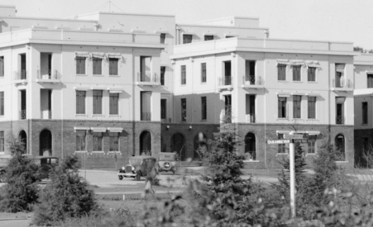
Figure 49 West elevation of West Block (part), c. 1928: the pull-down awnings in boxed casings were an early addition
Source: National Archives of Australia, NAA A3560, 4323
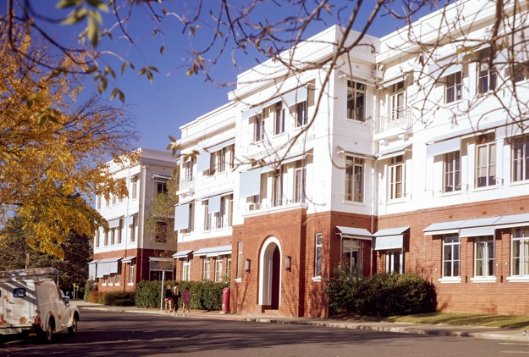
Figure 50 West elevation of West Block (part), 1972
Source: National Archives of Australia, NAA A6135, 11649152
Table 8 West Block interior – principles to guide change
Element | Principles to guide future change | Image |
North-south axis | The north-south axis connecting the four blocks should be retained over all levels. | 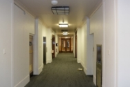
|
B Block staircases | The original staircases in B Block should be retained and conserved to the extent of original fabric. The raised brass handrail fixed with brackets can be retained or replaced with a sympathetic DDA-compliant solution. | 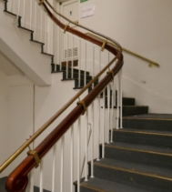
|
Original timber ceiling panels | Some of the original/early timber ceiling panels are extant in A, B and C Blocks, having been concealed by dropped ceilings since at least the 1980s. This includes a section that is known to survive on the ground floor of B Block. As far as possible, original/early ceiling panels should be retained, conserved and expressed in a future interior layout. | 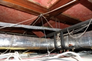
|
Timber structural framing on levels 1 and 2 | Timber posts and beams on levels 1 and 2 of A, B and C Blocks. | 
|
Strong rooms | In preference, the original door, door furniture, manufacturer’s name plate (Ajax Company, Sydney) and configuration of at least one of the original strong rooms should be retained. The strong rooms provide an insight into the security requirements of West Block’s original use. | 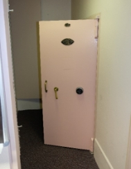
|
Table 9 The Dugout – principles to guide change
Element | Principles to guide future change | Image |
The Dugout | In preference, the 1980s screen wall should be demolished, to reveal the Dugout. In the event that the building ceases to be used as a substation, the 1980s addition at the south should be demolished and options for an active use explored | 
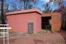
|
The introduction of new buildings at the subject site should be sensitive to the heritage values of the place, including the presentation of West Block and its siting in relation to the Land Axis.
The subject site has been subject to incremental change since the 1930s. Change has focussed on the main building mass, in the form of small additions and larger works (D Block). With the exception of the Dugout, there is no precedent for the introduction of new freestanding elements/buildings. However, recognising that change is imminent, it is considered that new works within the site is an action that can reasonably be contemplated.
With regards to new development, there is a balance to be struck between the site’s heritage values and attributes, and the objectives of the NCP. The NCP contemplates development on the car park site to the east of West Block; a building of broadly equivalent footprint is also anticipated to the west of East Block. The NCP also promotes a campus-style approach to development relating to Old Parliament House, East Block and West Block. At the time the NCP was amended to include the campus model, the three buildings were in common ownership. Since the disposal of East Block and West Block in 2017, that is no longer the case, a reality with consequences for the delivery of a co-ordinated approach to the use and operation of the three buildings.
Having regard to the above, a preferred approach to new development is one which:
- Does not obscure key views and visual relationships, as identified in this conservation policy – i.e. Commonwealth Avenue;
- Delivers a new built form (or forms) that does not rise above the parapet of West Block (AHD 581.10);
- Keeps the footprint of a new building (or buildings) to the minimum required, recognising West Block’s contribution to the symmetry of the Parliament House Vista;
- Delivers a package of conservation works to the retained significant fabric and elements; and
- Includes on-site interpretation to promote an understanding of the site’s history and cultural heritage significance (see also Policy 24 ‘Interpretation’)
A preferred location for new works is to the rear (east) of West Block, set away from Queen Victoria Terrace (and Old Parliament House) and set into the embankment to minimise its presence in key views of the building (Figure 51).
The appearance of new works, and the palette of materials, can contrast with West Block, but not in an obtrusive way. The new building elevations should desirably be treated so as to visually ‘recede’ in views from the public realm. A simple façade treatment, such as one with extensive glazing or a limited palette of materials, or simple detailing, would achieve this. Consideration may be given to the use of timber cladding, a subtle reference to the ‘temporary’ nature of West Block in the 1920s, and the use of timber for the framing of the upper levels.

Figure 51 Aerial view of West Block: the location of an indicative building envelope is in pink
Source: www.nearmap.com
Small-scale additions
If small-scale additions are required to support a viable and sustainable new use for West Block, such as pergolas or a porte-cochère, they should be of generally light weight construction and set clear from the historic building fabric.
Naming signage
West Block was designed without signage applied to the building exterior. Bronze serif lettering was mounted over the main entry in the early post-World War II period, reading ‘Commonwealth Offices West Block’ (Figure 52). By the 1980s this had been simplified to ‘West Block’. Over time, signage denoting the use of the building has also been mounted to D Block, south elevation and to the rear (east) elevation of B Block. If signage is required as related to a new use for West Block, this should be kept to the minimum required and in preference limited to the west elevation (B Block) and south elevation (D Block).
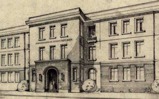
Figure 52 Lettering reading ‘Commonwealth Offices West Block’ was added over the main entrance in the early post-World War II period
Source: National Archives of Australia, NAA A2617, Section 14/16260
Policy 19 Re-establishment of original landscape features
Missing or diminished aspects of the original landscape treatment should be re-established.
The original formal planting arrangement to the north of West Block should, in preference, be re-established. This arrangement, indicated at Figure 53, includes Lombardy poplars (Populus nigra ‘Italica’) in small square enclosures as an extension of the axial vista. This arrangement was balanced on the north side of Queen Victoria Terrace, where these plantings have already been regenerated, and it would be appropriate to duplicate the current treatment of shaped hedges, edging pavements and other details which is established on the north side of the Terrace. At West Block, the termination of the axis was further developed in a broader formal setting of four Arizona cypress trees (Cupressus arizonica), all of which are extant today.
It is noted that one of the original Lombardy poplars on the south side of Queen Victoria Terrace, within the West Block curtilage, presently survives. It is appropriate to continue the retention of this tree as long as arboriculturally feasible, while reinstating the eastern partner tree of the pairing with new (preferably advanced) stock. When removal and replacement of the existing tree is ultimately required, a determination may be made as to the efficacy and aesthetic impact of maintaining two generationally non-matching trees versus the concurrent removal and replacement of both trees.
If the opportunity arises, reinstatement of the Lombardy poplar pair at the northwest corner of the car park, adjacent to the Queen Victoria Terrace / Commonwealth Avenue intersection, is also encouraged.

Figure 53 Detail of ‘Permanent Planting for the Governmental Group’, 1928, with the original structured arrangement indicated
Source: National Library of Australia, nla.obj-230044722
An alternating row of Giant redwood (Sequiadendron giganteum) and Atlantic Cedar (Cedrus atlantica) originally provided continuity with a large-scale avenue planting of the same species which was established on the irregularly-shaped parkland block to the north-west. While trees from this alignment have been progressively lost, two of the Atlantic cedars and one of the Giant redwoods still stand between the West Block car park and Commonwealth Avenue, as do a number of the constituent trees of the northern alignment to the north. It would be appropriate to establish infill plantings to regenerate the continuity and form of this avenue while retaining the existing trees within their feasible lifespans.
Policy 20 Changes to the landscape
Any changes to the landscape setting and broader heritage curtilage should be sensitive to the heritage values of the place.
Changes to the landscaping around West Block should be guided by the plan of permanent plantings for the Governmental Group of 1928 (Appendix B). The insertion of new structural or planted elements, and the modification or reconstruction of existing features, may be accommodated in the landscape provided that such change is undertaken in a manner sympathetic and subservient to the setting’s character as designed and as extant within the place today, and in accordance with other relevant policies in this HMP, including Policy 18.
New plantings and structural elements should be consistent with the original characters of Zone 1 and Zone 2. Where practical, species selections should be drawn from the original planting specifications and should otherwise be sympathetic to the character and intent of those selections. The informal native character of Zone 2 should be maintained.
Similarly, the location and treatment of new hard surfaces and structural landscape elements should be consistent with the original formal organisation and features of the place, with the division of circulation networks and with the architectural character of West Block. While new elements should employ materials or details which differentiate them from original fabric, they should be sympathetic to the form and qualities of that fabric and consistent with the treatment of similar elements elsewhere within the Parliamentary Triangle precinct.
Policy 21 Recording
Geocon, and subsequent owners, should maintain a record of significant interventions to West Block and the Dugout
Records of works/interventions to West Block should be maintained by Geocon. The record (or file) should include copies of all superseded architectural drawings, and photography of the affected areas before and after the works.
The outcomes of on-going (i.e. cyclical) monitoring of significant fabric and landscape elements/attributes should also be recorded by Geocon (and subsequent owners), to assist in maintaining the site’s Commonwealth heritage values. (See also Policy 12 ‘Cyclical maintenance and remedial works to significant built fabric’ and Policy 14 ‘Landscape maintenance’.)
This policy complies with EPBC Act Regulations, 2000, Schedule 7a (h) (x) and Schedule 7a (h) (ix).
Policy 22 Statutory controls
West Block should continue to be recognised as a place of cultural heritage significance to Australia through its inclusion in the Commonwealth Heritage list.
West Block has been assessed as a place of significance to Australia. As such, it should continue to be managed under the provisions of the EPBC Act 1999.
In the event that West Block is removed from the CHL, it should be nominated for inclusion in the ACT Heritage Register.
Policy 23 Training and awareness
A training program should be instigated to raise awareness of the heritage significance of West Block among Geocon staff.
The heritage significance of West Block may not be self-evident to casual observers, and those outside the heritage profession. It is recommended that a training program to promote awareness of the building’s heritage values is developed and implemented by Geocon as related to the proposed adaptation of the building as a hotel.
Policy 24 Access and security
Access to West Block and its setting for people with an interest in the place should be accommodated by the owners and operators of West Block, subject to appropriate security measures.
West Block was built as an office, a use that it served from 1927 into the twenty-first century. The building exterior was experienced by Canberrians as an element of the Parliamentary Triangle precinct. The building interior was the preserve of office workers and visitors to the building. The Dugout has been a secure building since 1943, with no public access.
As a long-standing feature of the Parliamentary Triangle landscape, members of the public, including the organisations, groups and individuals identified as stakeholders at Section 4.4, may have an interest in West Block. There is also the potential for interest in the Dugout, associated with its World War II history. Further, as noted in Chapter 1 and discussed at Policy 25 below, Traditional Owner groups have expressed a wish to access the grounds because of its location on a pathway between Black Mountain and Mount Kurrajong.
It would be appropriate for the owners and operators of the Commonwealth Heritage listed place to allow interested parties to access West Block and its setting. For security purposes, people wishing to visit the building should make themselves known to staff at the building and advise of the intended length of their visit. Depending on the use of the building, the operators may wish to limit internal access to common areas on the ground floor.
This policy complies with EPBC Act Regulations, 2000, Schedule 7a (h) (ii).
Policy 25 Interpretation and promotion of heritage values
Geocon and subsequent owners of West Block should promote and disseminate information about the Commonwealth Heritage Values of the place.
Strategies for the promotion and dissemination of information about the cultural heritage values of West Block should be prepared in the form of an interpretation plan. Recommendations for interpretation should be informed by but not limited to consideration of: best practice principles (including the Burra Charter 2013 practice note ‘Interpretation’); the identified heritage values of the place; the anticipated audience for interpretation; and existing interpretive programs at West Block (Figure 54).
Figure 54 Existing interpretation at West Block
Interpretation can be undertaken via a range of tools and methods. Information can be presented in a readable format (printed or electronic, including brochures, pamphlets, books and websites); through on-site signage; through the display of objects/artefacts; and through art works.
Interpretation of the place should acknowledge the site’s Indigenous heritage as a part of a pathway between the Black Mountain and Mount Kurrajong. Stakeholder engagement should form part of any interpretation of the indigenous heritage of West Block.
The historic value of West Block as a significant place during World War II in Canberra is an important part of the heritage interpretation. This should include communication of the values not readily evident, including the planned and historic association between East Block, West Block and the Provisional Parliament House.
The use of the Dugout as an air raid shelter and its important role in receiving and sending critical communication during war time should be interpreted on site. Correspondingly, the display of the statue of Winston Churchill donated to Geocon by the Churchill Society in mid-2018 should occur within the context of the broader interpretation of the site as informed by the interpretation plan.
It would be desirable for ‘West Block’ to be retained in the name of the premises, to maintain an understanding of the site’s origins – i.e. ‘Hotel West Block’, or similar.
Policy 26 Archaeology
The discovery of historical archaeological artefacts and objects, which can contribute to an understanding of the history of the site and its context, should be reported to the Department of the Environment and Energy.
The site of West Block was partially excavated in the mid-1920s, to establish a level site for construction. This activity, as well as grading works for the establishment of the integral car park and the landscape setting generally, means, there is limited potential for subsurface artefacts relating to earlier occupation and/or land use at the site. Exceptions may relate to subsurface evidence of pneumatic tubes that connected the buildings of the Parliament House group during the 1940s, and evidence of World War II-era defences (i.e. trenches).
In the event of archaeological remains being uncovered at the site, DoEE should be informed of the discovery before proceeding with further work.
Policy 27 Risk preparedness
A Risk Management Strategy should be integrated into the broader management and administration of West Block.
Risk preparedness and management is an important means of protecting and conserving the values of heritage places. While a detailed assessment of risk is beyond the scope of this report, the following table describes potential threats and hazards posed to the physical fabric at the subject site by environmental and man-made factors.
Table 10 Analysis of risk to West Block and the Dugout
Threat | Probability | Preparation/ Response |
Vandalism and theft | Moderate | Vandalism and theft are always possible and a normal level of awareness and security should be maintained. Installation of security cameras could be considered in discrete locations. These should be fixed to cause the minimum possible impact on the presentation of the tower. |
Fire | Always present | Establish a fire suppression and warning system as part of any adaptive re-use, and upgrade as required. Ensure there is an evacuation plan in place, and conduct regular training and rehearsals. Ensure that combustible materials do not come into contact with hot lights. Ensure that extinguishers, fire blankets etc, are located within reach of potential sources of fire. Maintain electrical systems in good order. Maintain liaison with fire brigade to regularly test and monitor systems. |
Flood | Possible | Localised internal flooding, from toilets, sinks and pipe work, is always possible. Maintenance of wet areas and pipe work is a means of minimising this possibility. |
Water ingress | Moderate | Rainwater goods (gutters, downpipes and sumps) should be repaired (where required), maintained, installed and kept clear. Inspect and maintain roofs, windows and doors regularly. |
A plan for the implementation of the policies set out at Section 5.2 ‘General policies’, 5.3 ‘Conservation policies’, 5.4 ‘Use, adaptation and change’ and 5.5 ‘Management policies’ is included at Table 11. This complies with EPBC Act Regulations, 2000, Schedule 7a (i).
As noted in Chapter 1, the West Block Trust (WBT) referred to below is a discretionary trust that owns the subject site. The beneficiaries of WBT are Nick Georgalis, and associated entities/persons. The trustee of WBT is West Block Pty Ltd. Nick Georgalis is the sole director, member and office holder of West Block Pty Ltd.
Table 11 Implementation plan
Policy | Responsibility | Timing | Funding |
Policy 1: Ensure that the Statement of Significance included at Chapter 4 of this report is referred to prior to any proposed works or alterations, including conservation and management, being undertaken to West Block and/or the Dugout. | West Block Trust | On-going | N/A |
Policy 2: Ensure that conservation, maintenance, preservation, restoration or adaptation works to West Block and the Dugout are consistent with the Burra Charter. | West Block Trust | On-going | N/A |
Policy 3: Ensure that the policies in this HMP are endorsed and form the primary guide for the management of West Block. | West Block Trust | On-going | N/A |
Policy 4: Maintain access to specialist contractors and consultants | West Block Trust | On-going | N/A |
Policies 5 and 24: Maintain protocols for compliance with legislation, including with regard to unexpected discoveries (archaeology) | West Block Trust | On-going | N/A |
Policy 6: Ensure that stakeholders identified at Chapter 4 of this report are provided with opportunities to comment on proposed changes to West Block. | West Block Trust | On-going | N/A |
Policy 7: Protocols to protect sensitive data and equipment should be maintained. | West Block Trust | On-going | N/A |
Policy 8: Ensure that a review of this HMP is undertaken by 2023 | West Block Trust | By 2023 | Funds to be allocated for HMP review by 2023. |
Policy 9: Ensure than elements and attributes intrinsic to the significance of West Block are conserved. | West Block Trust | On-going | Annual operating budget of hotel manager/operator |
Policy 10: Ensure that the on-going management of West Block, including the management of the landscape, demonstrates cognisance of the site’s relationship with the broader Parliamentary Zone landscape. | West Block Trust | On-going | N/A |
Policy 11: Consider key views and visual relationships as part of the on-going management of West Block. | West Block Trust; future hotel manager/operator; NCA | On-going | N/A |
Policy 12: Monitor and document the condition of the built fabric (annual maintenance regime). Undertake maintenance works as required. | West Block Trust; future hotel manager/operator | On-going | Annual operating budget of hotel manager/operator |
Policy 13: Ensure the management of Hazardous materials minimises impact on significant values and attributes | Geocon | As required | Annual operating budget of hotel manager/operator |
Policy 14: Landscape maintenance | West Block Trust; future hotel manager/operator | On-going | Annual operating budget of hotel manager/operator |
Policy 15: In the event of adaptation ensure that physical changes associated with a new use are compatible with the building’s assessed significance and CHL values | Geocon | As required | West Block Trust and/or hotel manager/operator |
Policy 16: Site management should have regard for West Block’s role as a feature of the Parliament House Vista (Land Axis) | Geocon | N/A | N/A |
Policy 17: Physical changes to West Block and the Dugout must be compatible with the building’s assessed significance and CHL values. | Geocon | On-going | N/A |
Policy 18: Ensure that new development at the site is responsive to the Commonwealth Heritage values of West Block and the Parliament House Vista. | Geocon | On-going | West Block Trust and/or hotel manager/operator |
Policies 19 and 20: Ensure that any changes to the landscape elements are consistent with the broader landscape elements and original 1928 plan | Geocon | On-going | N/A |
Policy 21: Maintain a record of significant interventions to built and landscape elements at West Block. | Geocon | N/A | Annual operating budget of hotel manager/operator |
Policy 22: Ensure that West Block remains subject to statutory heritage controls. | Geocon | On-going | N/A |
Policy 23: Instigate heritage awareness training program, to raise awareness of the building’s heritage significance | Geocon | Within the life of this plan (2018-2023) | Annual operating budget of hotel manager/operator |
Policy 24: Develop and implement an interpretation plan for West Block | Geocon | The | West Block Trust (assumes interpretation is delivered prior to hotel operations commencing) |
Policy 25: Ensure any discovery of archaeological finds are reported to the Department of Environment and Energy | Geocon | On-going | N/A |
Policy 26: Ensure that risks associated with vandalism, theft, fire and flood are managed in line with the recommendations set out in this report. | Geocon | Ongoing and within the life of this plan. | West Block Trust, and/or hotel operator (subject to timing) |
The implementation of the management plan, and its effectiveness in conserving West Block’s CHL values will be managed by the future manager/operator of the hotel and assessed by the West Block Trust.
BIBLIOGRAPHY
Primary sources
Archival sources
Convention on International Civil Aviation done at Chicago on the 7th day of December 1944
Department of Civil Aviation, Press Release, Melbourne Airport New Air Traffic Control System, 4 October 1956
Department of Civil Aviation, Report on Civil Aviation in Australia and Papua-New Guinea, 1948-1949
Melbourne Metropolitan Planning Scheme 1954, Surveys and Analysis, Melbourne and Metropolitan Board of Works, 1953
Newspapers
Age
Argus
Canberra Times
Centralian Advocate
Construction
Daily News
Sydney Morning Herald
West Australian
Journals
Civil Aviation Journal
Map and image collections
Civil Aviation Historical Society
State Library of Victoria
Secondary sources
Books and publications
Aldous, Grant, The Stop-over that Stayed: a history of Essendon, Wilkes and Company Ltd, Clayton, nd.
Unpublished reports
Godden Mackay Logan, Essendon Airport Buildings 46, 47, 48, 61 & 64 Heritage Assessment and Archival Record, prepared for Essendon Airport Pty Ltd, 2003
Lovell Chen, National Control Towers Heritage Assessment Appendix A Typological Study: Air Traffic Control Towers in Australia and Overseas, prepared for Airservices Australia, 2009
Lovell Chen, Detailed Heritage Assessment – Essendon Air Traffic Control Tower, prepared for Airservices Australia, 2009
Melbourne Airport, Information Document No.5, courtesy of the Civil Aviation Historical Society (date unknown).
Melbourne Airport – Brief History, 13 October 1976. Courtesy of the Civil Aviation Historical Society
Meyer, Roger, Historical Information Relating to the Control Tower at Essendon Airport, 30 May 2016
Websites
Airways Museum, various pages, accessed via
www.airwaysmuseum.com
Australian Heritage Database, Essendon Airport, Tullamarine Fwy, Strathmore, VIC, Register of the National Estate
www.environment.gov.au
Australian Heritage Database, Essendon Airport Air Traffic Control Tower, Wirraway Road, Strathmore, Commonwealth Heritage List
www.environment.gov.au
Essendon Airport, Our History and Timeline
www.essendonairport.com.au
[6] National Capital Authority, Kings and Commonwealth Avenues Draft Design Strategy, 2017.
[7] Parliamentary Precincts Act 1988 , Schedule 2, Section 3, accessed via the Federal Register of Legislation, www.legislation.gov.au, 24 June 2018.
[8] West Block, Heritage Management Plan, Eric Martin and Associates, 2014 (July), Appendix B.
[9] Australia ICOMOS, The Illustrated Burra Charter, 2004, pp. 100-101.
[10] Spelling according to Ann Jackson-Nakano, The Kamberri, a history from the records of aboriginal families in the Canberra-Queanbeyan district and surrounds 1820-1927 and historical overview 1928-2001. However numerous variants exist.
[11] NAA: A1818/12, Information, Conditions and Particulars for Guidance in the Preparation of Competitive Designs for the Capital City of the Commonwealth of Australia, p. 4.
[12] Paul Reid, Canberra following Griffin: A design history of Australia’s National Capital, Canberra: National Archives of Australia, 2002, p.66.
[13] Paul Reid, Canberra following Griffin, NAA, 2002, Chapter 4.
[14] Paul Reid, Canberra following Griffin, NAA, 2002, p. 107.
[15] Duncan Marshall et al, Parliament House Vista Area Heritage Management Plan, prepared for the National Capital Authority, 2010, p. 49.
[16] The National Capital Development Commission, Tomorrow’s Canberra, Planning for Change and Growth, Australian National University Press, Canberra, 1970, p. 11.
[17] Paul Reid, Canberra following Griffin, NAA, 2002, chapter 6.
[18] Roger Pegrum, The Bush Capital, Hale & Iremonger, 1983, p. 182.
[19] Peter Harrison, Walter Burley Griffin, Landscape Architect, National Library of Australia, 1995, p. 47.
[20] Paul Reid, Canberra following Griffin, NAA, 2002, p. 147.
[21] The National Capital Development Commission, Tomorrow’s Canberra, Planning for Change and Growth, Australian National University Press, Canberra, 1970, p. 12.
[22] Old Parliament House and Curtilage Heritage Management Plan, 2015-2010, Museum of Australian Democracy, 2015, pp. 152-153.
[23] Old Parliament House and Curtilage Heritage Management Plan, 2015-2010, Museum of Australian Democracy, 2015, p. 153.
[24] Paul Reid, Canberra following Griffin, NAA, 2002, p. 168.
[25] Construction of Canberra Final Report, Federal Capital Advisory Committee, The Parliament of the Commonwealth of Australia, 1926, NAA A1 1926/14780 Part I, p. 22; see also Paul Reid, pp. 168-169.
[26] Cited in Paul Reid, Canberra following Griffin: A design history of Australia’s National Capital, Canberra: National Archives of Australia, 2002, p.170
[27] Construction of Canberra Final Report, Federal Capital Advisory Committee, The Parliament of the Commonwealth of Australia, 1926, NAA A1 1926/14780 Part I, p. 19
[28] John Gorton Building, Parkes ACT formerly known as the Administration Building, Department of Finance Asset Record DFD-61008, 15 January 2015, p. 5
[29] Paul Reid, Canberra following Griffin: A design history of Australia’s National Capital, Canberra: National Archives of Australia, 2002, p.171
[30] Construction of Canberra Final Report, Federal Capital Advisory Committee, The Parliament of the Commonwealth of Australia, 1926, NAA A1 1926/14780 Part I, pp. 20-21
[31] Construction of Canberra Final Report, Federal Capital Advisory Committee, The Parliament of the Commonwealth of Australia, 1926, NAA A1 1926/14780 Part I, p.93
[32] Cited in Eric Martin & Associates, West Block Heritage Management Plan, 2014, p.12
[33] Cited in Eric Martin & Associates, West Block Heritage Management Plan, 2014, pp. 12-13.
[34] Construction of Canberra Final Report, Federal Capital Advisory Committee, The Parliament of the Commonwealth of Australia, 1926, NAA A1 1926/14780 Part I, p. 21
[35] Cited in Eric Martin & Associates, West Block Heritage Management Plan, 2014, p.18
[36] Secretariats in Canberra, The Sydney Morning Herald, 22 April 1927, p.12
[37] Canberra News, The Week, 12 August 1927, p.19
[38] David Rowe, ‘Murdoch, John Smith’, in The Encyclopedia of Australian Architecture, edited by Philip Goad and Julie Willis, Cambridge University Press, 2012, p. 480.
[39] Andrew Metcalf, ‘ACT (Australian Capital Territory) Architecture’, in The Encyclopedia of Australian Architecture, edited by Philip Goad and Julie Willis, Cambridge University Press, 2012, p. 4.
[40] John Edmund Gray, TCG Weston 1866-1945, Horticulturist and Arboriculturist, A Critical Review of His Contribution to the Establishment of the Landscape Foundations of Australia’s National Capital, Doctoral Thesis, University of Canberra, July 1999, p. 168.
[41] John Gray, Doctoral Thesis, July 1999, p. 174.
[42] John Gray, Doctoral Thesis, July 1999, pp. 175-76.
[43] John Gray, Doctoral Thesis, July 1999, p. 176.
[44] National Archives of Australia: A292, C3516, 24 July 1925, quoted in John Gray, Doctoral Thesis, July 1999, p. 176.
[45] John Gray, Doctoral Thesis, July 1999, p.176-177.
[46] Ken Taylor Canberra, City in the Landscape, NCA, Canberra, 2006. p. 61.
[47] John Gray, Doctoral Thesis, July 1999, p. 177.
[48] Eric Martin & Associates, West Block Heritage Management Plan, 2014, p.37.
[49] Eric Martin & Associates, West Block Management Plan, p.44.
[50] John Gray, Doctoral Thesis, July 1999, p.173 and p. 178.
[51] Eric Martin & Associates, West Block Management Plan, p.47.
[52] Greg Murphy, 'Weston, Thomas Charles George (1866–1935)', Australian Dictionary of Biography, National Centre of Biography, Australian National University, http://adb.anu.edu.au/biography/weston-thomas-charles-george-9054/text15955, accessed 11 July 2012.
[53] Ken Taylor, Canberra, City in the Landscape, Halstead Press and the NCA, 2006, p. 59.
[54] Ken Taylor Canberra, City in the Landscape, NCA, Canberra, 2006. p. 61.
[55] Lovell Chen and Harris Hobbs Landscapes, Manuka Circle Precinct CMP (draft), 2012, Chapter 4.
[57] Peter Harrison, Walter Burley Griffin, Landscape Architect, p. 68.
[58] Fourth Annual Report of the Federal Capital Commission for the year ended 30th June 1928, NAA A1 1929/1797 p.42
[61] Anne Galligan, Institutional in-sites: A role of the National Library of Australia, The Australian Library Journal, vol. 49 issue 3, 2000, p. 235
[62] Anne Galligan, Cultural in-sites: A history of the National Library of Australia, The Australian Library Journal, vol. 49 issue 3, 2000, p. 100
[63] Anne Galligan, Cultural in-sites: A history of the National Library of Australia, The Australian Library Journal, vol. 49 issue 3, 2000, p. 101
[64] Gough Whitlam, The Munn-Pitt Report—50 Years on, The Australian Library Journal, vol. 35 issue 1, 1986, p. 41
[65] Commonwealth Offices, The Canberra Times, 18 March 1936, p.4
[66] Public Offices, The Canberra Times, 3 July 1934, p.2; Contracts let, The Canberra Times, 13 March 1936, p.4
[67] Cited in Eric Martin & Associates, West Block Heritage Management Plan, 2014, p.23
[68] Cited in Eric Martin & Associates, West Block Heritage Management Plan, 2014, p.25
[69] Cited in Eric Martin & Associates, West Block Heritage Management Plan, 2014, p.25
[70] Contracts let in Canberra, The Canberra Times, 3 January 1941, p.5
[71] Private telephone exchange at West Block, The Canberra Times, 19 March 1949, p.3; Lifts for West Block, The Canberra Times, 5 January 1951, p.2
[73] Construction of an office block annexe to West Block offices, Canberra - Submission Withdrawn - replaced by Submission 1855 - see CL 1488, NAA: A5915, 1740
[76] Parliamentary Zone Review Outcomes, National Capital Authority, Canberra, March 2000, p. 34
[77] Parliamentary Zone Review Outcomes, National Capital Authority, Canberra, March 2000, p. 34
[83] Kimberley Le Lievre, ACT Greens oppose sale of heritage-listed East and West block in parliamentary triangle, The Canberra Times, 16 September 2017, https://www.canberratimes.com.au/national/act/act-greens-oppose-sale-of-heritagelisted-east-and-west-blocks-in-parliamentary-triangle-20170915-gyie59.html, accessed 28 June 2018; Daniella White, Geocon buys West Block buildings to create luxury hotel in parliamentary triangle, The Canberra Times, 21 September 2017, https://www.canberratimes.com.au/national/act/geocon-buys-west-block-buildings-to-create-luxury-hotel-in-parliamentary-triangle-20170921-gym191.html, accessed 28 June 2018
[86] Paul Reid, Canberra following Griffin, NAA, 2002, p. 162.
[87] Pers comm (email), Ian Beament, Heyday Group, 21 June 2018.
[88] Roger Pegrum, ‘Canberra: The Bush Capital’ in Pamela Stratham (ed), The Origins of Australia’s Capital Cities, Cambridge University Press, 1990, p. 317.
[89] David Headon, The Symbolic Role of the National Capital, National Capital Authority and the Commonwealth of Australia, 2003, p. 20.
[90] Labour Senator Arthur Rae, 1910, quoted in David Headon, The Symbolic Role of the National Capital, p. 39.
[91] Ken Charlton, Federal Capital Architecture, Canberra 1911-1939, National Trust of Australia (ACT), 1984, pp. 8-9.
[92] Ken Taylor, Canberra, City in the Landscape,, p. 57.
[93] See for examples Paul Reid, Canberra following Griffin, pp. 34-39.
[94] Ken Taylor, Canberra, City in the Landscape, p. 34.
[95] Friends of the ACT Arboreta, Westbourne Woods, Royal Canberra Golf Club, 2011.
[96] Friends of the ACT Arboreta, Westbourne Woods, Royal Canberra Golf Club, 2011.
[97] Friends of the ACT Arboreta, Westbourne Woods, Royal Canberra Golf Club, 2011.
[98] Peter Harrison, Walter Burley Griffin, Landscape Architect, National Library of Australia, 1995, p. 47.
[99] Roger Pegrum, The Bush Capital, Hale & Iremonger, 1983, p. 182.
[100] Ken Taylor Canberra, City in the Landscape, p. 61.
[101] Practice Note to the Burra Charter 2013, p. 4.
[102] Chris Johnston (Ms), What is Social Value? A Discussion Paper, Australian Government Publishing Service, Canberra, 1994, Foreword.
[103] Chris Johnston (Ms), What is Social Value?, pp. 7-11.
[104] Chris Johnston (Ms), What is Social Value?, p. 7.
[106] ‘What is a Significant Impact?’, Matters of National Environmental Significance, Significant Impact Guidelines 1.1, Environment Protection and Biodiversity Conservation Act 1999.
[107] ‘What is an Action?’, Matters of National Environmental Significance, Significant Impact Guidelines 1.1, Environment Protection and Biodiversity Conservation Act 1999.
[108] Commonwealth Heritage List entry for West Block and the Dugout, ID 105428.
[110] Duncan Marshall et al, Parliament House Vista Area Heritage Management Plan, 2010, p. 297.
[111] National Capital Plan, May 2016, Section 4.2.1.
[112] National Capital Plan, May 2016, Section 4.3.3.
[113] National Capital Plan, May 2016, Section 4.3.3.
[114] National Capital Plan, May 2016, Section 4.3.5.
[115] National Capital Plan, May 2016, Section 4.3.5 ‘Tree Planting’.
[116] Parliament of Australia, www.aph.gov.au, Joint Standing Committee on the National Capital and External Territories, accessed 25 June 2018.
[117] Parliament Act 1974.
[118] West Block, Heritage Management Plan, Eric Martin and Associates, 2014 (July), Appendix B.
[119] ‘Winston Churchill's grandson delivers $100,000 sculpture to Canberra,’ Canberra Times, 4 May 2018.
[120] Gold Leaf Tree Services, Tree Assessment and Condition Report, West Block, June 2018, p. 4.
[122] Heritage Office, Heritage Curtilages, Department of Urban Affairs and Planning, New South Wales, 1996, p.3.